File:ELEVATION OF COMMERCIAL BUILDING - Faubourg Marigny District, Laundry (Cardau Drugs), Spain and Burgundy Streets, New Orleans, Orleans Parish, LA HABS LA,36-NEWOR,77C-1.tif

Size of this JPG preview of this TIF file: 755 × 600 pixels. Other resolutions: 302 × 240 pixels | 604 × 480 pixels | 967 × 768 pixels | 1,280 × 1,017 pixels | 2,560 × 2,034 pixels | 5,000 × 3,972 pixels.
Original file (5,000 × 3,972 pixels, file size: 18.94 MB, MIME type: image/tiff)
Captions
Captions
Add a one-line explanation of what this file represents
Summary
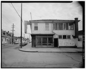
edit| ELEVATION OF COMMERCIAL BUILDING - Faubourg Marigny District, Laundry (Capdau Drugs), Spain and Burgundy Streets, New Orleans, Orleans Parish, LA
( |
||||||||||||||||||||||||
|---|---|---|---|---|---|---|---|---|---|---|---|---|---|---|---|---|---|---|---|---|---|---|---|---|
| Photographer |
|
|||||||||||||||||||||||
| Title |
ELEVATION OF COMMERCIAL BUILDING - Faubourg Marigny District, Laundry (Capdau Drugs), Spain and Burgundy Streets, New Orleans, Orleans Parish, LA |
|||||||||||||||||||||||
| Depicted place | Louisiana; Orleans Parish; New Orleans | |||||||||||||||||||||||
| Date | 1979 | |||||||||||||||||||||||
| Dimensions | 4 x 5 in. | |||||||||||||||||||||||
| Current location |
Library of Congress Prints and Photographs Division Washington, D.C. 20540 USA http://hdl.loc.gov/loc.pnp/pp.print |
|||||||||||||||||||||||
| Accession number |
HABS LA,36-NEWOR,77C-1 |
|||||||||||||||||||||||
| Credit line |
|
|||||||||||||||||||||||
| Notes |
|
|||||||||||||||||||||||
| Source | https://www.loc.gov/pictures/item/la0167.photos.073065p | |||||||||||||||||||||||
| Permission (Reusing this file) |
|
|||||||||||||||||||||||
| Other versions | Cropped jpg: File:MarignyCardauDrugsJetLowe.jpg | |||||||||||||||||||||||
.jpg)

| Object location | | View this and other nearby images on: OpenStreetMap |
|---|
File history
Click on a date/time to view the file as it appeared at that time.
| Date/Time | Thumbnail | Dimensions | User | Comment | |
|---|---|---|---|---|---|
| current | 23:19, 20 July 2014 |  | 5,000 × 3,972 (18.94 MB) | Fæ (talk | contribs) | GWToolset: Creating mediafile for Fæ. HABS 16 July 2014 (1201:1400) |
You cannot overwrite this file.
File usage on Commons
The following page uses this file: