File:Elevation downstream from west - Fryer's Ford Bridge, Spanning East Fork of Point Remove Creek at Fryer Bridge Road (CR 67), Solgohachia, Conway County, AR HAER AR-64-1.tif
Size of this JPG preview of this TIF file: 800 × 578 pixels. Other resolutions: 320 × 231 pixels | 640 × 463 pixels | 1,024 × 740 pixels | 1,280 × 925 pixels | 2,560 × 1,850 pixels | 5,088 × 3,677 pixels.
Original file (5,088 × 3,677 pixels, file size: 17.84 MB, MIME type: image/tiff)
Captions
Captions
Add a one-line explanation of what this file represents
Summary edit
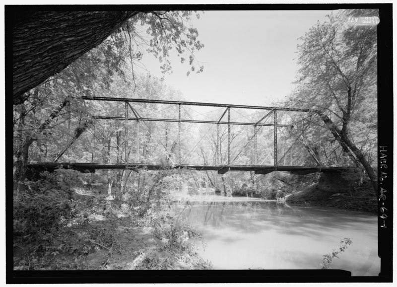
| Elevation downstream from west - Fryer's Ford Bridge, Spanning East Fork of Point Remove Creek at Fryer Bridge Road (CR 67), Solgohachia, Conway County, AR | ||||
|---|---|---|---|---|
| Photographer |
Lowe, Jet Related names:
|
|||
| Title |
Elevation downstream from west - Fryer's Ford Bridge, Spanning East Fork of Point Remove Creek at Fryer Bridge Road (CR 67), Solgohachia, Conway County, AR |
|||
| Depicted place | Arkansas; Conway County; Solgohachia | |||
| Date | 2008 | |||
| Dimensions | 5 x 7 in. | |||
| Current location |
Library of Congress Prints and Photographs Division Washington, D.C. 20540 USA http://hdl.loc.gov/loc.pnp/pp.print |
|||
| Accession number |
HAER AR-64-1 |
|||
| Credit line |
|
|||
| Notes |
|
|||
| References |
|
|||
| Source | https://www.loc.gov/pictures/item/ar0136.photos.363577p | |||
| Permission (Reusing this file) |
|
|||

| Object location | | View this and other nearby images on: OpenStreetMap |
|---|
File history
Click on a date/time to view the file as it appeared at that time.
| Date/Time | Thumbnail | Dimensions | User | Comment | |
|---|---|---|---|---|---|
| current | 15:55, 27 June 2014 |  | 5,088 × 3,677 (17.84 MB) | Fæ (talk | contribs) | GWToolset: Creating mediafile for Fæ. HABS batch upload 26 June 2014 (151:200) |
You cannot overwrite this file.
File usage on Commons
The following page uses this file:
File usage on other wikis
The following other wikis use this file:
- Usage on en.wikipedia.org