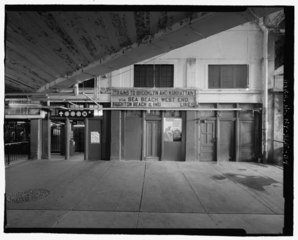
File:Entrance to waiting room from arcade area. Looking north. - Stillwell Avenue Station, Intersection of Stillwell and Surf Avenues, Brooklyn, Kings County, NY HAER NY-325-34.tif

Size of this JPG preview of this TIF file: 743 × 599 pixels. Other resolutions: 298 × 240 pixels | 595 × 480 pixels | 952 × 768 pixels | 1,270 × 1,024 pixels | 2,539 × 2,048 pixels | 5,231 × 4,219 pixels.
Original file (5,231 × 4,219 pixels, file size: 21.05 MB, MIME type: image/tiff)
Captions
Captions
Add a one-line explanation of what this file represents
Summary edit
| Entrance to waiting room from arcade area. Looking north. - Stillwell Avenue Station, Intersection of Stillwell and Surf Avenues, Brooklyn, Kings County, NY | ||||
|---|---|---|---|---|
| Photographer |
Related names:
|
|||
| Title |
Entrance to waiting room from arcade area. Looking north. - Stillwell Avenue Station, Intersection of Stillwell and Surf Avenues, Brooklyn, Kings County, NY |
|||
| Depicted place | New York; Kings County; Brooklyn | |||
| Date | Documentation compiled after 1968 | |||
| Dimensions | 4 x 5 in. | |||
| Current location |
Library of Congress Prints and Photographs Division Washington, D.C. 20540 USA http://hdl.loc.gov/loc.pnp/pp.print |
|||
| Accession number |
HAER NY-325-34 |
|||
| Credit line |
|
|||
| Notes |
|
|||
| Source | https://www.loc.gov/pictures/item/ny1863.photos.199037p | |||
| Permission (Reusing this file) |
|
|||

| Object location | | View this and other nearby images on: OpenStreetMap |
|---|
File history
Click on a date/time to view the file as it appeared at that time.
| Date/Time | Thumbnail | Dimensions | User | Comment | |
|---|---|---|---|---|---|
| current | 11:38, 1 August 2014 |  | 5,231 × 4,219 (21.05 MB) | Fæ (talk | contribs) | GWToolset: Creating mediafile for Fæ. HABS 1 Aug (2301:2600) missing |
You cannot overwrite this file.
File usage on Commons
The following page uses this file: