File:FIFTH FLOOR PLAN, SECTIONS AND DETAILS OF 1937 ADDITION TO BUILDINGS No. 2 and 4, DATED JUNE 24, 1937- SCHMIDT, GARDEN AND ERICKSON, ARCHITECTS - Underwriters' Laboratories, HABS ILL,16-CHIG,103-60.tif

Size of this JPG preview of this TIF file: 800 × 520 pixels. Other resolutions: 320 × 208 pixels | 640 × 416 pixels | 1,024 × 666 pixels | 1,280 × 832 pixels | 2,560 × 1,664 pixels | 5,000 × 3,250 pixels.
Original file (5,000 × 3,250 pixels, file size: 15.5 MB, MIME type: image/tiff)
Captions
Captions
Add a one-line explanation of what this file represents
Summary edit
| FIFTH FLOOR PLAN, SECTIONS AND DETAILS OF 1937 ADDITION TO BUILDINGS No. 2 and 4, DATED JUNE 24, 1937- SCHMIDT, GARDEN AND ERICKSON, ARCHITECTS - Underwriters' Laboratories, 207-231 East Ohio Street, Chicago, Cook County, IL | ||||
|---|---|---|---|---|
| Title |
FIFTH FLOOR PLAN, SECTIONS AND DETAILS OF 1937 ADDITION TO BUILDINGS No. 2 and 4, DATED JUNE 24, 1937- SCHMIDT, GARDEN AND ERICKSON, ARCHITECTS - Underwriters' Laboratories, 207-231 East Ohio Street, Chicago, Cook County, IL |
|||
| Depicted place | Illinois; Cook County; Chicago | |||
| Date | Documentation compiled after 1933 | |||
| Dimensions | 8 x 10 in. | |||
| Current location |
Library of Congress Prints and Photographs Division Washington, D.C. 20540 USA http://hdl.loc.gov/loc.pnp/pp.print |
|||
| Accession number |
HABS ILL,16-CHIG,103-60 |
|||
| Credit line |
|
|||
| Notes |
|
|||
| Source | https://www.loc.gov/pictures/item/il0083.photos.060651p | |||
| Permission (Reusing this file) |
|
|||

| Object location | | View this and other nearby images on: OpenStreetMap |
|---|
File history
Click on a date/time to view the file as it appeared at that time.
| Date/Time | Thumbnail | Dimensions | User | Comment | |
|---|---|---|---|---|---|
| current | 06:25, 16 July 2014 | 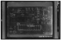 | 5,000 × 3,250 (15.5 MB) | Fæ (talk | contribs) | GWToolset: Creating mediafile for Fæ. HABS 11 July 2014 (1001:1200) |
You cannot overwrite this file.
File usage on Commons
The following page uses this file: