File:FIRST FLOOR, DETAIL OF CORNER FRAMING LOOKING WEST NORTHWEST - Retirement Barn, U.S. Route 13, South of Route 2, Biddles Corner, New Castle County, DE HABS DEL,2-BIDCO.V,3-3.tif

Size of this JPG preview of this TIF file: 478 × 599 pixels. Other resolutions: 191 × 240 pixels | 383 × 480 pixels | 613 × 768 pixels | 817 × 1,024 pixels | 1,634 × 2,048 pixels | 3,989 × 5,000 pixels.
Original file (3,989 × 5,000 pixels, file size: 19.02 MB, MIME type: image/tiff)
Captions
Captions
Add a one-line explanation of what this file represents
Summary edit
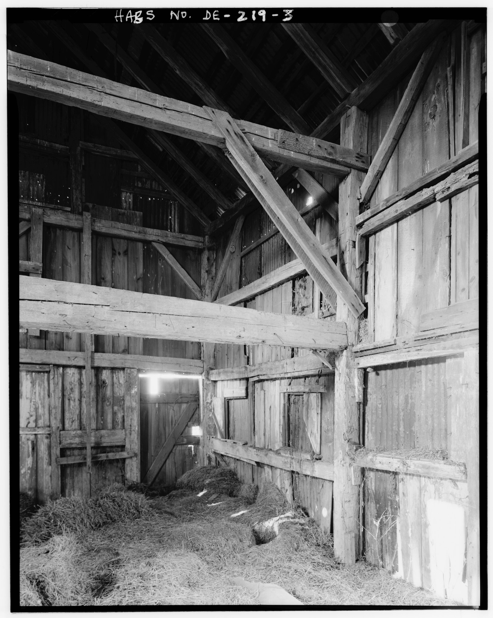
| FIRST FLOOR, DETAIL OF CORNER FRAMING LOOKING WEST NORTHWEST - Retirement Barn, U.S. Route 13, South of Route 2, Biddles Corner, New Castle County, DE | ||||
|---|---|---|---|---|
| Photographer |
Related names:
|
|||
| Title |
FIRST FLOOR, DETAIL OF CORNER FRAMING LOOKING WEST NORTHWEST - Retirement Barn, U.S. Route 13, South of Route 2, Biddles Corner, New Castle County, DE |
|||
| Depicted place | Delaware; New Castle County; Biddles Corner | |||
| Date | Documentation compiled after 1933 | |||
| Dimensions | 4 x 5 in. | |||
| Current location |
Library of Congress Prints and Photographs Division Washington, D.C. 20540 USA http://hdl.loc.gov/loc.pnp/pp.print |
|||
| Accession number |
HABS DEL,2-BIDCO.V,3-3 |
|||
| Credit line |
|
|||
| Notes |
|
|||
| Source | https://www.loc.gov/pictures/item/de0261.photos.031358p | |||
| Permission (Reusing this file) |
|
|||

| Object location | | View this and other nearby images on: OpenStreetMap |
|---|
File history
Click on a date/time to view the file as it appeared at that time.
| Date/Time | Thumbnail | Dimensions | User | Comment | |
|---|---|---|---|---|---|
| current | 18:14, 10 July 2014 |  | 3,989 × 5,000 (19.02 MB) | Fæ (talk | contribs) | GWToolset: Creating mediafile for Fæ. HABS 09 July 2014 (801:1000) |
You cannot overwrite this file.
File usage on Commons
The following page uses this file: