File:GENERAL VIEW OF SHOSHONE HYDROELECTRIC PLANT, VIEW TO THE NORTHWEST. - Shoshone Hydroelectric Plant Complex, 60111 U.S. Highway 6, Glenwood Springs, Garfield County, CO HAER COLO,23-GLENS.V,1-3.tif
Size of this JPG preview of this TIF file: 753 × 600 pixels. Other resolutions: 302 × 240 pixels | 603 × 480 pixels | 965 × 768 pixels | 1,280 × 1,019 pixels | 2,560 × 2,039 pixels | 5,072 × 4,039 pixels.
Original file (5,072 × 4,039 pixels, file size: 19.54 MB, MIME type: image/tiff)
Captions
Captions
Add a one-line explanation of what this file represents
Summary edit
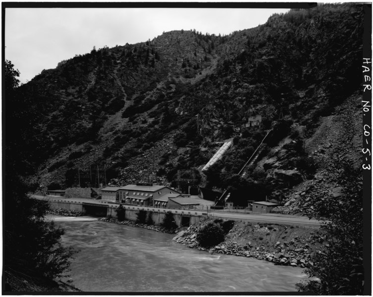
| GENERAL VIEW OF SHOSHONE HYDROELECTRIC PLANT, VIEW TO THE NORTHWEST. - Shoshone Hydroelectric Plant Complex, 60111 U.S. Highway 6, Glenwood Springs, Garfield County, CO | ||||
|---|---|---|---|---|
| Title |
GENERAL VIEW OF SHOSHONE HYDROELECTRIC PLANT, VIEW TO THE NORTHWEST. - Shoshone Hydroelectric Plant Complex, 60111 U.S. Highway 6, Glenwood Springs, Garfield County, CO |
|||
| Depicted place | Colorado; Garfield County; Glenwood Springs | |||
| Date | Documentation compiled after 1968 | |||
| Dimensions | 4 x 5 in. | |||
| Current location |
Library of Congress Prints and Photographs Division Washington, D.C. 20540 USA http://hdl.loc.gov/loc.pnp/pp.print |
|||
| Accession number |
HAER COLO,23-GLENS.V,1-3 |
|||
| Credit line |
|
|||
| Notes |
|
|||
| Source | https://www.loc.gov/pictures/item/co0088.photos.021288p | |||
| Permission (Reusing this file) |
|
|||

| Object location | | View this and other nearby images on: OpenStreetMap |
|---|
File history
Click on a date/time to view the file as it appeared at that time.
| Date/Time | Thumbnail | Dimensions | User | Comment | |
|---|---|---|---|---|---|
| current | 08:48, 8 July 2014 |  | 5,072 × 4,039 (19.54 MB) | Fæ (talk | contribs) | GWToolset: Creating mediafile for Fæ. HABS 05 July 2014 (501:600) |
You cannot overwrite this file.
File usage on Commons
The following page uses this file: