File:Gray's new map of the countries surrounding the Black Sea comprising Turkey in Europe and part of Turkey in Asia, Greece (Hellas, Southern Russia etc. (IA bp 32238).pdf


Original file (4,104 × 2,541 pixels, file size: 8.92 MB, MIME type: application/pdf, 2 pages)
Captions
Captions
Summary
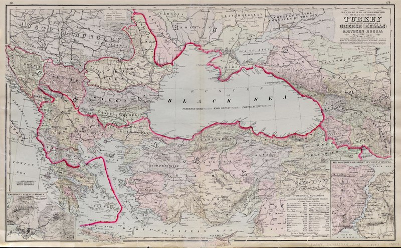
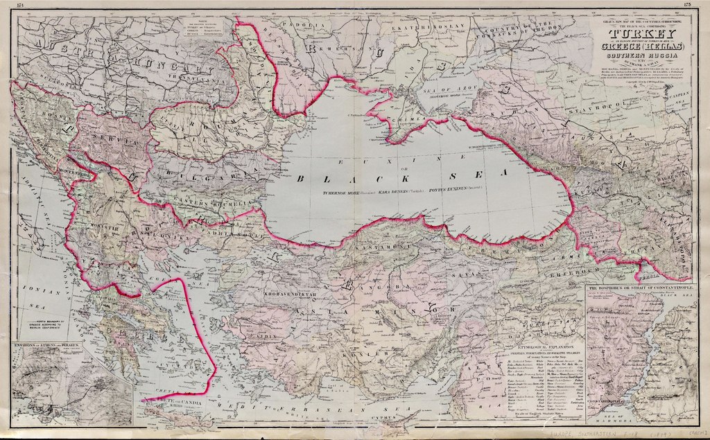
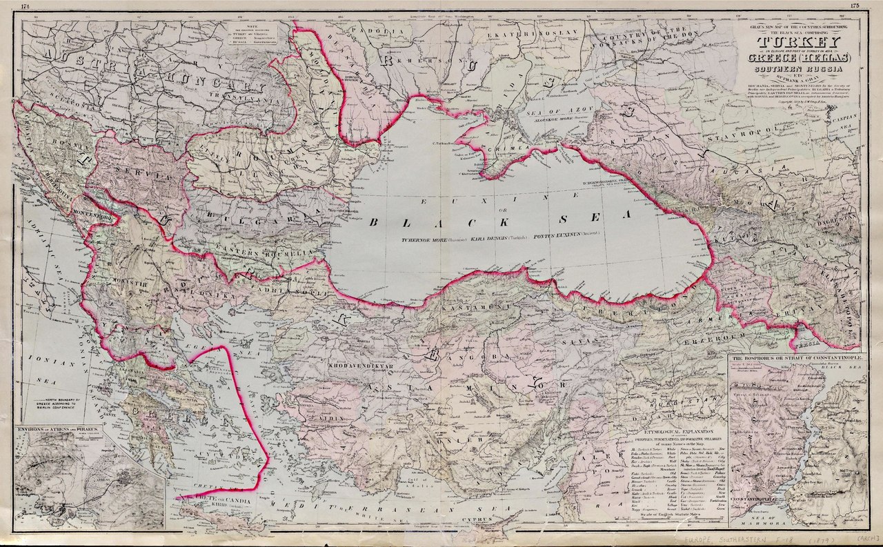
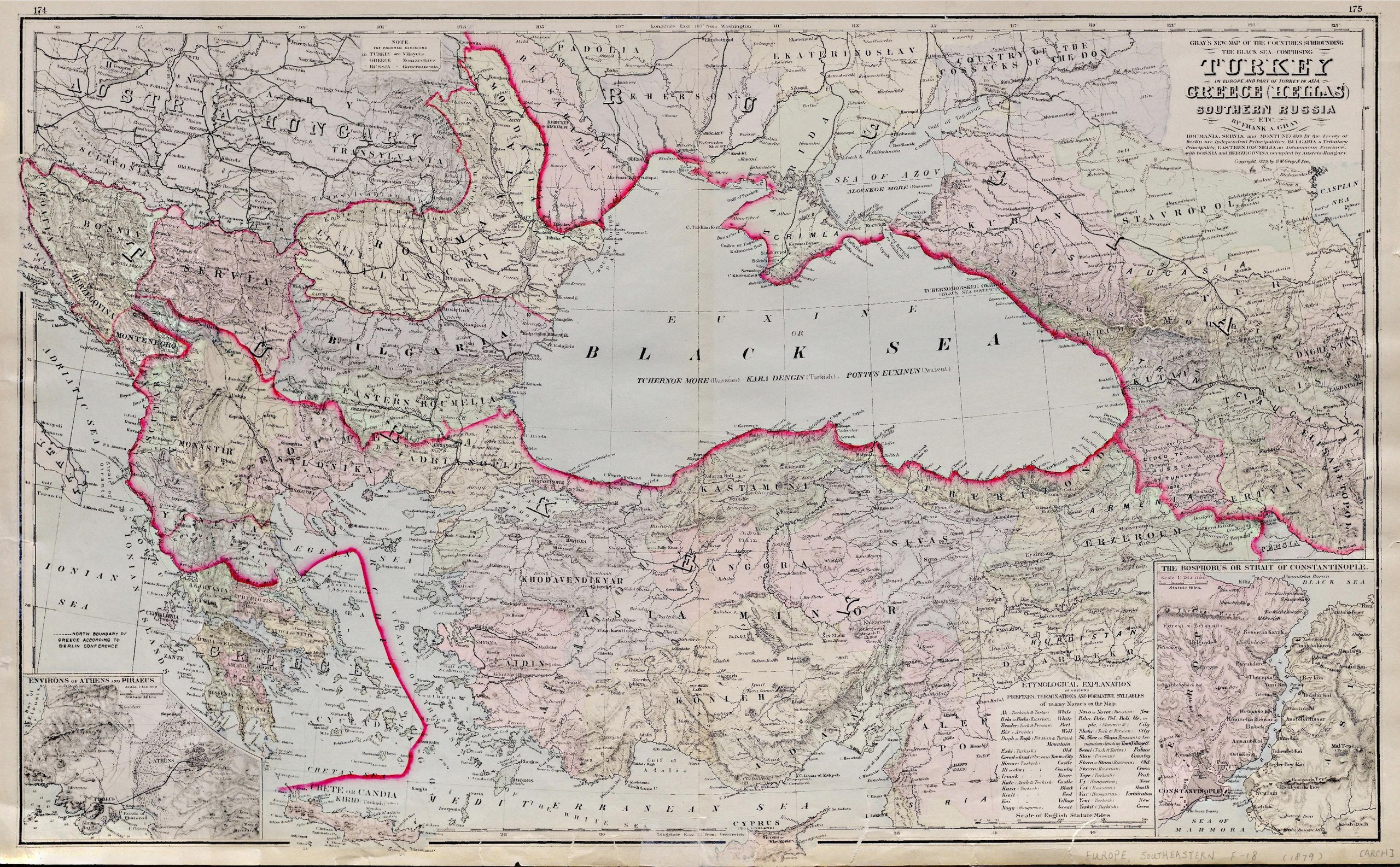
edit| Gray's new map of the countries surrounding the Black Sea comprising Turkey in Europe and part of Turkey in Asia, Greece (Hellas, Southern Russia etc.
( |
|
|---|---|
| Title |
Gray's new map of the countries surrounding the Black Sea comprising Turkey in Europe and part of Turkey in Asia, Greece (Hellas, Southern Russia etc. |
| Publisher |
O.W. Gray & Son, Philadelphia |
| Description |
Insets of the "Environs of Athens and Piraeus" and "The Bosphorus or Strait of Constantinople".;By Frank A. Gray.;Relief depicted by hachures.;Col., 40 x 67 cm. on folded atlas sheet 44 x 72 cm.;Shows countries surrounding Black Sea and their administrative divisions, populated centers and geographic features.;[Plates] 174 and 175.;Table of Etymological explanation of names used.;On verso: Gray's new map of Russia in Europe, 1:10,000,000, [Plate] 176 -- Gray's new map of Italy, 1:3,759,000, [Plate] 173.;From the Whistance-Smith Collection. Subjects: Europe, Southern--Political geography |
| Language | English |
| Publication date | 1879 |
| Current location |
IA Collections: wcw_gale; wcw; university_of_alberta_libraries; toronto |
| Accession number |
bp_32238 |
| Notes | Scale: Ca. 1:3,750,000 |
| Source | |
Licensing
edit|
This work is in the public domain in its country of origin and other countries and areas where the copyright term is the author's life plus 70 years or fewer.
| |
| This file has been identified as being free of known restrictions under copyright law, including all related and neighboring rights. | |
File history
Click on a date/time to view the file as it appeared at that time.
| Date/Time | Thumbnail | Dimensions | User | Comment | |
|---|---|---|---|---|---|
| current | 12:43, 27 August 2021 |  | 4,104 × 2,541, 2 pages (8.92 MB) | Fæ (talk | contribs) | IA Query "collection:(wcw) date:[1000 TO 1899]" bp_32238 Category:William C. Wonders Map Collection (COM:IA books#query) (1879 #235) |
You cannot overwrite this file.
File usage on Commons
The following page uses this file: