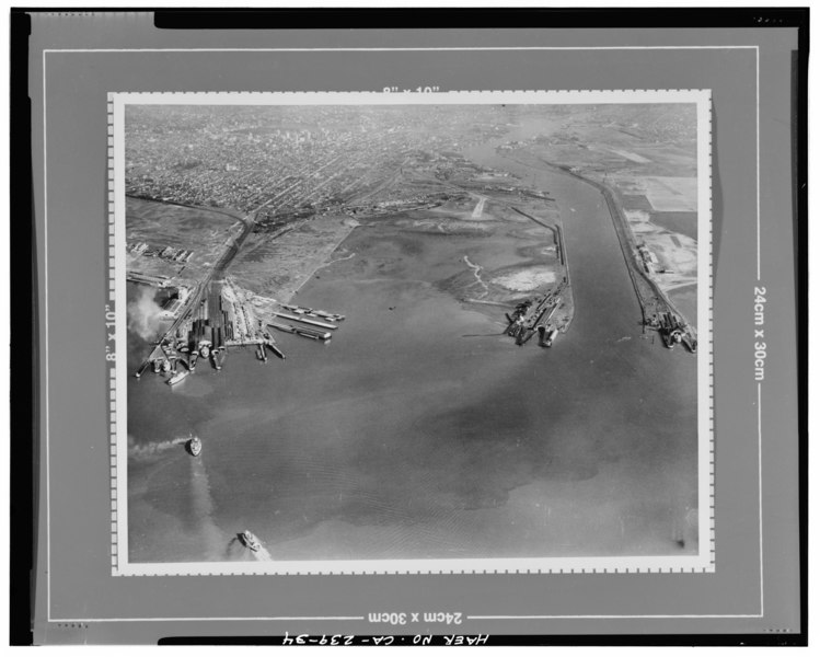
File:LOW OBLIQUE AERIAL VIEW LOOKING EAST OVER THE FUTURE SITE OF THE NAVAL SUPPLY CENTER TO DOWNTOWN OAKLAND. THE FEDERAL CHANNEL IS AT THE RIGHT. No date, probably mid 1930's. Clyde HAER CAL,1-OAK,28-34.tif
Size of this JPG preview of this TIF file: 749 × 600 pixels. Other resolutions: 300 × 240 pixels | 600 × 480 pixels | 959 × 768 pixels | 1,279 × 1,024 pixels | 2,558 × 2,048 pixels | 5,560 × 4,452 pixels.
Original file (5,560 × 4,452 pixels, file size: 23.61 MB, MIME type: image/tiff)
Captions
Captions
Add a one-line explanation of what this file represents
Summary edit
| Title |
LOW OBLIQUE AERIAL VIEW LOOKING EAST OVER THE FUTURE SITE OF THE NAVAL SUPPLY CENTER TO DOWNTOWN OAKLAND. THE FEDERAL CHANNEL IS AT THE RIGHT. No date, probably mid 1930's. Clyde Sunderland, photographer. Original print on file at the Port of Oakland, California. - Oakland Harbor Training Walls, Mouth of Federal Channel to Inner Harbor, Oakland, Alameda County, CA |
|||
| Depicted place | California; Alameda County; Oakland | |||
| Dimensions | 4 x 5 in. | |||
| Current location |
Library of Congress Prints and Photographs Division Washington, D.C. 20540 USA http://hdl.loc.gov/loc.pnp/pp.print |
|||
| Accession number |
HAER CAL,1-OAK,28-34 |
|||
| Credit line |
|
|||
| Source | https://www.loc.gov/pictures/item/ca2606.photos.382155p | |||
| Permission (Reusing this file) |
|

| Camera location | | View this and other nearby images on: OpenStreetMap |
|---|
File history
Click on a date/time to view the file as it appeared at that time.
| Date/Time | Thumbnail | Dimensions | User | Comment | |
|---|---|---|---|---|---|
| current | 10:44, 7 July 2014 |  | 5,560 × 4,452 (23.61 MB) | Fæ (talk | contribs) | GWToolset: Creating mediafile for Fæ. HABS 05 July 2014 (401:500) |
You cannot overwrite this file.
File usage on Commons
The following page uses this file: