File:Map of Manitoba drawm (sic) for the "Star" Almanac. (IA bp 2697).pdf

Original file (1,283 × 943 pixels, file size: 449 KB, MIME type: application/pdf)
Captions
Captions
Summary
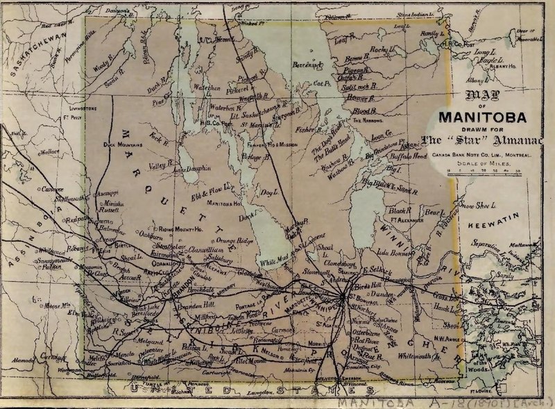
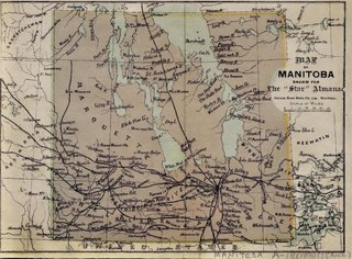
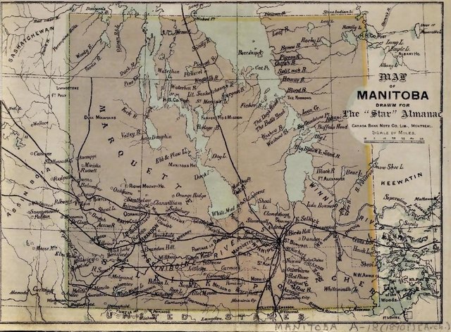
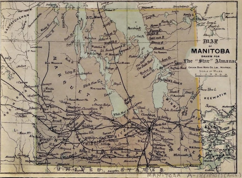
edit| Map of Manitoba drawm (sic) for the "Star" Almanac.
( |
|
|---|---|
| Title |
Map of Manitoba drawm (sic) for the "Star" Almanac. |
| Publisher |
Dept. of the Interior, Natural Resources Intelligence Branch, Canada |
| Description |
1 map : col., mounted on linen ; 15.5 x 21.3 cm. on sheet 16.5 x 22.1 cm. folded to 19 x 11 cm.;Scanned in Peel's Prairie Provinces database: Map 213: http://peel.library.ualberta.ca/maps/M000213.html;Shows parts of Saskatchewan, Assiniboia and Keewatin.;Railways are prominent. Subjects: Manitoba--Special category.;Manitoba--Transportation and communications |
| Language | English |
| Publication date | 1890? |
| Current location |
IA Collections: wcw_gale; wcw; university_of_alberta_libraries; toronto |
| Accession number |
bp_2697 |
| Notes | Scale: Ca 1:3,500,000. |
| Source | |
Licensing
edit|
This work is in the public domain in its country of origin and other countries and areas where the copyright term is the author's life plus 70 years or fewer.
| |
| This file has been identified as being free of known restrictions under copyright law, including all related and neighboring rights. | |
File history
Click on a date/time to view the file as it appeared at that time.
| Date/Time | Thumbnail | Dimensions | User | Comment | |
|---|---|---|---|---|---|
| current | 12:33, 27 August 2021 |  | 1,283 × 943 (449 KB) | Fæ (talk | contribs) | IA Query "collection:(wcw) date:[1000 TO 1899]" bp_2697 Category:William C. Wonders Map Collection (COM:IA books#query) (1890 #211) |
You cannot overwrite this file.
File usage on Commons
The following page uses this file: