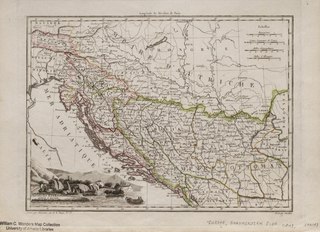
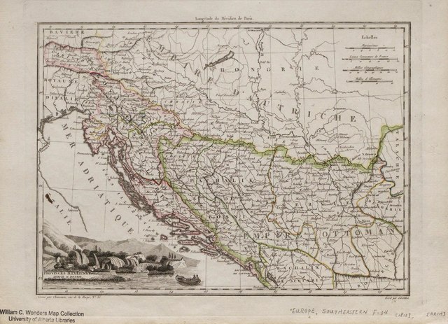
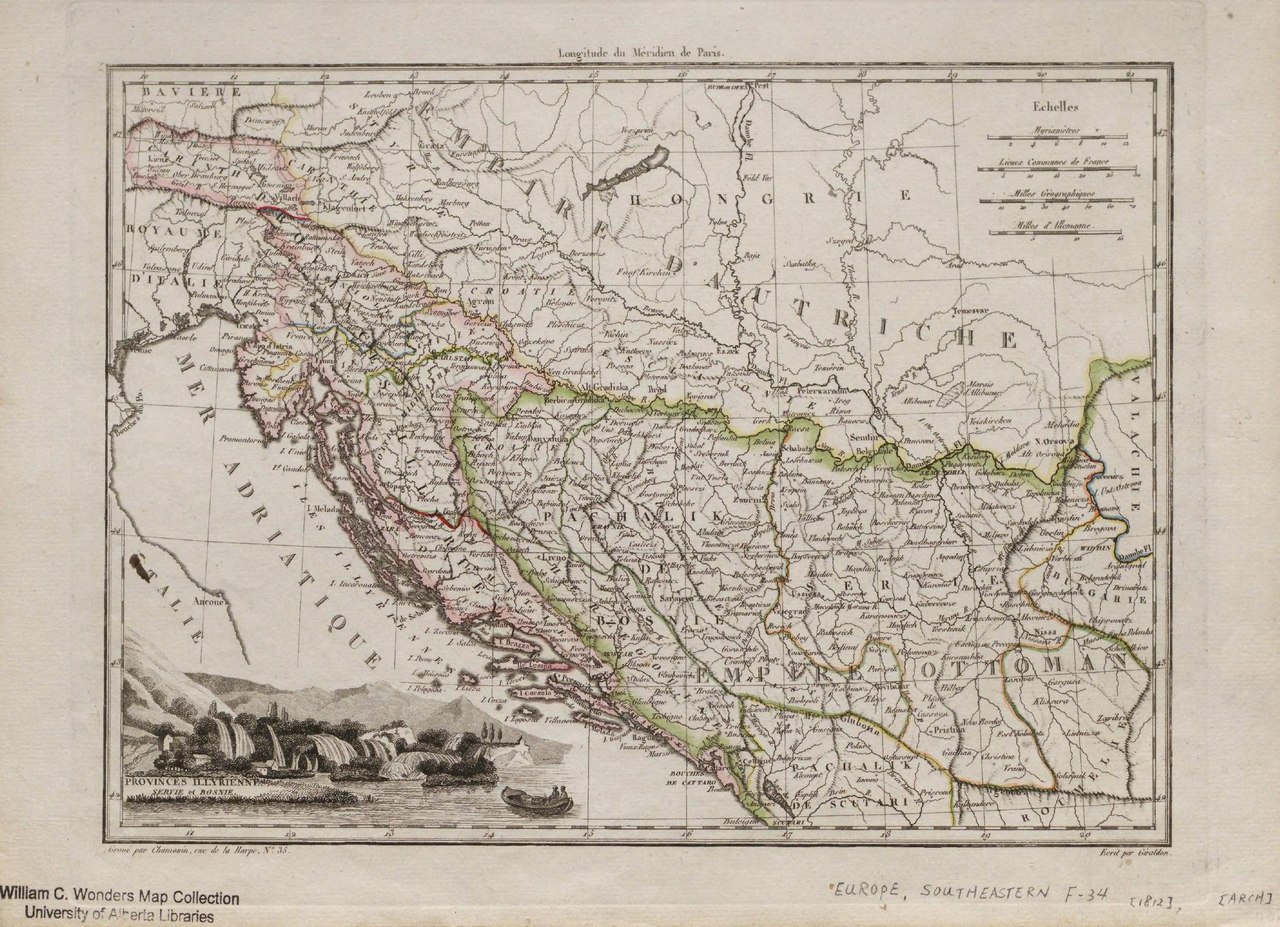
File:Provinces Illyriennes Servie et Bosnie. (IA bp 33177).pdf

Original file (2,116 × 1,531 pixels, file size: 1.13 MB, MIME type: application/pdf)
Captions
Captions
Summary
edit| Provinces Illyriennes Servie et Bosnie.
( |
|
|---|---|
| Title |
Provinces Illyriennes Servie et Bosnie. |
| Publisher |
Chez Francois Buisson, [Paris] |
| Description |
Additional description available in J. Eugene Horvath's: A Canadian collection of Hungaria [CCH]. v. 2, Maps & city views 1493-1817. (Library has book).;"Grave par Chamouin, rue de la Harpe No.35" and "Ecrit par Giraldon" in lower margin.;Hand col. outlines, engraved, 21 x 29 cm. on atlas sheet 26 x 36 cm.;Ottoman Empire portion of map includes: Serbia, Bosnia, Herzegovina, Bulgaria etc.;Includes place names, administrative borders and geographic features.;The Provinces Illyriennes (Illrian) are the lands of the north and east coast of the Adriatic Sea ceded by the Austrian Empire in 1809 to the French Empire (Croatia, Carinthie, Carniole, Dalmatie, Triest ...);Map straddles the boundary between the Austrian and Ottoman Empires.;Possible source: "Atlas complet du precis de la Geographie Universelle du Malte-Brun" dressee par M. Lapie ..., Paris, 1812.;Relief shown by hachures.;Map from the Horvath Collection [CCH-141]. Subjects: Europe, Southeastern--Political geography |
| Language | French |
| Publication date | [1812] |
| Current location |
IA Collections: wcw_gale; wcw; university_of_alberta_libraries; toronto |
| Accession number |
bp_33177 |
| Notes | Scale: Ca. 1:633,600 |
| Source | |
Licensing
edit|
This work is in the public domain in its country of origin and other countries and areas where the copyright term is the author's life plus 70 years or fewer.
| |
| This file has been identified as being free of known restrictions under copyright law, including all related and neighboring rights. | |
File history
Click on a date/time to view the file as it appeared at that time.
| Date/Time | Thumbnail | Dimensions | User | Comment | |
|---|---|---|---|---|---|
| current | 13:04, 27 August 2021 |  | 2,116 × 1,531 (1.13 MB) | Fæ (talk | contribs) | IA Query "collection:(wcw) date:[1000 TO 1899]" bp_33177 Category:William C. Wonders Map Collection (COM:IA books#query) (1812 #306) |
You cannot overwrite this file.
File usage on Commons
The following page uses this file: