File:ROADWAY APPROACH FROM THE GLOUCESTER SIDE, LOOKING SOUTHWEST. - George P. Coleman Memorial Bridge, Spanning York River at U.S. Route 17, Yorktown, York County, VA HAER VA,100-YORK,19-5.tif

Size of this JPG preview of this TIF file: 747 × 600 pixels. Other resolutions: 299 × 240 pixels | 598 × 480 pixels | 957 × 768 pixels | 1,275 × 1,024 pixels | 2,551 × 2,048 pixels | 5,000 × 4,015 pixels.
Original file (5,000 × 4,015 pixels, file size: 19.15 MB, MIME type: image/tiff)
Captions
Captions
Add a one-line explanation of what this file represents
Summary edit
| ROADWAY APPROACH FROM THE GLOUCESTER SIDE, LOOKING SOUTHWEST. - George P. Coleman Memorial Bridge, Spanning York River at U.S. Route 17, Yorktown, York County, VA | ||||
|---|---|---|---|---|
| Title |
ROADWAY APPROACH FROM THE GLOUCESTER SIDE, LOOKING SOUTHWEST. - George P. Coleman Memorial Bridge, Spanning York River at U.S. Route 17, Yorktown, York County, VA |
|||
| Depicted place | Virginia; York County; Yorktown | |||
| Date | Documentation compiled after 1968 | |||
| Dimensions | 4 x 5 in. | |||
| Current location |
Library of Congress Prints and Photographs Division Washington, D.C. 20540 USA http://hdl.loc.gov/loc.pnp/pp.print |
|||
| Accession number |
HAER VA,100-YORK,19-5 |
|||
| Credit line |
|
|||
| Notes |
|
|||
| Source | https://www.loc.gov/pictures/item/va1612.photos.368252p | |||
| Permission (Reusing this file) |
|
|||

File history
Click on a date/time to view the file as it appeared at that time.
| Date/Time | Thumbnail | Dimensions | User | Comment | |
|---|---|---|---|---|---|
| current | 10:38, 4 August 2014 | 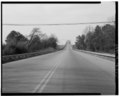 | 5,000 × 4,015 (19.15 MB) | Fæ (talk | contribs) | GWToolset: Creating mediafile for Fæ. HABS 2014-08-02 (3401:3600) |
You cannot overwrite this file.
File usage on Commons
The following page uses this file: