File:Topographic map of eastern Ontario, undated (IA topographicmape00foer).pdf

Size of this JPG preview of this PDF file: 418 × 600 pixels. Other resolutions: 167 × 240 pixels | 334 × 480 pixels | 535 × 768 pixels | 713 × 1,024 pixels | 1,427 × 2,048 pixels | 3,702 × 5,312 pixels.

Original file (3,702 × 5,312 pixels, file size: 1.04 MB, MIME type: application/pdf, 2 pages)
Captions
Captions
Add a one-line explanation of what this file represents
Summary
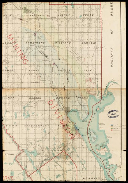
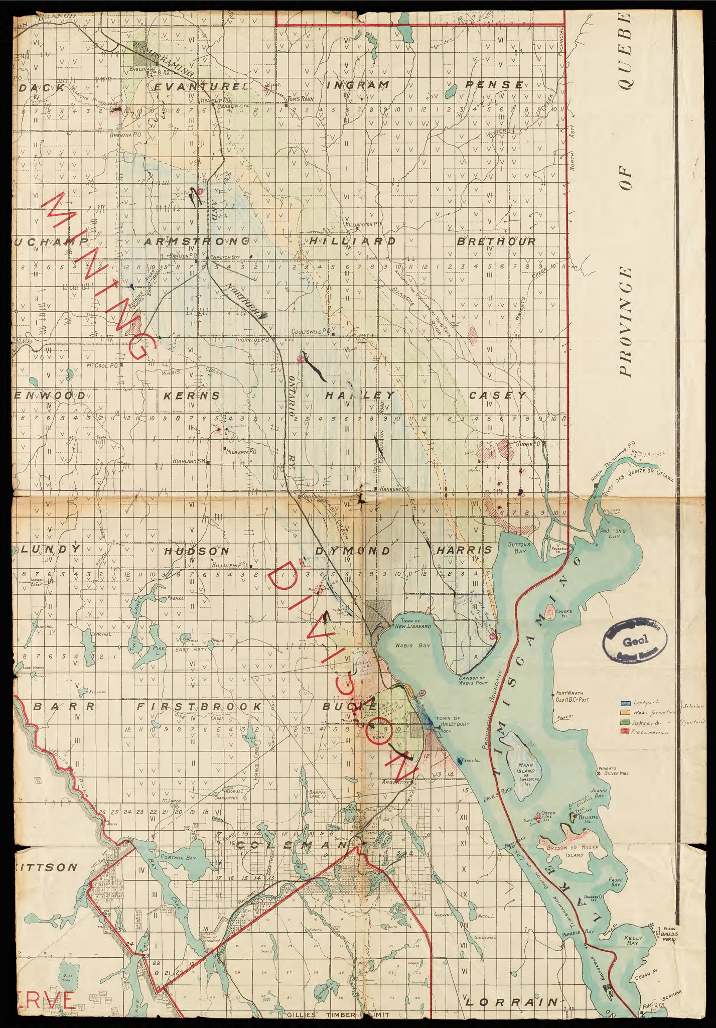
edit| Topographic map of eastern Ontario, undated
( |
||
|---|---|---|
| Author |
Foerste, Aug. F (Aug. Frederic), 1862-1936 |
 |
| Title |
Topographic map of eastern Ontario, undated |
|
| Description |
The topographical map document geological fieldwork completed by August Foerste in Ontario, Canada (undated). Notations indicate locations of formations and whether they are Silurian or Trenton. Regions are colored, and there is a key Subjects: Geology |
|
| Language | eng | |
| Publication date | 1887 | |
| Current location |
IA Collections: biodiversity; fieldnotesclir2016 |
|
| Accession number |
topographicmape00foer |
|
| Source | ||
Licensing
edit
|
This file comes from the Biodiversity Heritage Library.
This tag does not indicate the copyright status of the attached work. A normal copyright tag is still required. See Commons:Licensing.
|
This work is in the public domain in the United States because it is a work prepared by an officer or employee of the United States Government as part of that person’s official duties under the terms of Title 17, Chapter 1, Section 105 of the US Code.
Note: This only applies to original works of the Federal Government and not to the work of any individual U.S. state, territory, commonwealth, county, municipality, or any other subdivision. This template also does not apply to postage stamp designs published by the United States Postal Service since 1978. (See § 313.6(C)(1) of Compendium of U.S. Copyright Office Practices). It also does not apply to certain US coins; see The US Mint Terms of Use.
|
 | |
| This file has been identified as being free of known restrictions under copyright law, including all related and neighboring rights. | ||
File history
Click on a date/time to view the file as it appeared at that time.
| Date/Time | Thumbnail | Dimensions | User | Comment | |
|---|---|---|---|---|---|
| current | 12:53, 24 June 2020 |  | 3,702 × 5,312, 2 pages (1.04 MB) | Fæ (talk | contribs) | BHL Field Notes Project topographicmape00foer (User talk:Fæ/CCE volumes#Fork7) (batch 1800-1924 #1306) |
You cannot overwrite this file.
File usage on Commons
The following page uses this file: