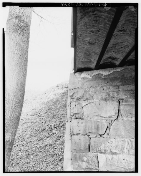
File:VIEW EAST, NORTH END OF EASTERN ABUTMENT, SHOWING 1903 STONEWORK, 1918 CONCRETE FACING AND CAP, AND UNDERSIDE OF 1918 STEEL-AND-CONCRETE DECK - Cyrus Bridge, 195 feet West of HAER WVA,50-CYRUS,1-4.tif
Size of this JPG preview of this TIF file: 479 × 599 pixels. Other resolutions: 192 × 240 pixels | 384 × 480 pixels | 614 × 768 pixels | 818 × 1,024 pixels | 1,637 × 2,048 pixels | 3,996 × 5,000 pixels.
Original file (3,996 × 5,000 pixels, file size: 19.06 MB, MIME type: image/tiff)
Captions
Captions
Add a one-line explanation of what this file represents
Summary edit
| VIEW EAST, NORTH END OF EASTERN ABUTMENT, SHOWING 1903 STONEWORK, 1918 CONCRETE FACING AND CAP, AND UNDERSIDE OF 1918 STEEL-AND-CONCRETE DECK - Cyrus Bridge, 195 feet West of intersection of County Road 19 and U.S. Route 52, Cyrus, Wayne County, WV | ||||
|---|---|---|---|---|
| Title |
VIEW EAST, NORTH END OF EASTERN ABUTMENT, SHOWING 1903 STONEWORK, 1918 CONCRETE FACING AND CAP, AND UNDERSIDE OF 1918 STEEL-AND-CONCRETE DECK - Cyrus Bridge, 195 feet West of intersection of County Road 19 and U.S. Route 52, Cyrus, Wayne County, WV |
|||
| Depicted place | West Virginia; Wayne County; Cyrus | |||
| Date | Documentation compiled after 1968 | |||
| Dimensions | 4 x 5 in. | |||
| Current location |
Library of Congress Prints and Photographs Division Washington, D.C. 20540 USA http://hdl.loc.gov/loc.pnp/pp.print |
|||
| Accession number |
HAER WVA,50-CYRUS,1-4 |
|||
| Credit line |
|
|||
| Notes |
|
|||
| Source | https://www.loc.gov/pictures/item/wv0355.photos.372852p | |||
| Permission (Reusing this file) |
|
|||

File history
Click on a date/time to view the file as it appeared at that time.
| Date/Time | Thumbnail | Dimensions | User | Comment | |
|---|---|---|---|---|---|
| current | 09:15, 5 August 2014 |  | 3,996 × 5,000 (19.06 MB) | Fæ (talk | contribs) | GWToolset: Creating mediafile for Fæ. HABS 2014-08-04 (3601:3800) Penultimate Tranche! |
You cannot overwrite this file.
File usage on Commons
The following page uses this file: