File:VIEW FROM CENTER POINT OF NORTH SIDE, NOTE BRACING - Brownsville Covered Bridge, Spanning East Fork Whitewater River (moved to Eagle Creek Park, Indianapolis), Brownsville, HAER IND,81-BROVI,1-11.tif

Size of this JPG preview of this TIF file: 431 × 599 pixels. Other resolutions: 173 × 240 pixels | 345 × 480 pixels | 552 × 768 pixels | 737 × 1,024 pixels | 1,474 × 2,048 pixels | 3,844 × 5,342 pixels.
Original file (3,844 × 5,342 pixels, file size: 19.59 MB, MIME type: image/tiff)
Captions
Captions
Add a one-line explanation of what this file represents
Summary edit
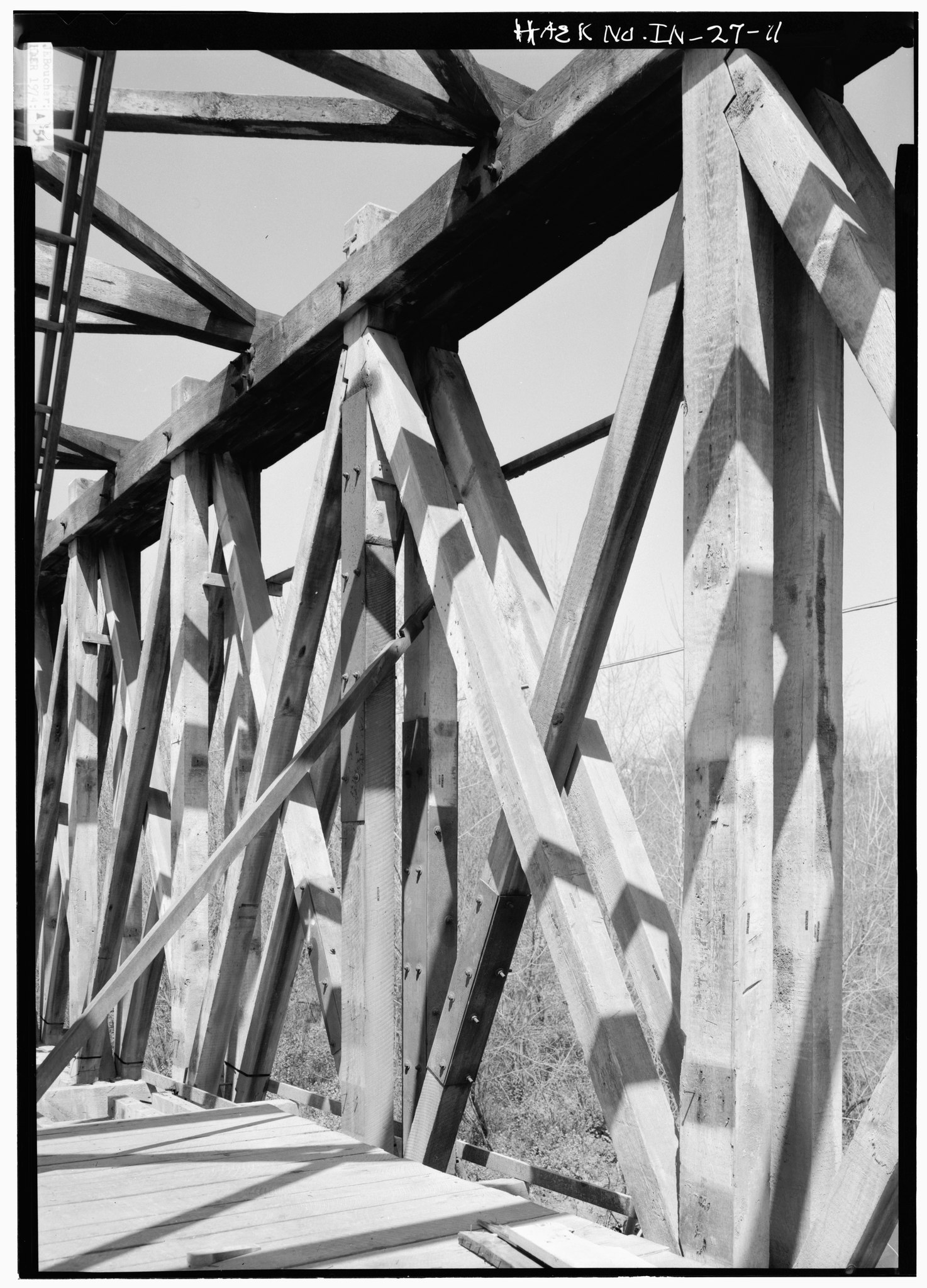
| VIEW FROM CENTER POINT OF NORTH SIDE, NOTE BRACING - Brownsville Covered Bridge, Spanning East Fork Whitewater River (moved to Eagle Creek Park, Indianapolis), Brownsville, Union County, IN
( |
||||||||||||||||||||||||||
|---|---|---|---|---|---|---|---|---|---|---|---|---|---|---|---|---|---|---|---|---|---|---|---|---|---|---|
| Photographer |
|
|||||||||||||||||||||||||
| Title |
VIEW FROM CENTER POINT OF NORTH SIDE, NOTE BRACING - Brownsville Covered Bridge, Spanning East Fork Whitewater River (moved to Eagle Creek Park, Indianapolis), Brownsville, Union County, IN |
|||||||||||||||||||||||||
| Description |
Long, Stephen H; Mason, Adam; Ball State University College of Architecture and Planning, sponsor |
|||||||||||||||||||||||||
| Depicted place | Indiana; Union County; Brownsville | |||||||||||||||||||||||||
| Date | Documentation compiled after 1968; 1974 | |||||||||||||||||||||||||
| Dimensions | 5 x 7 in. | |||||||||||||||||||||||||
| Current location |
Library of Congress Prints and Photographs Division Washington, D.C. 20540 USA http://hdl.loc.gov/loc.pnp/pp.print |
|||||||||||||||||||||||||
| Accession number |
HAER IND,81-BROVI,1-11 |
|||||||||||||||||||||||||
| Credit line |
|
|||||||||||||||||||||||||
| Notes |
|
|||||||||||||||||||||||||
| Source | https://www.loc.gov/pictures/item/in0118.photos.065934p | |||||||||||||||||||||||||
| Permission (Reusing this file) |
|
|||||||||||||||||||||||||

File history
Click on a date/time to view the file as it appeared at that time.
| Date/Time | Thumbnail | Dimensions | User | Comment | |
|---|---|---|---|---|---|
| current | 03:36, 18 July 2014 |  | 3,844 × 5,342 (19.59 MB) | Fæ (talk | contribs) | GWToolset: Creating mediafile for Fæ. HABS 16 July 2014 (1201:1400) |
You cannot overwrite this file.
File usage on Commons
The following page uses this file: