Category:1986 United States Senate election maps
Media in category "1986 United States Senate election maps"
The following 48 files are in this category, out of 48 total.
-
 1986 Arizona.png 2,000 × 2,332; 215 KB
-
 1986 California Senate Counties.png 2,819 × 3,902; 713 KB
-

-

-

-

-

-

-

-
 1986 United States Senate election in Florida results map by county.svg 744 × 727; 422 KB
-

-
 1986 United States Senate election in Hawaii results map by county.svg 1,052 × 614; 2.12 MB
-
-
-

-
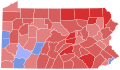
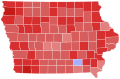 1986 United States Senate election in Iowa results map by county.svg 810 × 532; 31 KB
-

-

-
-
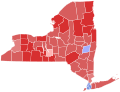
 1986 United States Senate election in Maryland results map by county.svg 744 × 405; 222 KB
-

-
-

-

-
-

-

-

-
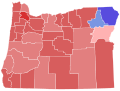
 1986 United States Senate election in Ohio results map by county.svg 810 × 810; 39 KB
-

-
-
-

-

-
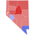
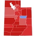 1986 United States Senate election in Utah results map by county.svg 810 × 810; 29 KB
-

-

-
-

-
 1986 United States Senate elections results map.svg 959 × 593; 83 KB
-

-
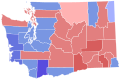
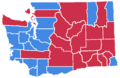 1986 Washington senate election.png 610 × 398; 17 KB
-
 86GASenateCounties.PNG 517 × 599; 91 KB
-
 86NDSenateCounties.PNG 800 × 476; 71 KB
-
 86SDSenateCounties.PNG 800 × 492; 77 KB
-
 Ohio 1986 Senate Election By Township.svg 744 × 744; 4.66 MB
-
 Oklahoma 1986 Senate Election.gif 399 × 195; 8 KB
-
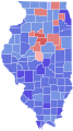
 United States Senate election in Illinois, 1986 map.png 226 × 375; 33 KB


