Category:Old maps of Fife
Council areas (municipalities) of Scotland: Aberdeen · Aberdeenshire · Angus · Argyll and Bute · Clackmannanshire · Dumfries and Galloway · Dundee · East Lothian · Edinburgh · Fife · Glasgow · Highland · Midlothian · Moray · Outer Hebrides · Orkney Islands · Renfrewshire · Scottish Borders · Shetland Islands · West Lothian
Traditional counties (shires) of Scotland: Aberdeenshire · Angus · Argyll · Ayrshire · Banffshire · Berwickshire · Buteshire · Caithness · Clackmannanshire · Cromartyshire · Dumbartonshire · Dumfriesshire · East Lothian · Fife · Inverness-shire · Kincardineshire · Kinross-shire · Kirkcudbrightshire · Lanarkshire · Midlothian · Moray · Nairnshire · Orkney Islands · Peeblesshire · Perthshire · Renfrewshire · Ross-shire · Roxburghshire · Selkirkshire · Shetland Islands · Stirlingshire · Sutherland · West Lothian · Wigtownshire
Subcategories
This category has the following 2 subcategories, out of 2 total.
- Old county maps of Fife (4 F)
R
- Fife RJD 1914 (2 F)
Media in category "Old maps of Fife"
The following 21 files are in this category, out of 21 total.
-
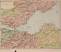
 Fifae Pars Occidentalis, The West Part of Fife - btv1b53056256b (1 of 2).jpg 7,416 × 6,032; 5.31 MB
-
 Fifae Pars Orientalis, The East Part of Fife - btv1b530569382 (1 of 2).jpg 7,456 × 6,032; 5.88 MB
-
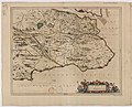
 Fifae Vicecomitatus, The Sherifdome of Fyfe - btv1b530567906 (1 of 2).jpg 7,320 × 6,056; 5.93 MB
-
 "Fifae Pars Occidentalis = The West part of Fife." (22071187850).jpg 3,976 × 3,126; 2.14 MB
-
-

-
 1855 Ordnance Survey map of Gauldry, Fife.png 6,297 × 3,727; 18.47 MB
-
-

-

-
-

-

-

-

-
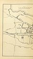
 Auchtertool 1854.png 982 × 592; 841 KB
-
-
 Kincardine Bridgemap1945.jpg 1,861 × 606; 611 KB
-
 Kincardinemap1945 very high res.jpg 2,108 × 2,078; 1.77 MB
-
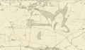
 Kincardinemap1945.png 665 × 647; 923 KB
-
 Ordnance Survey Sheet NT 29 39 Kirkcaldy, Published 1970.jpg 14,767 × 7,061; 38.74 MB
.jpg)
.jpg)
.jpg)
.jpg)
.jpg)
.jpg)

_(14598423608).jpg)
_(14784717472).jpg)
.jpg)
.jpg)
.jpg)
.jpg)
.jpg)
.jpg)


