Category:Old maps of the Orkney Islands
Traditional counties (shires) of Scotland: Aberdeenshire · Angus · Argyll ≈ Argyllshire · Ayrshire · Banffshire · Berwickshire · Buteshire · Caithness · Clackmannanshire · Cromartyshire · Dumbartonshire · Dumfriesshire · East Lothian · Fife · Inverness-shire · Kincardineshire · Kinross-shire · Kirkcudbrightshire · Lanarkshire · Midlothian · Moray · Nairnshire · the Orkney Islands ≈ Orkney Islands · Peeblesshire · Perthshire · Renfrewshire · Ross-shire · Roxburghshire · Selkirkshire · the Shetland Islands ≈ Shetland Islands · Stirlingshire · Sutherland · West Lothian · Wigtownshire
Subcategories
This category has the following 6 subcategories, out of 6 total.
E
O
Media in category "Old maps of the Orkney Islands"
The following 66 files are in this category, out of 66 total.
-
 "Orcadum et Schetlandiae insularum accuratissima descriptio." (21636210744).jpg 4,095 × 3,139; 2.43 MB
-
 17th Century map of the Orkney Islands.JPG 3,456 × 2,592; 5.45 MB
-
 18 of '(North Sea Pilot.)' (11115230804).jpg 1,593 × 2,562; 594 KB
-
 18 of '(North Sea Pilot.)' (11190544426).jpg 1,607 × 2,643; 602 KB
-
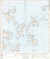
 1861 ORKNEY ISLANDS Civil Parish map.jpg 3,994 × 6,000; 1.71 MB
-

-

-

-

-
 The Harmsworth atlas and Gazetter 1908 (135848634).jpg 12,532 × 9,586; 130.01 MB
-
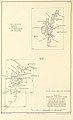
 Kartskiss över Scapa flow.png 375 × 327; 15 KB
-
 Close's indexed charts of the British isles - the Orkney & Shetland islands - btv1b53221760v.jpg 10,490 × 13,454; 22.68 MB
-
 28 of '(North Sea Pilot.)' (11228848544).jpg 1,600 × 2,615; 703 KB
-

-
 619 of 'Illustreret Norges historie. (With plates.)' (11180901725).jpg 1,599 × 2,510; 779 KB
-
 A chart of the islands of Orkney - btv1b530097217.jpg 12,295 × 12,118; 18.8 MB
-

-

-
 Admiralty Chart No 1119 Lerwick to Stronsay, Published 1956.jpg 8,190 × 11,216; 14.28 MB
-
 Admiralty Chart No 1553 Kirkwall Bay, Published 1898.jpg 8,222 × 11,239; 29.66 MB
-
 Admiralty Chart No 2179 Orkney Islands - southern part, Published 1961.jpg 9,889 × 6,785; 19.38 MB
-
 Admiralty Chart No 2180 Orkney Islands, Surveyed 1850.png 7,953 × 10,319; 87.57 MB
-
 Admiralty Chart No 2180a Northern portion of the Orkney Islands, Scotland, Published 1886.jpg 11,916 × 8,312; 9.53 MB
-
 Admiralty Chart No 2180b Southern portion of the Orkney Islands, Scotland, Published 1886.jpg 11,787 × 8,260; 11.67 MB
-

-
 Admiralty Chart No 2182c North Sea Northern Sheet Published 1915.jpg 12,118 × 7,374; 5.57 MB
-
 Admiralty Chart No 219 Western approaches to the Orkneys and Shetlands, Published 1941.jpg 16,267 × 11,165; 41.68 MB
-

-
 Admiralty Chart No 2568 Hoy Sound, Published 1858.jpg 10,828 × 8,322; 29.31 MB
-
 Admiralty Chart No 2581 Long Hope and Widewall Harbour, Published 1858.jpg 10,100 × 6,644; 21.85 MB
-
 Admiralty Chart No 2581 Scapa Flow and Approaches Southern Sheet, Published 1909.jpg 10,038 × 6,685; 26.32 MB
-
 Admiralty Chart No 2582 Pierowall Road, Published 1858.jpg 10,887 × 8,111; 18.12 MB
-
 Admiralty Chart No 2583 Deer Sound and Inganess Bay, Published 1858.jpg 10,912 × 8,172; 26.46 MB
-
 Admiralty Chart No 2584 Approaches to Kirkwall, Published 1898.jpg 16,431 × 11,287; 60.02 MB
-
 Admiralty Chart No 3729 Scapa Flow and Approaches Northern Sheet, Published 1909.jpg 10,228 × 6,560; 28.92 MB
-
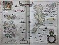
 Blaeu - Atlas of Scotland 1654 - ORCADVM ET SCHETLANDIÆ - Orkney and Shetland.jpg 6,300 × 4,800; 7.38 MB
-
 Blaeu - Atlas of Scotland 1654 - SCOTIA REGNUM - Kingdom of Scotland.jpg 6,492 × 5,000; 9.41 MB
-

-
 Internment at Scarpa Flow.jpg 738 × 518; 260 KB
-
 Kart over Orknøyene - no-nb krt 00744.jpg 5,171 × 6,313; 7.03 MB
-
 Nieuwe Accurate Pas-caart van de Eylanden d'Orcades - btv1b53056820p.jpg 6,304 × 5,160; 4.29 MB
-
 North East Coast of Orkney Mackenzie 85449280.jpg 8,793 × 12,462; 17.38 MB
-
 North west coast of Orkney Mackenzie 5449283.jpg 11,216 × 8,791; 14.49 MB
-
 Orcades Carta Marina.JPG 939 × 1,322; 310 KB
-
 Orcadum et Schetlandiae insularum accuratissima descriptio - CBT 6587134.jpg 5,726 × 4,416; 6.5 MB
-
 Ordnance Survey ARMY AIR Sheet 8 Orkneys.jpg 6,367 × 8,231; 5.1 MB
-
 Ordnance Survey One-Inch Sheet 5 Orkney (North), Published 1958.jpg 8,280 × 9,862; 6.18 MB
-
 Ordnance Survey One-Inch Sheet 6 Orkney (Kirkwall), Published 1959.jpg 8,275 × 9,882; 8.34 MB
-
 Ordnance Survey One-Inch Sheet 6 Orkney Islands (Mainland), Published 1948.jpg 13,958 × 10,689; 12.65 MB
-
 Ordnance Survey One-Inch Sheet 7 Pentland Firth, Published 1959.jpg 8,236 × 9,868; 6.93 MB
-
 Ordnance Survey Quarter-inch sheet 1 Orkney and Shetland Islands, published 1962.jpg 9,840 × 9,026; 5.79 MB
-
 Orkney Civil Parish map c. 1845.jpg 1,412 × 1,912; 3.46 MB
-
 Orkney isl. (Map 1) - btv1b530103710.jpg 9,761 × 6,442; 9.16 MB
-
 Orkney Islands - btv1b530096659.jpg 4,365 × 6,289; 3.49 MB
-
 ORKNEY ISLANDS Civil Parish map c.1854.jpg 3,880 × 6,000; 2.5 MB
-
 Orkney Islands Mackenzie 85449271.jpg 12,600 × 8,804; 19.48 MB
-
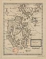 Orkney Shire - By H. Moll - btv1b53056939h.jpg 2,688 × 3,480; 1.21 MB
-
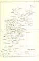
 Papa Stronsay map 1903.png 1,033 × 804; 980 KB
-
 Peach Horne Orkney Geological Map 1883 orkneysshetlandt00tudo 0234.jpg 1,468 × 2,067; 363 KB
-
 Pomona or main-land Mackenzie 85449277.png 12,456 × 8,839; 122.76 MB
-
 South isles of Orkney Mackenzie 85449274.jpg 11,808 × 9,955; 20.27 MB
-
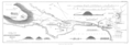 Stenness Plan Thomas 1851 50.png 10,883 × 3,844; 3.05 MB
-
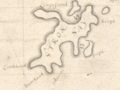 Stronsay map 1682.png 611 × 458; 433 KB
-
 The Quarterly journal of the Geological Society of London (12960670054).jpg 1,171 × 1,524; 361 KB
-
 UBBasel Map 1570-1590 Kartenslg Mappe 238-45 Hebride Orcade.tiff 4,320 × 1,959, 2 pages; 24.24 MB
-
 UBBasel Map Schottland Färöer Shetlandinseln Orkneyinseln Hebriden 1685-1686 Kartenslg Mappe 238-46.tif 3,344 × 4,466, 2 pages; 42.75 MB
.jpg)

%27_(11115230804).jpg)
%27_(11190544426).jpg)

_(14593715150).jpg)
_(14780084982).jpg)
%27_(16403174390).jpg)
.jpg)
.jpg)


%27_(11228848544).jpg)
%27_(11006109923).jpg)
%27_(11180901725).jpg)


,_Published_1958.jpg)
,_Published_1959.jpg)
,_Published_1948.jpg)


_-_btv1b530103710.jpg)


.jpg)