Category:SVG labeled maps of administrative divisions of Lithuania (location map scheme)


.svg)


_(Paris_zoom).svg)
.svg)
,_administrative_divisions_-_de_-_colored_(multizoom).svg)
_-_colored.svg)
.svg)
,_administrative_divisions_-_Nmbrs_(multizoom).svg)
,_administrative_divisions_-_de_-_colored.svg)
_-_de_-_colored.svg)

.svg)

.svg)
Media in category "SVG labeled maps of administrative divisions of Lithuania (location map scheme)"
The following 18 files are in this category, out of 18 total.
-
 Lithuania districts ISO 3166-2.svg 1,095 × 822; 271 KB
-
-

-

-
-
 Lithuania, administrative divisions (districts+municipalities) - th - colored.svg 1,095 × 821; 1.17 MB
-
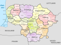
 Lithuania, administrative divisions - de (districts) - colored.svg 1,095 × 821; 402 KB
-
 Lithuania, administrative divisions - de (districts).svg 1,095 × 821; 352 KB
-
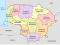
 Lithuania, administrative divisions - de - colored.svg 1,095 × 821; 667 KB
-
 Lithuania, administrative divisions - de.svg 1,095 × 821; 534 KB
-
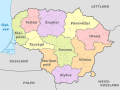
 Lithuania, administrative divisions - et (districts) - colored.svg 1,095 × 821; 378 KB
-
 Lithuania, administrative divisions - et - colored.svg 1,095 × 821; 708 KB
-
 Lithuania, administrative divisions - lt.svg 1,095 × 821; 513 KB
-
 Lithuania, administrative divisions - Nmbrs (districts) - colored.svg 1,095 × 821; 294 KB
-
 Lithuania, administrative divisions - Nmbrs (districts).svg 1,095 × 821; 291 KB
-
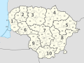
 Lithuania, administrative divisions - Nmbrs - colored.svg 1,095 × 821; 356 KB
-
 Lithuania, administrative divisions - Nmbrs.svg 1,095 × 821; 356 KB
-
 Lithuania, administrative divisions - th - colored.svg 1,095 × 821; 1.05 MB

_-_de_-_colored.svg)
_-_de_-_monochrome.svg)
_-_Nmbrs_-_colored.svg)
_-_Nmbrs_-_monochrome.svg)
_-_th_-_colored.svg)
_-_colored.svg)
.svg)


_-_colored.svg)


_-_colored.svg)
.svg)


