Category:SVG labeled maps of administrative divisions of the Republic of Ireland (location map scheme)


.svg)


_(Paris_zoom).svg)
.svg)
,_administrative_divisions_-_de_-_colored_(multizoom).svg)
_-_colored.svg)
.svg)
,_administrative_divisions_-_Nmbrs_(multizoom).svg)
,_administrative_divisions_-_de_-_colored.svg)
_-_de_-_colored.svg)

.svg)

.svg)
Media in category "SVG labeled maps of administrative divisions of the Republic of Ireland (location map scheme)"
The following 14 files are in this category, out of 14 total.
-
 Ireland, administrative divisions (provinces+counties) - th - colored.svg 1,450 × 1,807; 1.42 MB
-
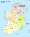 Ireland, administrative divisions (provinces+counties)- de - colored.svg 1,450 × 1,807; 1.15 MB
-
 Ireland, administrative divisions (provinces+counties)- de - monochrome.svg 1,450 × 1,807; 1.16 MB
-
 Ireland, administrative divisions (provinces+counties)- Nmbrs - colored.svg 1,450 × 1,807; 1.15 MB
-
 Ireland, administrative divisions (provinces+counties)- Nmbrs - monochrome.svg 1,450 × 1,807; 1.16 MB
-
 Ireland, administrative divisions - de (provinces) - colored.svg 1,450 × 1,807; 882 KB
-
 Ireland, administrative divisions - de (provinces).svg 1,450 × 1,807; 718 KB
-
 Ireland, administrative divisions - de - colored.svg 1,450 × 1,807; 1.06 MB
-
 Ireland, administrative divisions - de.svg 1,450 × 1,807; 1.07 MB
-
 Ireland, administrative divisions - Nmbrs (provinces) - colored.svg 1,450 × 1,807; 673 KB
-
 Ireland, administrative divisions - Nmbrs (provinces).svg 1,450 × 1,807; 670 KB
-
 Ireland, administrative divisions - Nmbrs - colored.svg 1,450 × 1,807; 1.1 MB
-
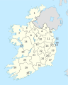 Ireland, administrative divisions - Nmbrs.svg 1,450 × 1,807; 1.1 MB
-
 Ireland, administrative divisions - th - colored.svg 1,450 × 1,807; 1.32 MB
_-_th_-_colored.svg)
-_de_-_colored.svg)
-_de_-_monochrome.svg)
-_Nmbrs_-_colored.svg)
-_Nmbrs_-_monochrome.svg)
_-_colored.svg)
.svg)


_-_colored.svg)
.svg)


