Category:1886 maps of Puerto Rico
States of the United States: California · Connecticut · Georgia · Hawaii · Illinois · Indiana · Iowa · Kansas · Kentucky · Louisiana · Maine · Maryland · Massachusetts · Michigan · Mississippi · Missouri · Montana · New Hampshire · New Jersey · New Mexico · New York · Ohio · Pennsylvania · Rhode Island · South Carolina · South Dakota · Tennessee · Texas · Utah · Vermont · Virginia · West Virginia · Wisconsin · Wyoming
Puerto Rico
Puerto Rico
| 1886 |
Media in category "1886 maps of Puerto Rico"
The following 6 files are in this category, out of 6 total.
-
 Mapa topografico de la isla de Puerto-Rico - btv1b53022843j.jpg 11,065 × 7,949; 12.5 MB
-
 Mapa topográfico de la isla de Puerto Rico retusche.jpg 9,919 × 6,588; 57.19 MB
-
 Mapa topográfico de la isla de Puerto Rico. LOC 98687140 (retocada).jpg 9,920 × 6,592; 49.01 MB
-
 Mapa topográfico de la isla de Puerto Rico. LOC 98687140.jpg 9,919 × 6,588; 9.72 MB
-
 Mapa topográfico de la isla de Puerto Rico. LOC 98687140.tif 9,919 × 6,588; 186.96 MB
-
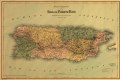
 Puerto Rico departamentos 1886.jpg 2,250 × 1,494; 1.44 MB


.jpg)

