Category:1886 maps of Georgia (U.S. state)
States of the United States: California · Connecticut · Georgia · Illinois · Iowa · Kansas · Kentucky · Louisiana · Maine · Maryland · Massachusetts · Michigan · Mississippi · Missouri · Montana · New Hampshire · New Jersey · New Mexico · New York · Ohio · Pennsylvania · Rhode Island · South Carolina · South Dakota · Tennessee · Texas · Utah · Vermont · Virginia · West Virginia · Wisconsin · Wyoming
Puerto Rico
Puerto Rico
| 1884 1885 1886 1887 1888 1889 → |
Subcategories
This category has only the following subcategory.
S
Media in category "1886 maps of Georgia (U.S. state)"
The following 11 files are in this category, out of 11 total.
-

-
 Bridgescolumbus.jpg 707 × 446; 168 KB
-
 Georgia, Dahlonega sheet LOC 2007626716.jpg 4,768 × 5,868; 4.16 MB
-
 Georgia, Dahlonega sheet LOC 2007626716.tif 4,768 × 5,868; 80.05 MB
-
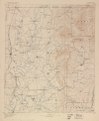
 Georgia, Dalton sheet LOC 2007626717.jpg 4,836 × 5,872; 3.72 MB
-
 Georgia, Dalton sheet LOC 2007626717.tif 4,836 × 5,872; 81.24 MB
-
 Perspective map of Columbus, Ga., county seat (of Muscogee Cou)nty, 188(6). LOC 75693191.jpg 11,280 × 7,392; 18.56 MB
-
 Perspective map of Columbus, Ga., county seat (of Muscogee Cou)nty, 188(6). LOC 75693191.tif 11,280 × 7,392; 238.56 MB
-
 Sanborn Fire Insurance Map from Atlanta, Fulton County, Georgia. LOC sanborn01378 003-18.jpg 6,715 × 7,913; 5.73 MB
-
 Sanborn Fire Insurance Map from Atlanta, Fulton County, Georgia. LOC sanborn01378 003-26.jpg 6,685 × 7,914; 5.25 MB
-
 Sanborn Fire Insurance Map from Atlanta, Fulton County, Georgia. LOC sanborn01378 003-32.tif 6,689 × 7,913; 151.43 MB


nty,_188(6)._LOC_75693191.jpg)

