Category:19th-century maps of Namibia
Countries of Africa: Algeria · Angola · Benin · Botswana · Cameroon · Cape Verde · Chad · Democratic Republic of the Congo · Republic of the Congo · Djibouti · Egypt‡ · Equatorial Guinea · Eritrea · Eswatini · Ethiopia · Gabon · The Gambia · Ghana · Guinea · Guinea-Bissau · Ivory Coast · Kenya · Lesotho · Liberia · Libya · Madagascar · Mali · Mauritania · Morocco · Mozambique · Namibia · Niger · Nigeria · Senegal · Sierra Leone · Somalia · South Africa · South Sudan · Sudan · Tanzania · Togo · Tunisia · Uganda · Zambia · Zimbabwe
Other areas: Canary Islands · Madeira · Western Sahara
‡: partly located in Africa
Other areas: Canary Islands · Madeira · Western Sahara
‡: partly located in Africa
Media in category "19th-century maps of Namibia"
The following 28 files are in this category, out of 28 total.
-
-
-
 BARROW(1806) p420 A chart of the southern extremity of Africa.jpg 2,203 × 1,532; 2.11 MB
-
-

-

-

-
 Meyers leiner Hand-atlas 1893 (73137692).jpg 9,552 × 6,507; 9.07 MB
-
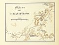 Nama und Damara pg036 Skizze des Tsaukhab-Thales.jpg 1,900 × 1,462; 536 KB
-
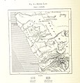
 Nama und Damara pg059 Skizze von Groß- und Klein-Windhoek.jpg 3,917 × 3,103; 2.21 MB
-
 Southern Africa 1890s Political.jpg 2,090 × 1,817; 469 KB
-

-

-

-

-

-

-
 Admiralty Chart No 1806 Africa west coast Great Fish Bay to Walfisch Bay, Published 1880.jpg 8,215 × 12,285; 11.94 MB
-
 Admiralty Chart No 632 Africa west coast Walfisch Bay to Orange River, Published 1881.jpg 8,229 × 12,291; 12.51 MB
-
 Admiralty Chart No 897 Africa west coast Milkbosch point to Orange River, Published 1879.jpg 6,242 × 8,359; 4.68 MB
-
 Die Gartenlaube (1884) b 667.jpg 721 × 1,309; 104 KB
-

-
 Le Tour du monde-01-p244.jpg 816 × 530; 118 KB
-

-

-
 Originalkarte des unteren !Khuiseb Thales.png 5,682 × 3,674; 27 MB
-
 Penguin Islands on 1897 map.jpg 524 × 455; 156 KB
-
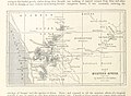
 Rep Upingtonia 1886.jpg 1,200 × 850; 774 KB
.jpg)
.jpg)
_p420_A_chart_of_the_southern_extremity_of_Africa.jpg)
.jpg)

%27_(15970346593).jpg)
.jpg)
.jpg)


.jpg)
.jpg)
.jpg)
.jpg)
.jpg)
.jpg)


_b_667.jpg)
%27_(11015428424).jpg)

._-_DPLA_-_98ecbcb49ab62e9dcd279ff240412cd8.jpg)
_-_DPLA_-_7b4d44c524ffcad25ddfde4580aaa22b.jpg)


