Category:19th-century maps of South Sudan
Countries of Africa: Algeria · Angola · Benin · Botswana · Cameroon · Cape Verde · Chad · Democratic Republic of the Congo · Republic of the Congo · Djibouti · Egypt‡ · Equatorial Guinea · Eritrea · Eswatini · Ethiopia · Gabon · The Gambia · Ghana · Guinea · Guinea-Bissau · Ivory Coast · Kenya · Lesotho · Liberia · Libya · Madagascar · Mali · Mauritania · Morocco · Mozambique · Namibia · Niger · Nigeria · Senegal · Sierra Leone · Somalia · South Africa · South Sudan · Sudan · Tanzania · Togo · Tunisia · Uganda · Zambia · Zimbabwe
Other areas: Canary Islands · Madeira · Western Sahara
‡: partly located in Africa
Other areas: Canary Islands · Madeira · Western Sahara
‡: partly located in Africa
Subcategories
This category has only the following subcategory.
Media in category "19th-century maps of South Sudan"
The following 20 files are in this category, out of 20 total.
-
 Northeast Africa 1885.jpg 860 × 779; 240 KB
-
 Die Quellen des Mbomu, Bikki und Uërre in Ndoruma's Gebiet.png 1,816 × 2,591; 6.14 MB
-
 Die Umgebung von Ndoruma's Residenz.png 1,762 × 2,337; 5.52 MB
-
 Mudirije Makaraka, westliche Seite.png 2,512 × 2,607; 8.83 MB
-
 Mudirije Makaraka, östliche Seite.png 1,703 × 2,540; 6.3 MB
-
 Seriba Tangasi und Umgebung.png 1,749 × 2,649; 6.42 MB
-
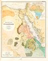
 Ägypten Dar Fur und Abessinien.jpg 2,832 × 3,488; 4.11 MB
-
 ACSIE003 - Map of Egypt, Abyssinia, and the Soudan.jpg 650 × 787; 85 KB
-
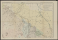
 BahrElGhazal FrankLupton EGRavenstein 1884.jpg 1,151 × 1,600; 420 KB
-
 Der östliche Teil der Mudirje Hat el-Estiva zur Zeit der Mahdisten-Invasion 1884 & 1885.png 1,646 × 2,308; 5.38 MB
-
 Fr. Bohndorff's Reisen in Central-Afrika in den Jahren 1880 bis 1883.png 3,753 × 4,613; 22.31 MB
-
 Joseph Menges Reisen zwischen Kassala und dem Setit.png 1,907 × 2,304; 5.94 MB
-
 Karte von Inner-Afrika, Blatt 8 - Gondokoro.png 8,870 × 7,565; 87.12 MB
-
 Le Tour du monde-05-p395.png 820 × 567; 130 KB
-
 Lepsius-Projekt tw 1-1-01.jpg 1,603 × 2,051; 544 KB
-
 Mahdi 1885.png 333 × 600; 418 KB
-
 Vierblattkarte von Central-Afrika, Sektion I.png 6,655 × 4,597; 35.2 MB
-
 Vierblattkarte von Central-Afrika, Sektion II.png 6,633 × 4,569; 37.53 MB
-
 Vierblattkarte von Central-Afrika, Sektion III.png 6,667 × 4,585; 35.06 MB
-
 Vierblattkarte von Central-Afrika, Sektion IV.png 6,633 × 4,569; 38.66 MB


