Category:20th-century maps of Cameroon
Countries of Africa: Algeria · Angola · Benin · Botswana · Burkina Faso · Burundi · Cameroon · Cape Verde · Central African Republic · Chad · Comoros · Democratic Republic of the Congo · Republic of the Congo · Djibouti · Egypt‡ · Equatorial Guinea · Eritrea · Eswatini · Ethiopia · Gabon · The Gambia · Ghana · Guinea · Guinea-Bissau · Ivory Coast · Kenya · Lesotho · Liberia · Libya · Madagascar · Malawi · Mali · Mauritania · Morocco · Mozambique · Namibia · Niger · Nigeria · Rwanda · São Tomé and Príncipe · Senegal · Sierra Leone · Somalia · South Africa · South Sudan · Sudan · Tanzania · Togo · Tunisia · Uganda · Zambia · Zimbabwe
Limited recognition: Somaliland – Other areas: Madeira · Western Sahara
‡: partly located in Africa
Limited recognition: Somaliland – Other areas: Madeira · Western Sahara
‡: partly located in Africa
Media in category "20th-century maps of Cameroon"
The following 29 files are in this category, out of 29 total.
-
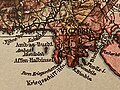 Kartenausschnitt Ambas Bucht - Deutscher Kolonialatlas, 1910.jpg 4,032 × 3,024; 3.35 MB
-
 1911French Congo.png 1,348 × 1,360; 1.98 MB
-
 Hand-drawn map of the Kamerun Campaign of World War I in West Africa.jpg 5,736 × 7,046; 6.12 MB
-
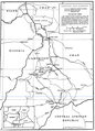
 1967 data of Central and Southern African countries.jpg 5,856 × 2,900; 2.34 MB
-
 Baumwollkarte Kamerun 1909.jpg 2,461 × 2,323; 503 KB
-
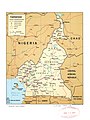
 Cameroon-Chad boundary map.png 766 × 1,064; 277 KB
-
 Cameroon-Gabon border.png 1,216 × 888; 325 KB
-
 Cameroon-Republic of Congo border.png 1,440 × 1,020; 184 KB
-
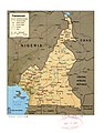
 Cameroon. LOC 2005631064.jpg 2,291 × 3,058; 700 KB
-
 Cameroon. LOC 2005631064.tif 2,291 × 3,058; 20.04 MB
-
 Cameroon. LOC 2005631065.jpg 2,339 × 2,996; 737 KB
-
 Cameroon. LOC 2005631065.tif 2,339 × 2,996; 20.05 MB
-
 Cameroons - btv1b532099561.jpg 9,158 × 11,830; 20.39 MB
-
 Cameroons that Saker laboured.jpg 869 × 1,360; 526 KB
-

-
 Carte de l'Afrique Équatoriale Française et du Cameroun - btv1b53192486g.jpg 6,449 × 9,352; 10.31 MB
-

-
-

-
 Kamerun - bearbeitet von Moisel, 1-1.000.000. Deutsche Kolonialgesellschaft - btv1b53006653z.jpg 13,664 × 16,581; 30.88 MB
-

-
 Lake Chad 1973.jpg 971 × 997; 553 KB
-
 Lange diercke sachsen afrika ehemalige schutzgebiete kamerun.jpg 1,064 × 824; 518 KB
-
 Map of the Central African Republic-Cameroon border.png 716 × 1,002; 290 KB
-
 Mission Chevalier 1902-1904 Congo fr et Cameroun allemand.png 2,031 × 1,918; 4.5 MB
-

-
 P407 - N° 585. Avance de l’Islam en Adamaoua. - Liv4-Ch10.png 1,442 × 1,704; 505 KB
-
-


_-_btv1b530665594.jpg)


.jpg)
_(14596429539).jpg)


_d%27Ibi_au_Tchad,_les_cartes_du_Tchad_du_Capitaine_Tilho_(1904)_et_de_H._de_Marquardsen_(1905),_les..._-_btv1b530781852_(1_of_2).jpg)


