Category:20th-century maps of Sudan
Countries of Africa: Algeria · Angola · Benin · Botswana · Burkina Faso · Burundi · Cameroon · Cape Verde · Central African Republic · Chad · Comoros · Democratic Republic of the Congo · Republic of the Congo · Djibouti · Egypt‡ · Equatorial Guinea · Eritrea · Eswatini · Ethiopia · Gabon · The Gambia · Ghana · Guinea · Guinea-Bissau · Ivory Coast · Kenya · Lesotho · Liberia · Libya · Madagascar · Malawi · Mali · Mauritania · Morocco · Mozambique · Namibia · Niger · Nigeria · Rwanda · São Tomé and Príncipe · Senegal · Sierra Leone · Somalia · South Africa · South Sudan · Sudan · Tanzania · Togo · Tunisia · Uganda · Zambia · Zimbabwe
Limited recognition: Somaliland – Other areas: Canary Islands · Madeira · Western Sahara
‡: partly located in Africa
Limited recognition: Somaliland – Other areas: Canary Islands · Madeira · Western Sahara
‡: partly located in Africa
Subcategories
This category has the following 11 subcategories, out of 11 total.
- 2000 maps of Sudan (6 F)
Media in category "20th-century maps of Sudan"
The following 2 files are in this category, out of 2 total.
-
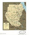 Sudan. LOC 2001620696.jpg 2,431 × 3,010; 800 KB
-
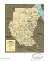 Sudan. LOC 2001620696.tif 2,431 × 3,010; 20.94 MB
