Category:20th-century maps of Guinea-Bissau
Countries of Africa: Algeria · Angola · Benin · Botswana · Burkina Faso · Burundi · Cameroon · Cape Verde · Central African Republic · Chad · Comoros · Democratic Republic of the Congo · Republic of the Congo · Djibouti · Egypt‡ · Equatorial Guinea · Eritrea · Eswatini · Ethiopia · Gabon · The Gambia · Ghana · Guinea · Guinea-Bissau · Ivory Coast · Kenya · Lesotho · Liberia · Libya · Madagascar · Malawi · Mali · Mauritania · Morocco · Mozambique · Namibia · Niger · Nigeria · Rwanda · São Tomé and Príncipe · Senegal · Sierra Leone · Somalia · South Africa · South Sudan · Sudan · Tanzania · Togo · Tunisia · Uganda · Zambia · Zimbabwe
Limited recognition: Somaliland – Other areas: Canary Islands · Madeira · Western Sahara
‡: partly located in Africa
Limited recognition: Somaliland – Other areas: Canary Islands · Madeira · Western Sahara
‡: partly located in Africa
Media in category "20th-century maps of Guinea-Bissau"
The following 10 files are in this category, out of 10 total.
-
-
 1967 data of Western African countries.jpg 3,936 × 2,892; 1.58 MB
-
 Admiralty Chart No 1147 Cap Vert to Cape St Ann, Published 1970.jpg 11,261 × 16,388; 23 MB
-
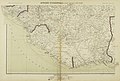
 Guinea - Guinea-Bissau border.png 855 × 1,173; 300 KB
-
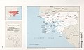
 Guinea Bissau Senegal border map.png 1,219 × 908; 195 KB
-
 Guinea-Bissau - Senegal border.png 1,218 × 910; 96 KB
-
 Guiné-Porto de Bissau - 1915.png 480 × 511; 366 KB
-
 GuinéeCasamance1906.jpg 1,241 × 1,027; 247 KB
-
 Maps of the world's nations. LOC 76602171-24.jpg 5,396 × 3,185; 1.46 MB
-
 Maps of the world's nations. LOC 76602171-24.tif 5,396 × 3,185; 49.17 MB
.jpg)


