Category:20th-century maps of Chad
Countries of Africa: Algeria · Angola · Benin · Botswana · Burkina Faso · Burundi · Cameroon · Cape Verde · Central African Republic · Chad · Comoros · Democratic Republic of the Congo · Republic of the Congo · Djibouti · Egypt‡ · Equatorial Guinea · Eritrea · Eswatini · Ethiopia · Gabon · The Gambia · Ghana · Guinea · Guinea-Bissau · Ivory Coast · Kenya · Lesotho · Liberia · Libya · Madagascar · Malawi · Mali · Mauritania · Morocco · Mozambique · Namibia · Niger · Nigeria · Rwanda · São Tomé and Príncipe · Senegal · Sierra Leone · Somalia · South Africa · South Sudan · Sudan · Tanzania · Togo · Tunisia · Uganda · Zambia · Zimbabwe
Limited recognition: Somaliland – Other areas: Canary Islands · Madeira · Western Sahara
‡: partly located in Africa
Limited recognition: Somaliland – Other areas: Canary Islands · Madeira · Western Sahara
‡: partly located in Africa
Subcategories
This category has the following 3 subcategories, out of 3 total.
- 1960s maps of Chad (4 F)
Media in category "20th-century maps of Chad"
The following 21 files are in this category, out of 21 total.
-

-
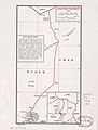
 Central African Republic-Chad boundary. LOC 84692137.tif 4,114 × 3,161; 37.21 MB
-
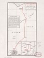
 Chad - (administrative divisions). LOC 94686098.jpg 2,593 × 3,560; 1.21 MB
-
 Chad - (administrative divisions). LOC 94686098.tif 2,593 × 3,560; 26.41 MB
-
 Chad-Libya boundary. LOC 2002622517.jpg 4,149 × 3,164; 1.19 MB
-
 Chad-Libya boundary. LOC 2002622517.tif 4,149 × 3,164; 37.56 MB
-
 Chad-Libya boundary. LOC 84692106.jpg 4,146 × 3,167; 1.33 MB
-
 Chad-Libya boundary. LOC 84692106.tif 4,146 × 3,167; 37.57 MB
-
 Chad-Niger boundary. LOC 85697523.jpg 3,164 × 4,176; 1.34 MB
-
 Chad-Niger boundary. LOC 85697523.tif 3,164 × 4,176; 37.8 MB
-
 Chad-Sudan border 1924.jpg 3,247 × 2,679; 1.51 MB
-
 Chad. LOC 91681423.jpg 1,997 × 2,784; 587 KB
-
 Chad. LOC 91681423.tif 1,997 × 2,784; 15.91 MB
-
 Chad. LOC 91681424.jpg 2,003 × 2,753; 669 KB
-
 Chad. LOC 91681424.tif 2,003 × 2,753; 15.78 MB
-
 La Mission Joalland - Meynier (Itinéraire du Niger jusqu'au lac Tchad) - btv1b53069930t.jpg 5,349 × 3,482; 1.87 MB
-
 Lake Chad 1973.jpg 971 × 997; 553 KB
-
 Limite du domaine toubou (1986).jpg 1,141 × 855; 360 KB
-
-

-
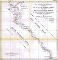
 Tchad. Portions navigables des cours d'eau - btv1b8458995h.jpg 9,379 × 6,247; 4.27 MB

._LOC_94686098.jpg)


_-_btv1b53069930t.jpg)

.jpg)


