Category:Maps of the Northern Mariana Islands
Countries of Oceania: Australia · Fiji · Federated States of Micronesia · Kiribati · Marshall Islands · Nauru · New Zealand · Palau · Papua New Guinea · Samoa · Solomon Islands · Tonga · Tuvalu · Vanuatu
Other areas: American Samoa · Clipperton Island · Cocos (Keeling) Islands · Cook Islands · French Polynesia · Guam · Hawaii · New Caledonia · Niue · Norfolk Island · Northern Mariana Islands · Pitcairn Islands · Tokelau · Wallis and Futuna – Partly: British overseas territories · Overseas France · Indonesia · French Southern and Antarctic Lands · United States Minor Outlying Islands
Other areas: American Samoa · Clipperton Island · Cocos (Keeling) Islands · Cook Islands · French Polynesia · Guam · Hawaii · New Caledonia · Niue · Norfolk Island · Northern Mariana Islands · Pitcairn Islands · Tokelau · Wallis and Futuna – Partly: British overseas territories · Overseas France · Indonesia · French Southern and Antarctic Lands · United States Minor Outlying Islands
States of the United States: Alabama · Alaska · Arizona · Arkansas · California · Colorado · Connecticut · Delaware · Florida · Georgia · Hawaii · Idaho · Illinois · Indiana · Iowa · Kansas · Kentucky · Louisiana · Maine · Maryland · Massachusetts · Michigan · Minnesota · Mississippi · Missouri · Montana · Nebraska · Nevada · New Hampshire · New Jersey · New Mexico · New York · North Carolina · North Dakota · Ohio · Oklahoma · Oregon · Pennsylvania · Rhode Island · South Carolina · South Dakota · Tennessee · Texas · Utah · Vermont · Virginia · Washington · West Virginia · Wisconsin · Wyoming – Washington, D.C.
insular area of the United States: American Samoa · Guam · Northern Mariana Islands · Puerto Rico · United States Virgin Islands – United States Minor Outlying Islands: Baker Island · Howland Island · Jarvis Island · Johnston Atoll · Kingman Reef · Midway Atoll · Navassa Island · Palmyra Atoll · Wake Island
insular area of the United States: American Samoa · Guam · Northern Mariana Islands · Puerto Rico · United States Virgin Islands – United States Minor Outlying Islands: Baker Island · Howland Island · Jarvis Island · Johnston Atoll · Kingman Reef · Midway Atoll · Navassa Island · Palmyra Atoll · Wake Island
Wikimedia category | |||||
| Upload media | |||||
| Instance of | |||||
|---|---|---|---|---|---|
| Category combines topics | |||||
| Northern Mariana Islands | |||||
islands in the United States    | |||||
| Pronunciation audio | |||||
| Instance of |
| ||||
| Part of | |||||
| Named after |
| ||||
| Location |
| ||||
| Located in or next to body of water | |||||
| Capital | |||||
| Legislative body |
| ||||
| Executive body |
| ||||
| Highest judicial authority |
| ||||
| Official language | |||||
| Anthem |
| ||||
| Currency | |||||
| Head of government |
| ||||
| Has part(s) | |||||
| Inception |
| ||||
| Coastline |
| ||||
| Highest point |
| ||||
| Population |
| ||||
| Area |
| ||||
| Top-level Internet domain | |||||
| Maximum temperature record |
| ||||
| Minimum temperature record |
| ||||
| official website | |||||
 | |||||
Subcategories
This category has the following 11 subcategories, out of 11 total.
!
C
O
S
T
Pages in category "Maps of the Northern Mariana Islands"
The following 2 pages are in this category, out of 2 total.
Media in category "Maps of the Northern Mariana Islands"
The following 51 files are in this category, out of 51 total.
-
-
 Casta Marianas small.jpg 276 × 327; 62 KB
-
 Casta Marianas.jpg 803 × 991; 225 KB
-
 Cq-map.png 329 × 355; 6 KB
-
 Geographic Areas Reference Manual Figure 7-6.png 514 × 624; 49 KB
-
 Idioma chamorro.png 1,408 × 1,944; 17 KB
-
 Map Mariana Islands volcanoes.gif 400 × 608; 19 KB
-
 Map Northern Mariana Islands closer.gif 435 × 580; 34 KB
-
 Map of Saipan+name.jpg 3,738 × 5,000; 4.2 MB
-
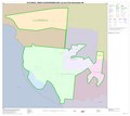
 Map of the Northern Mariana Islands admin.png 643 × 1,787; 66 KB
-
 Map Saipan Tinian islands closer.jpg 290 × 410; 31 KB
-
 Mariana Islands - Agrihan.PNG 829 × 538; 26 KB
-
 Mariana Islands - Aguijan.PNG 829 × 538; 26 KB
-
 Mariana Islands - Alamagan.PNG 829 × 538; 26 KB
-
 Mariana Islands - Anatahan.PNG 829 × 538; 26 KB
-
 Mariana Islands - Ascuncion Island.PNG 829 × 538; 26 KB
-
 Mariana Islands - Farallon de Medinilla.PNG 829 × 538; 26 KB
-
 Mariana Islands - Farallon de Pajaros.PNG 829 × 538; 26 KB
-
 Mariana Islands - Guguan.PNG 829 × 538; 26 KB
-
 Mariana Islands - Maug Islands.PNG 829 × 538; 26 KB
-
 Mariana Islands - Pagan.PNG 829 × 538; 26 KB
-
 Mariana Islands - Rota.PNG 829 × 538; 26 KB
-
 Mariana Islands - Saipan.PNG 829 × 538; 26 KB
-
 Mariana Islands - Sarigan.PNG 829 × 538; 26 KB
-
 Mariana Islands - Tinian.PNG 829 × 538; 26 KB
-
 Mariany mapa.png 1,376 × 2,305; 1.39 MB
-
 Mariany Saipan2.jpg 3,297 × 4,281; 1.36 MB
-
 Mariany-admin-Northern Islands.png 1,286 × 3,574; 52 KB
-
 Mariany-admin-Rota.png 1,286 × 3,574; 52 KB
-
 Mariany-admin-Saipan.png 1,286 × 3,574; 52 KB
-
 Mariany-admin-Tinian.png 1,286 × 3,574; 52 KB
-
 Maug caldera bathymetry.jpg 3,693 × 2,250; 673 KB
-
 NOAA Asuncion Island Benthic Map.png 922 × 908; 790 KB
-
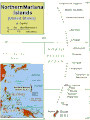
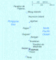 Northern Mariana Islands map.gif 345 × 371; 24 KB
-
 PAT - Northern Mariana Islands.gif 800 × 1,090; 65 KB
-
 Rota 2.jpg 371 × 282; 71 KB
-
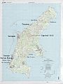
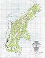
 Rota CNMI 1999 topographic map USGS.jpg 5,000 × 3,304; 2.02 MB
-
 Rota soil map, 1988.jpg 3,187 × 1,622; 495 KB
-
 Saipan and Tinian 2.jpg 371 × 413; 98 KB
-
 Saipan soil map, 1988.jpg 1,577 × 3,192; 516 KB
-
 Saipan USGS 1999 map.jpg 3,738 × 5,000; 2.46 MB
-
 Saipan-Tinian.jpg 378 × 428; 37 KB
-
 SaipanTinianAquijan.png 649 × 505; 7 KB
-
 Serianthes nelsonii distribution on Rota.gif 260 × 195; 9 KB
-
 Tinian CNMI 1999 topographic map USGS.jpg 3,495 × 5,000; 1.63 MB
-
 Tinian soil 1988.jpg 1,108 × 2,822; 288 KB
-
 Txu-pclmaps-oclc-22834566 j-14b.jpg 9,552 × 6,858; 7.9 MB
-
 Txu-pclmaps-oclc-22834566 j-14c.jpg 9,445 × 6,827; 7.67 MB
-
 Txu-pclmaps-oclc-22834566 k-13b (cropped).jpg 669 × 811; 252 KB
-
 Txu-pclmaps-oclc-22834566 k-13b (Tinian Channel crop).jpg 345 × 321; 69 KB
-
 Txu-pclmaps-oclc-22834566 k-13b.jpg 9,406 × 6,900; 8.77 MB


.jpg)
.jpg)
