Category:Maps of New Jersey
States of the United States: Alabama · Alaska · Arizona · Arkansas · California · Colorado · Connecticut · Delaware · Florida · Georgia · Hawaii · Idaho · Illinois · Indiana · Iowa · Kansas · Kentucky · Louisiana · Maine · Maryland · Massachusetts · Michigan · Minnesota · Mississippi · Missouri · Montana · Nebraska · Nevada · New Hampshire · New Jersey · New Mexico · New York · North Carolina · North Dakota · Ohio · Oklahoma · Oregon · Pennsylvania · Rhode Island · South Carolina · South Dakota · Tennessee · Texas · Utah · Vermont · Virginia · Washington · West Virginia · Wisconsin · Wyoming – Washington, D.C.
insular area of the United States: American Samoa · Guam · Northern Mariana Islands · Puerto Rico · United States Virgin Islands – United States Minor Outlying Islands: Baker Island · Howland Island · Jarvis Island · Johnston Atoll · Kingman Reef · Midway Atoll · Navassa Island · Palmyra Atoll · Wake Island
insular area of the United States: American Samoa · Guam · Northern Mariana Islands · Puerto Rico · United States Virgin Islands – United States Minor Outlying Islands: Baker Island · Howland Island · Jarvis Island · Johnston Atoll · Kingman Reef · Midway Atoll · Navassa Island · Palmyra Atoll · Wake Island
Wikimedia category | |||||
| Upload media | |||||
| Instance of | |||||
|---|---|---|---|---|---|
| Category combines topics | |||||
| New Jersey | |||||
state of the United States of America    .svg) | |||||
| Pronunciation audio | |||||
| Instance of |
| ||||
| Part of | |||||
| Named after | |||||
| Location |
| ||||
| Located in or next to body of water | |||||
| Capital | |||||
| Legislative body | |||||
| Executive body | |||||
| Highest judicial authority | |||||
| Official language | |||||
| Head of government |
| ||||
| Inception |
| ||||
| Highest point | |||||
| Population |
| ||||
| Area |
| ||||
| Elevation above sea level |
| ||||
| Replaces | |||||
| Different from | |||||
| Maximum temperature record |
| ||||
| Minimum temperature record |
| ||||
| official website | |||||
 | |||||

Subcategories
This category has the following 29 subcategories, out of 29 total.
*
- Travel maps of New Jersey (2 F)
A
- Area code maps of New Jersey (4 F)
B
C
D
E
G
H
L
- Location maps of New Jersey (26 F)
M
- Maps of Long Beach Island (20 F)
O
P
R
S
T
Pages in category "Maps of New Jersey"
This category contains only the following page.
Media in category "Maps of New Jersey"
The following 127 files are in this category, out of 127 total.
-
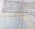
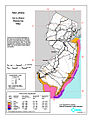
 07930 Zip Code Lyons NJ2.jpg 330 × 395; 25 KB
-

-
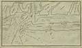
 1919GreenvilleJerseyCityUpperNYBay.tiff 754 × 641; 837 KB
-
-
 A mapp of New Jarsey (NYPL Hades-118558-54685).tif 4,740 × 4,154; 56.34 MB
-
 Ablefarmmap.png 1,816 × 936; 2.13 MB
-
 Allamuchy panther valley cdp nj 041.png 660 × 580; 44 KB
-
 ALTERNATIVE 2 - USACE.png 1,354 × 957; 674 KB
-
 AtlanticWindLeasesNewJersey.tiff 504 × 645; 180 KB
-
 Baltimore and Ohio employees magazine (1912) (14574968458).jpg 2,480 × 3,820; 1.56 MB
-
 Barnegat Bay No Discharge Zone.jpg 582 × 955; 161 KB
-
 Battle of Springfield.jpg 355 × 548; 79 KB
-
 Beach and inlet changes at Ludlam Beach, New Jersey (1980) (20350110482).jpg 2,256 × 1,738; 591 KB
-
 Beach and inlet changes at Ludlam Beach, New Jersey (1980) (20350117452).jpg 2,304 × 1,660; 587 KB
-
 Blaeu - Nova Belgica et Anglia Nova (Detail Hudson Area).png 798 × 465; 685 KB
-
 Bound brook nj 035.png 600 × 580; 45 KB
-
 Census Bureau map of ZCTA 08022 Columbus, New Jersey.gif 575 × 425; 78 KB
-
 Census Bureau map of ZCTA 08859 Parlin, New Jersey.gif 575 × 425; 68 KB
-
 ClintonCemeteryIrvingtonEarlyMap.tif 605 × 407; 327 KB
-
 CoVid19 New Jersey movie July 12.gif 800 × 715; 23.65 MB
-
 Delaware01.png 1,182 × 1,387; 473 KB
-
 Detect 27-2.jpg 305 × 254; 16 KB
-
 Detect 27.jpg 494 × 681; 37 KB
-
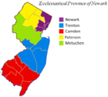 Ecclesiastical Province of Newark map.png 588 × 530; 71 KB
-
 Electric railway journal (1911) (14757250574).jpg 3,872 × 2,699; 1.29 MB
-
 Electric railway journal (1911) (14759309022).jpg 2,502 × 3,720; 994 KB
-
 Ellisdalelocation.png 279 × 507; 69 KB
-
-

-
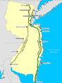
 Gateway National Recreation Area map de Ausschnitt.png 500 × 500; 86 KB
-
 Gateway National Recreation Area map.pdf 1,275 × 1,650; 1.62 MB
-
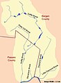 GoffleBrook DiamondBrook DrainageBasin.jpg 454 × 618; 45 KB
-
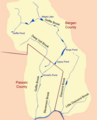 GoffleBrookDrainage.png 500 × 620; 75 KB
-
 HackensackCBD1905.png 509 × 693; 802 KB
-
 HighlandsConnecticutNewJerseyNewYorkPennsylvaniaMap.jpg 2,550 × 3,300; 529 KB
-

-
 Hudson-Raritan Estuary USACEregionsmap.tif 524 × 688; 708 KB
-
 Identified east west new jersey.png 350 × 408; 53 KB
-
 Karte Haiangriffe NJ.png 312 × 500; 69 KB
-
 Kean University CDP (2020).jpg 1,342 × 740; 144 KB
-
 Long-beach-island-map-with-locales.png 580 × 580; 48 KB
-
 Long-beach-island-map.png 580 × 580; 47 KB
-
 Lower metedeconk river.jpg 1,134 × 619; 177 KB
-
 LSP location.jpg 1,120 × 1,197; 578 KB
-
 Map Monmouth County NJ Asbury Park.gif 500 × 540; 56 KB
-
 Map Monmouth County NJ towns.gif 520 × 525; 54 KB
-
 Map New Jersey NA.jpg 697 × 1,300; 187 KB
-
 Map New Jersey north NA.jpg 580 × 845; 129 KB
-
 Map of Gloucester County highlighting Pitman Borough.png 550 × 469; 10 KB
-
 Map of Gloucester County highlighting Swedesboro Borough.png 550 × 469; 10 KB
-
 Map of New Jersey and Pennsylvania WDL9594.png 1,376 × 1,024; 2.19 MB
-
 Map of New Jersey municipalities by type.png 521 × 749; 187 KB
-
 Map of New Jersey NA.png 2,122 × 1,640; 1.2 MB
-
 Map of New Jersey.jpg 1,975 × 2,918; 1.96 MB
-

-

-

-
 Map Passaic County Paterson NJ.gif 450 × 580; 40 KB
-
 Map Somerset Hills.jpg 300 × 269; 43 KB
-
 Map Union County NJ Union Twp.gif 610 × 525; 48 KB
-
 Montclair State University CDP (2020).jpg 1,422 × 808; 217 KB
-

-

-
 National-atlas-new-jersey.png 764 × 589; 77 KB
-
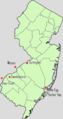
 Neighborhood map of New Jersey.png 674 × 769; 313 KB
-
 New jersey 90.jpg 480 × 741; 159 KB
-
 New Jersey Counties OutlineCENTRAL.png 1,426 × 2,700; 312 KB
-
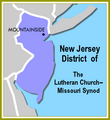 New Jersey District LCMS.png 320 × 350; 31 KB
-
 New Jersey Division.png 679 × 623; 77 KB
-
 New Jersey Köppen.png 6,300 × 10,200; 456 KB
-
 New Jersey Level IV ecoregions.pdf 2,400 × 3,900; 664 KB
-
 New Jersey Locator Map with US.PNG 292 × 528; 20 KB
-
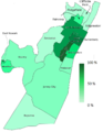
 New Jersey Population Map.png 600 × 600; 187 KB
-
 New Jersey Prison Map 1933.png 1,863 × 2,889; 3.04 MB
-
 New Jersey State Shape.png 250 × 250; 9 KB
-
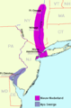
 New Jersey wind resource map 50m 800.jpg 850 × 1,100; 432 KB
-

-

-
 New York Community Bank footprint 2010-05.png 1,131 × 918; 125 KB
-
 Newark1666-1916BoundaryMap.tiff 529 × 679; 925 KB
-
 NewJersey.Falkenberg.locations.2.png 316 × 598; 50 KB
-
 NewJersey.Falkenberg.locations.png 316 × 598; 45 KB
-
 NewJerseyForageWar.png 923 × 570; 755 KB
-
 NewJerseyForageWar2.jpg 964 × 654; 422 KB
-
 Newjerseymap2017.png 390 × 640; 171 KB
-
 Nieuw Nederland and Nya Sverige.png 420 × 640; 13 KB
-
 Nj cboug.jpg 703 × 1,109; 234 KB
-
 NJ Counties by Population (2020 census).png 1,200 × 2,272; 291 KB
-
 NJ County Commissioner Seats.svg 810 × 810; 39 KB
-
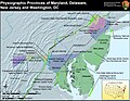
 NJ Geo Regions.jpg 450 × 550; 25 KB
-
 NJ GSPTP.png 1,373 × 1,830; 186 KB
-
 NJBritishOutposts.jpg 5,640 × 3,080; 2.84 MB
-
 NJMidlandRail(NYS&W)1872servicemap.tiff 307 × 497; 219 KB
-
 Northandsouthjersey.png 334 × 632; 8 KB
-
 Northern New Jersey Hispanic Population.png 1,216 × 1,572; 224 KB
-
 NorthernNewJersey1777.jpg 1,628 × 1,072; 918 KB
-
 NY-NJ Highlands.jpg 825 × 638; 175 KB
-
 Ocean County, New Jersey Municipalities.png 380 × 580; 68 KB
-
 Oxford cdp nj 041.png 660 × 580; 43 KB
-
 PassaicRiverNorthBend.png 474 × 708; 101 KB
-
-
 Pohatcong twp nj.png 492 × 585; 44 KB
-
 Population density of New Jersey counties (2020).png 2,006 × 3,740; 616 KB
-
 Ramapo College of New Jersey CDP.jpg 922 × 684; 157 KB
-
 Rand McNally Map of New Jersey.jpg 2,629 × 3,591; 2.66 MB
-

-
-
 Rockaway Valley railroad Map.tif 1,504 × 1,573; 6.77 MB
-

-
 Rutherford Electric Railroad.jpg 2,880 × 662; 344 KB
-
 Sanitary & Topographical Map of Hudson County, N.J.PNG 1,094 × 706; 1.59 MB
-
 Screen burn.jpg 3,024 × 4,032; 3.03 MB
-
 Shallow Brook, New Jersey (map).jpg 1,506 × 264; 92 KB
-
 Shopping mall retail area per capita by NJ counties.png 1,247 × 1,535; 126 KB
-
 State of New Jersey.jpg 2,068 × 3,272; 1.54 MB
-
 Stockton University census-designated place (2020).jpg 1,319 × 777; 209 KB
-
 The Bulletin of the Beach Erosion Board (1947) (20449055501).jpg 1,360 × 2,540; 769 KB
-
 The North River in New Netherland WDL10084.png 1,414 × 1,024; 2.85 MB
-
 Greater Amwell and Sourland Region.png 2,048 × 2,677; 1.03 MB
-
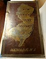 Trade sign for New Jersey Fire Insurance Company in Newark, New Jersey.jpg 2,056 × 2,668; 2.41 MB
-
 TrentonPhiladelphia1806.jpg 920 × 536; 257 KB
-
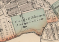 Unitedschutzenassociation.png 413 × 291; 255 KB
-
 USACE(NY-NJ)CoastalStormRiskReductionProjectsStudiesMap.tif 659 × 416; 281 KB
-
 USGS Paterson New Jersey 1900 topo.jpg 1,792 × 2,160; 3.14 MB
-
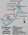 WatchungSubRanges.png 500 × 616; 13 KB
-
 Wildwoods.jpg 432 × 1,005; 244 KB
-
 Wpdms east west new jersey.png 273 × 318; 5 KB

,_New_Jersey_-_Geographicus_-_BarnegatInlet-uscs-1865.jpg)
.jpg)


_(14574968458).jpg)


_(20350110482).jpg)
_(20350117452).jpg)
.png)


_(14757250574).jpg)
_(14759309022).jpg)

.jpg)
.jpg)


_(14781152023).jpg)


.jpg)


.jpg)
_-_NARA_-_68886515.jpg)
_-_NARA_-_68886519.jpg)


.png)
.png)


.png)


.jpg)

.png)


_(14589706849).jpg)
_(14776379245).jpg)
.jpg)


.jpg)
_(20449055501).jpg)


.jpg)