Category:Maps of the history of Ohio
States of the United States: Alabama · Alaska · Arizona · Arkansas · California · Colorado · Connecticut · Delaware · Florida · Georgia · Hawaii · Idaho · Illinois · Indiana · Iowa · Kansas · Kentucky · Louisiana · Maine · Maryland · Massachusetts · Michigan · Minnesota · Mississippi · Missouri · Montana · Nebraska · Nevada · New Hampshire · New Jersey · New Mexico · New York · North Carolina · North Dakota · Ohio · Oklahoma · Oregon · Pennsylvania · Rhode Island · South Carolina · South Dakota · Tennessee · Texas · Utah · Vermont · Virginia · Washington · West Virginia · Wisconsin · Wyoming – Washington, D.C.
Puerto Rico
Puerto Rico
Subcategories
This category has the following 2 subcategories, out of 2 total.
Media in category "Maps of the history of Ohio"
The following 75 files are in this category, out of 75 total.
-
1805 Survey - Twelve Mile Square Reserve.png 1,854 × 1,854; 1.16 MB
-
Battle of Fort Stephenson from 1912 History Book.png 927 × 623; 149 KB
-
Battle of Piqua Map National Park Service.png 531 × 602; 312 KB
-
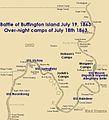
Buffington-battle-map.jpg 709 × 779; 77 KB
-
Congress Lands in Ohio.png 696 × 824; 734 KB
-
Connecticut western reserve.png 370 × 403; 2 KB
-
Delaware Salt Reservation.png 513 × 722; 37 KB
-
Disputed Toledo Strip.png 660 × 200; 68 KB
-
Donation Tract (Ohio).png 970 × 507; 767 KB
-
East of Scioto River Survey.png 697 × 919; 415 KB
-
FMIB 39499 Map showing the effect of the glacial dam at Cincinnati.jpeg 1,339 × 863; 253 KB
-
Fort Ancient Monongahela cultures HRoe 2010.jpg 700 × 496; 312 KB
-
Fort Washington Cincinnati map.png 455 × 701; 45 KB
-
French Grant in Ohio.png 696 × 1,038; 1.02 MB
-
French Grants.jpg 3,522 × 5,276; 1.27 MB
-
Geography of Ohio - DPLA - aaba7b3295ff6973b6fd1e23e33cde14 (page 116) (cropped).jpg 1,843 × 1,918; 599 KB
-
Glaize.png 8,769 × 6,063; 1.38 MB
-
Greenville Treaty Line Map.png 544 × 711; 79 KB
-
Gville Treaty Line sign.jpg 3,264 × 2,448; 3.62 MB
-
Indian Land Grants 218.png 827 × 553; 280 KB
-
Indian Land Grants 222.png 489 × 813; 84 KB
-
Kekewepelethy locations.png 6,905 × 6,194; 2.18 MB
-
Land Act of 1785 section numbering.png 1,327 × 1,239; 27 KB
-
Lochry defeat map.PNG 1,138 × 1,038; 952 KB
-
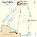
Logans Raid.png 3,083 × 3,083; 612 KB
-
Map from Indian land cessions in the United States by Charles C. Royce 53.jpg 3,297 × 4,256; 5 MB
-
Maumee Road Lands.png 936 × 543; 372 KB
-
Mayfield Township-CuyahogaCoOH.png 1,887 × 1,507; 39 KB
-
Ministerial lands.png 587 × 721; 79 KB
-
Muskingum Salt Reservations.png 835 × 554; 83 KB
-
National road map.png 600 × 353; 73 KB
-
Newburgh Township and Union-Miles Park.jpg 3,076 × 2,868; 3.16 MB
-
North and East of First Principal Meridian.png 811 × 845; 701 KB
-
North of Old Seven Ranges.png 764 × 828; 941 KB
-
NorthwestIndianWarMap.jpg 408 × 459; 35 KB
-
Nov10map2.JPG 398 × 453; 24 KB
-
Ohio Arch Cultures map HRoe 2008.jpg 710 × 510; 425 KB
-
Ohio archæological and historical quarterly (1887) (14586329538).jpg 1,979 × 2,796; 717 KB
-
Ohio Company and Donation Tract.png 538 × 822; 633 KB
-
Ohio Counties 1802.png 649 × 621; 254 KB
-
Ohio Country en.png 1,217 × 920; 1.41 MB
-
Ohio Lands.svg 323 × 364; 242 KB
-
Ohio-scioto lands.png 540 × 672; 396 KB
-
Palmsundayalltornadoes.jpg 1,024 × 768; 181 KB
-
Pennsylvania Lines West of Pittsburgh, Flood of March 1913 (51806780928).jpg 5,548 × 3,499; 14.46 MB
-
Plssohio.gif 350 × 379; 47 KB
-
Refugee in Ohio.png 697 × 919; 1.01 MB
-
Refugee Tracts.png 929 × 451; 176 KB
-
Reorganization-of-1848.png 314 × 430; 126 KB
-
Royce-areas-ohio.jpg 1,567 × 1,661; 522 KB
-
Scioto salt reservation.png 546 × 761; 320 KB
-
Seven in Ohio.png 794 × 918; 1.02 MB
-
Seven Ranges.png 467 × 913; 699 KB
-
Shawnee towns in Ohio to 1808.png 5,790 × 5,571; 1.87 MB
-
South & East of First Principal Meridian.png 1,028 × 919; 1.04 MB
-
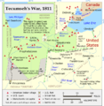
Tecumseh's War.png 822 × 840; 322 KB
-
Toledo Strip.png 629 × 436; 17 KB
-
ToledoStrip.svg 239 × 88; 44 KB
-
Turnpike Lands.png 462 × 949; 79 KB
-
Two Mile Square Reserve.png 539 × 650; 53 KB
-
Union-Miles Park annexation overlap.jpg 3,076 × 2,868; 3.22 MB
-
US Military Dist (Ohio).png 1,143 × 597; 601 KB
-
US Military District in Ohio.png 697 × 919; 1.01 MB
-
Uses 1785 numbering.png 620 × 782; 139 KB
-
USMD Subdivisions.png 547 × 609; 97 KB
-
Virginia Military District with counties.png 547 × 947; 283 KB
-
West Of Miami River Survey.png 501 × 937; 250 KB
-
Worthington Earthworks map (Charles Whittlesey, 1848) 2.jpg 800 × 559; 102 KB
-
Worthington Earthworks map (Charles Whittlesey, 1848).png 423 × 305; 96 KB
-
Wpdms ohio country.png 300 × 223; 31 KB
-
Zane Hocking River Survey.png 512 × 582; 28 KB
-
Zane Scioto River Survey.png 486 × 566; 29 KB
-
Zane Survey on Muskingum River.png 699 × 601; 35 KB
-
Zane's Trace.png 795 × 605; 332 KB


