Category:Maps of the history of Alaska
States of the United States: Alabama · Alaska · Arizona · Arkansas · California · Colorado · Connecticut · Delaware · Florida · Georgia · Hawaii · Idaho · Illinois · Indiana · Iowa · Kansas · Kentucky · Louisiana · Maine · Maryland · Massachusetts · Michigan · Minnesota · Mississippi · Missouri · Montana · Nebraska · Nevada · New Hampshire · New Jersey · New Mexico · New York · North Carolina · North Dakota · Ohio · Oklahoma · Oregon · Pennsylvania · Rhode Island · South Carolina · South Dakota · Tennessee · Texas · Utah · Vermont · Virginia · Washington · West Virginia · Wisconsin · Wyoming – Washington, D.C.
Puerto Rico
Puerto Rico
Subcategories
This category has the following 2 subcategories, out of 2 total.
Media in category "Maps of the history of Alaska"
The following 16 files are in this category, out of 16 total.
-
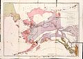
 1903 Alaska boundary dispute.png 538 × 538; 16 KB
-
 1926 Canada-Alaska 1903 boundary-map.jpg 448 × 432; 55 KB
-
 1926 Canada-Alaska 1903 boundary-map.png 429 × 418; 433 KB
-
 Newly Established National Monuments December 1978.png 1,100 × 816; 285 KB
-
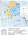
 National Conservation Areas in ANILCA December 1980.png 1,100 × 816; 356 KB
-
 Alaska and the Aleutians.jpg 5,020 × 2,775; 1.44 MB
-
 Alaska boundary dispute.jpg 1,184 × 1,096; 438 KB
-
 Dall alaska1875.jpg 11,508 × 8,238; 4.29 MB
-
 Early Indian Languages Alaska.jpg 1,920 × 2,421; 920 KB
-
 Flickr - USCapitol - Alaskan Purchase, 1867.jpg 2,832 × 2,268; 4.5 MB
-
 Map Chilkoot Trail NPS.jpg 935 × 1,484; 1,022 KB
-

-
 Petroff Tribes Map.jpg 650 × 492; 52 KB
-
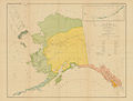
 Proposed National Conservation Areas December 1973.png 1,100 × 816; 285 KB
-
 Voyages of Ilya Voznesensky (1840-1848) - es.svg 1,482 × 1,086; 1,011 KB
-
 Voyages of Ilya Voznesensky (1840-1848) - ru.svg 1,482 × 1,086; 913 KB


_-_es.svg)
_-_ru.svg)