Category:Maps of the history of South Dakota
States of the United States: Alabama · Alaska · Arizona · Arkansas · California · Colorado · Connecticut · Delaware · Florida · Georgia · Hawaii · Idaho · Illinois · Indiana · Iowa · Kansas · Kentucky · Louisiana · Maine · Maryland · Massachusetts · Michigan · Minnesota · Mississippi · Missouri · Montana · Nebraska · Nevada · New Hampshire · New Jersey · New Mexico · New York · North Carolina · North Dakota · Ohio · Oklahoma · Oregon · Pennsylvania · Rhode Island · South Carolina · South Dakota · Tennessee · Texas · Utah · Vermont · Virginia · Washington · West Virginia · Wisconsin · Wyoming – Washington, D.C.
Puerto Rico
Puerto Rico
Subcategories
This category has the following 2 subcategories, out of 2 total.
Media in category "Maps of the history of South Dakota"
The following 11 files are in this category, out of 11 total.
-
 Arikara movements, 1795 to 1862.png 1,776 × 2,502; 7.43 MB
-

-
 Battlefields (approx.) - U.S. Army and Lakotas, 1854-1890.png 500 × 371; 298 KB
-
 Dakotas 1 Indian Land Cessions.jpg 770 × 880; 203 KB
-
 Pawnee Indian cessions (2). (Pawnee country after 1833).png 2,256 × 1,462; 5.83 MB
-
 Pawnee Indian cessions (3). Pawnee country after 1848).png 2,256 × 1,462; 5.83 MB
-
 Pawnee Indian cessions (4). (Pawnee country after 1857).png 2,256 × 1,462; 5.84 MB
-
 The Ponca (Dhegiha) migration story according to oral tradition. (Map improved 2018).png 2,154 × 1,468; 1.57 MB
-
 Treaty of Traverse des Sioux 1851.jpg 1,650 × 1,275; 654 KB
-
 Wounded Knee mapa positive.jpg 672 × 594; 71 KB
-
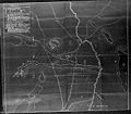 Wounded Knee mapa.jpg 700 × 614; 92 KB

_-_U.S._Army_and_Lakotas,_1854-1868_(blue_x)_and_1869-1890_(red_x).png)
_-_U.S._Army_and_Lakotas,_1854-1890.png)

._(Pawnee_country_after_1833).png)
._Pawnee_country_after_1848).png)
._(Pawnee_country_after_1857).png)
_migration_story_according_to_oral_tradition._(Map_improved_2018).png)


