Category:Maps of the history of Virginia
States of the United States: Alabama · Alaska · Arizona · Arkansas · California · Colorado · Connecticut · Delaware · Florida · Georgia · Hawaii · Idaho · Illinois · Indiana · Iowa · Kansas · Kentucky · Louisiana · Maine · Maryland · Massachusetts · Michigan · Minnesota · Mississippi · Missouri · Montana · Nebraska · Nevada · New Hampshire · New Jersey · New Mexico · New York · North Carolina · North Dakota · Ohio · Oklahoma · Oregon · Pennsylvania · Rhode Island · South Carolina · South Dakota · Tennessee · Texas · Utah · Vermont · Virginia · Washington · West Virginia · Wisconsin · Wyoming – Washington, D.C.
Puerto Rico
Puerto Rico
Subcategories
This category has the following 17 subcategories, out of 17 total.
Media in category "Maps of the history of Virginia"
The following 28 files are in this category, out of 28 total.
-
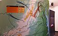 "An American Turning Point- The Civil War in Virginia (16864672811).jpg 4,226 × 2,592; 4.1 MB
-
 Virginiacolony.png 600 × 627; 291 KB
-
 1634 Virginia Counties- Henrico Focus.jpg 922 × 602; 229 KB
-
 1646linemap.jpg 300 × 250; 19 KB
-

-
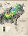 1860-61 Secession in Appalachia by County.jpg 1,887 × 2,393; 1.82 MB
-
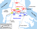 1Yorktown1862 rus.gif 1,268 × 1,006; 58 KB
-
-
 Approximate Boundaries of the City of Henrico in 1619.jpg 1,040 × 779; 324 KB
-
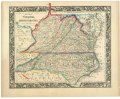
 County map of Virginia, and North Carolina. LOC lva0000076.jpg 4,697 × 3,881; 4.08 MB
-
 County map of Virginia, and North Carolina. LOC lva0000076.tif 4,697 × 3,881; 52.15 MB
-
 EB9 United States - historical maps (top).jpg 2,488 × 1,803; 997 KB
-
 Great Grant Location Rev.png 1,200 × 780; 311 KB
-
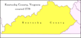 Kentucky County, Virginia 1776.png 638 × 300; 145 KB
-
 Kentucky County, Virginia 1780.png 638 × 300; 222 KB
-
 Languages in VA circa 1700AD.jpg 434 × 297; 28 KB
-
 Map showing location of Jamestown and Roanoke Island Colonies.PNG 600 × 400; 119 KB
-
 Northern Virginia Map - Potomac, Fredericksburg, & Piedmont Railroad.jpg 3,382 × 1,616; 4.97 MB
-
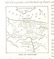
 The War of 1812 in the Chesapeake.jpg 564 × 684; 84 KB
-
 Treaty of Lochaber.jpg 4,160 × 3,778; 2.43 MB
-
 United States Central map 1784-05-12 to 1787-07-13.png 2,000 × 1,320; 249 KB
-
 Virginia (1640).jpg 1,107 × 985; 183 KB
-
 Virginia Under the Stuarts - Dale's Settlements.png 1,040 × 779; 169 KB
-
 Flag map of the Colony of Virginia (English Flag).png 3,388 × 1,292; 38 KB
-
 Flag map of the Colony of Virginia (Union Jack).png 3,388 × 1,292; 69 KB
-
 Virginia1781.jpg 795 × 661; 99 KB
-
 Watauga.Lochaber. corner.jpg 792 × 612; 230 KB
-
 West Virginia regions 1863.jpg 6,587 × 5,100; 2.69 MB
.jpg)


_and_North_Carolina_-_Geographicus_-_VANC-mitchell-1860.jpg)


.jpg)


.jpg)


.jpg)


.png)
.png)