Category:Old maps of Alaska
States of the United States: Alabama · Alaska · Arizona · Arkansas · California · Colorado · Connecticut · Delaware · Florida · Georgia · Hawaii · Idaho · Illinois · Indiana · Iowa · Kansas · Kentucky · Louisiana · Maine · Maryland · Massachusetts · Michigan · Minnesota · Mississippi · Missouri · Montana · Nebraska · Nevada · New Hampshire · New Jersey · New Mexico · New York · North Carolina · North Dakota · Ohio · Oklahoma · Oregon · Pennsylvania · Rhode Island · South Carolina · South Dakota · Tennessee · Texas · Utah · Vermont · Virginia · Washington · West Virginia · Wisconsin · Wyoming – District of Columbia: Washington, D.C.
Guam · Northern Mariana Islands · Puerto Rico
Guam · Northern Mariana Islands · Puerto Rico
Subcategories
This category has the following 8 subcategories, out of 8 total.
- 16th-century maps of Alaska (2 F)
- 17th-century maps of Alaska (empty)
O
- Old geological maps of Alaska (12 F)
Media in category "Old maps of Alaska"
The following 134 files are in this category, out of 134 total.
-
 (Collected reprints, 1911-1931 (19-)) (20121415284).jpg 2,458 × 3,922; 1.12 MB
-
 (Collected reprints, 1911-1931 (19-)) (20123058723).jpg 2,362 × 4,684; 965 KB
-
 (Collected reprints, 1911-1931 (19-)) (20556026788).jpg 3,244 × 4,848; 873 KB
-
 1926 Canada-Alaska 1903 boundary-map.png 429 × 418; 433 KB
-

-

-

-

-

-

-

-
 A Chart shewing (sic) part of the coast of N.W. America LOC 85692999.jpg 8,100 × 9,889; 11.11 MB
-
 A Chart shewing (sic) part of the coast of N.W. America LOC 85692999.tif 8,100 × 9,889; 229.17 MB
-
 AK Juneau D-4 356371 1951 63360 geo.pdf 2,550 × 3,129; 9.79 MB
-

-
 Aleutian Islands Reservation EO 1733 illustration.jpg 3,210 × 2,252; 475 KB
-
 AleutianIslands.jpeg 650 × 182; 30 KB
-
 AmCyc Alaska.jpg 1,927 × 1,417; 467 KB
-
 Amérique Septentrionale (MAPS 107).jpg 8,067 × 5,512; 10.61 MB
-

-

-
 Articles about birds from National geographic magazine ((19-?)-(193-?)) (20790721602).jpg 2,352 × 1,732; 1.19 MB
-
-
 Bering Glacier.PNG 751 × 550; 99 KB
-
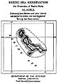 Bering Sea Reservation EO 1037 illustration.jpg 2,668 × 3,809; 659 KB
-
 Berners Bay map.PNG 417 × 606; 41 KB
-
 Bogoslof Reservation EO 1049 illustration.jpg 2,678 × 3,469; 838 KB
-
 Booster map Stikine River route to Klondike.jpg 800 × 1,097; 300 KB
-
 Britannica Alaska.jpg 2,539 × 1,852; 3.39 MB
-
 Bulletin de la Société impériale des naturalistes de Moscou (1829-1917.) (20247203650).jpg 2,988 × 2,036; 1.19 MB
-
 Chitina River.PNG 842 × 479; 67 KB
-

-
 Copper River Gold District.jpg 2,095 × 3,442; 2.04 MB
-
 Copper River.PNG 4,384 × 4,346; 1.58 MB
-
-
 Defense Map - Alaska - DPLA - 21576761eff2fbd873c757bb6e03c0b7.jpg 5,160 × 6,640; 1.94 MB
-
 Douglas Island gold mines.PNG 1,186 × 598; 277 KB
-
 E-MJ - engineering and mining journal (1920) (14785134673).jpg 2,092 × 2,166; 422 KB
-
 Fairbanks Alaska region showing U.S. military telegraph line. LOC 2006629761.jpg 10,544 × 4,069; 5.95 MB
-
 Fairbanks Alaska region showing U.S. military telegraph line. LOC 2006629761.tif 10,544 × 4,069; 122.75 MB
-
 Flickr - USCapitol - Alaskan Purchase, 1867.jpg 2,832 × 2,268; 4.5 MB
-
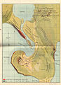 FMIB 33603 Lagoon Rookery.jpeg 1,173 × 1,618; 419 KB
-
 FMIB 38787 Sketch of Yes Bay Stream and Lake.jpeg 1,011 × 1,091; 103 KB
-
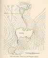
 FMIB 38802 Sketch of Hunter Bay Lake System.jpeg 583 × 729; 56 KB
-
 FMIB 40759 Kutlakoo Lake and Stream, Kuiu Island.jpeg 789 × 1,099; 158 KB
-
 FMIB 40762 Aleck Lake and Stream, Tobenkof Bay, Kuiu Island.jpeg 1,007 × 1,142; 164 KB
-
 FMIB 40766 Lake and Stream, Ward Cove, Revillagigedo Island.jpeg 920 × 1,103; 214 KB
-
 FMIB 40781 Sketch of Hetta Hatchery, Prince of Wales Island, Alaska.jpeg 1,016 × 867; 151 KB
-

-
-

-
 FMIB 45996 Fur-Seal Industry of the Pribylov Islands, Alaska.jpeg 2,175 × 1,638; 740 KB
-
 FMIB 45997 Fur-Seal Industry of the Pribylov Islands, Alaska.jpeg 2,264 × 1,665; 480 KB
-
 FMIB 49057 Cholmondeley Sound, showing 80 purse seines in operation season of 1914.jpeg 1,613 × 1,008; 177 KB
-
 FMIB 49060 Head of Kasaan Bay, showing 40 purse seines in operation season of 1914.jpeg 1,095 × 1,166; 447 KB
-
 FMIB 49065 Three proposed fishing districts for southeast Alaska.jpeg 1,139 × 1,499; 330 KB
-

-

-
 Funter Bay map.PNG 581 × 597; 50 KB
-
 Going to Klondyke. LOC 99446193.jpg 5,956 × 4,654; 6.21 MB
-
 Going to Klondyke. LOC 99446193.tif 5,956 × 4,654; 79.31 MB
-
 Holkham Bay.PNG 697 × 507; 37 KB
-
 Hydah Indian Reservation EO 1555 illustration.png 2,000 × 3,100; 73 KB
-

-

-
 Juneau Gold Belt.PNG 429 × 586; 49 KB
-
 KantishnaRegion.png 758 × 490; 101 KB
-
 Karta Ledovitago mori︠a︡ i Vostochnago okeana LOC 99447835.tif 11,078 × 7,660; 242.78 MB
-
-
 Katalla Alaska.PNG 515 × 530; 73 KB
-
 Kootznahoo Inlet map.PNG 972 × 549; 52 KB
-
 Kowee Creek map.PNG 453 × 606; 38 KB
-
 Kuk River EO 5359 illustration.png 3,204 × 2,553; 182 KB
-

-

-
 Map of Alaska and adjoining regions. LOC 99446186.tif 2,828 × 2,322; 18.79 MB
-
 Map of Alaska LOC 2012586808.tif 7,650 × 5,671; 124.12 MB
-

-
 Map of Alaska. - NARA - 298017.jpg 3,000 × 1,658; 2.12 MB
-
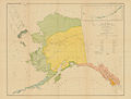
 Map of Alaska.jpg 3,480 × 2,939; 2.77 MB
-
 Map of Arctic Alaska - The American Museum journal (c1900-(1918)) (17537136424).jpg 2,816 × 1,946; 704 KB
-
 Map of Chukotka and Alyaska by Daurkin.jpeg 500 × 403; 87 KB
-
 Map of Controller Bay Alaska 1911.jpg 4,420 × 3,230; 2.14 MB
-
 Map of Koyukuk River, Alaska LOC 2006629787.tif 6,327 × 7,350; 133.05 MB
-
 Map of the Alaskan gold fields. LOC 99446192.jpg 3,679 × 2,782; 1.71 MB
-
 Map of the Alaskan gold fields. LOC 99446192.tif 3,679 × 2,782; 29.28 MB
-
-
-
 Map of Vogages of Muir and Yourg.jpg 1,950 × 3,191; 1,022 KB
-
 Mendenhall glacier map.PNG 712 × 573; 60 KB
-

-
 Millroy's map of Alaska and the Klondyke gold fields. LOC 99446191.jpg 6,549 × 4,936; 5.72 MB
-
 Millroy's map of Alaska and the Klondyke gold fields. LOC 99446191.tif 6,549 × 4,936; 92.49 MB
-
 NIE 1905 Alaska.jpg 2,005 × 1,721; 2.19 MB
-
 Nome Beach map.PNG 703 × 576; 183 KB
-
 Nome-sand-spit.jpg 812 × 238; 83 KB
-
 North western America, from Port Clarence to mouth of Kvichpak (sic) River LOC 2004630135.tif 10,363 × 7,804; 231.38 MB
-
 Nunivak Island Reservation EO 5095 illustration.png 2,679 × 4,204; 326 KB
-
 Nunivak Island Reservation EO 5470 illustration.png 2,715 × 4,234; 300 KB
-

-
 Petroff Tribes Map.jpg 650 × 492; 52 KB
-
 Plan Novo-Arhangelyska ok. 1805.jpg 626 × 807; 78 KB
-
 Port Snettisham.PNG 724 × 520; 30 KB
-
 Pribilof Reservation EO 1044 illustration.jpg 1,438 × 2,031; 270 KB
-

-
 Report of the National conservation commission. February, 1909 (1909) (14766204905).jpg 2,960 × 2,392; 1.66 MB
-

-
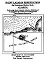 Saint Lazaria Reservation EO 1040 illustration..jpg 2,884 × 3,764; 707 KB
-
 Saint Paul Island figb0218.jpg 1,844 × 1,176; 541 KB
-
 Seal and salmon fisheries and general resources of Alaska (1898) (14766790785).jpg 2,542 × 3,168; 796 KB
-

-
 Smithsonian miscellaneous collections (1910) (14756355896).jpg 2,984 × 2,282; 639 KB
-

-

-
 The Alaska Line. LOC 99466709.tif 8,667 × 6,486; 160.83 MB
-
 The American Museum journal (1912) (18156717002).jpg 2,754 × 1,408; 629 KB
-
 The American Museum journal (c1900-(1918)) (17537803104).jpg 2,864 × 1,132; 535 KB
-
 The American Museum journal (c1900-(1918)) (17539307953).jpg 1,954 × 2,584; 965 KB
-
-

-
-

-
 The route of the Alaska excursion steamers. LOC 99446184.tif 8,551 × 4,165; 101.9 MB
-

-

-
 Transactions (1871) (14783598722).jpg 3,168 × 2,340; 770 KB
-
 Tuxedni Reservation EO 1039 illustration.jpg 2,754 × 3,572; 1.74 MB
-
 Windham Bay.PNG 424 × 588; 35 KB
-
 Yukon Delta Reservation EO 1041 illustration.jpg 2,894 × 4,448; 857 KB
-
 Карта Ледовитого Моря и Восточного Океана.jpg 2,770 × 1,915; 980 KB
-
 Карта Российских владений в Северной Америке (1821).jpg 1,680 × 945; 1.45 MB
-
 Карта Российских владений на берегах Восточного океана (1861).jpg 3,543 × 2,657; 2.77 MB
-
 План Ново-Архангельска 1836.jpg 582 × 586; 96 KB
-
 Этнографическая карта Русской Америки на 1859 год.jpg 3,192 × 1,722; 678 KB
)_(20121415284).jpg)
)_(20123058723).jpg)
)_(20556026788).jpg)

%27_(11245722416).jpg)
.jpg)
.jpg)
.jpg)
.jpg)
.jpg)
_part_of_the_coast_of_N.W._America_LOC_85692999.jpg)
_(14778238925).jpg)


.jpg)
_(17815595643).jpg)
_(14578445557).jpg)
-(193-%3F))_(20790721602).jpg)
-(193-%3F))_(20807198571).jpg)


_(20247203650).jpg)

_U.S._(20689848691).jpg)


_(14785134673).jpg)


_(With_a_map.)%27_(16589557662).jpg)
.jpg)


)_(17537136424).jpg)


.jpg)


_(14779914841).jpg)
_(14766204905).jpg)
_(14598224009).jpg)


_(14766790785).jpg)
.jpg)
_(14756355896).jpg)
_(1892)_(19995527134).jpg)

_(18156717002).jpg)
)_(17539307953).jpg)
_(14774239334).jpg)

.jpg)
.jpg)
.jpg)


.jpg)
.jpg)


.jpg)
)_(17537803104).jpg)
_(14783598722).jpg)