Category:Old maps of New York (state)
States of the United States: Alabama · Alaska · Arizona · Arkansas · California · Colorado · Connecticut · Delaware · Florida · Georgia · Hawaii · Idaho · Illinois · Indiana · Iowa · Kansas · Kentucky · Louisiana · Maine · Maryland · Massachusetts · Michigan · Minnesota · Mississippi · Missouri · Montana · Nebraska · Nevada · New Hampshire · New Jersey · New Mexico · New York · North Carolina · North Dakota · Ohio · Oklahoma · Oregon · Pennsylvania · Rhode Island · South Carolina · South Dakota · Tennessee · Texas · Utah · Vermont · Virginia · Washington · West Virginia · Wisconsin · Wyoming – District of Columbia: Washington, D.C.
Guam · Northern Mariana Islands · Puerto Rico
Guam · Northern Mariana Islands · Puerto Rico
Subcategories
This category has the following 17 subcategories, out of 17 total.
*
A
I
L
M
N
O
R
S
Media in category "Old maps of New York (state)"
The following 200 files are in this category, out of 574 total.
(previous page) (next page)-
 "Onondaga, Cortland, Broome, Madison, and Chenango Counties" NYPL1575789.tiff 5,006 × 6,334; 90.72 MB
-
 (Frog's Point avec batteries de Partie de Longue Island. LOC gm71002333.jpg 4,060 × 3,037; 1.49 MB
-
 (Frog's Point avec batteries de Partie de Longue Island. LOC gm71002333.tif 4,060 × 3,037; 35.28 MB
-
 (Map of New York Island and vicinity. LOC gm71000923.jpg 4,752 × 6,314; 3.24 MB
-
 (Map of New York Island and vicinity. LOC gm71000923.tif 4,752 × 6,314; 85.84 MB
-

-
-

-
 113 of 'The Boundary Disputes of Connecticut' (11148460834).jpg 3,168 × 1,446; 404 KB
-
-
 154-155BriarcliffManor1.jpg 1,536 × 1,079; 409 KB
-
 154-155BriarcliffManor2.jpg 647 × 332; 56 KB
-
 154-155BriarcliffManor3.jpg 723 × 580; 102 KB
-
 Tierra nveva (NYPL b15307938-434490)(c).jpg 4,160 × 2,912; 1.93 MB
-
 Tierra nveva (NYPL b15307938-434490).jpg 4,899 × 3,856; 2.54 MB
-
 Tierra nveva (NYPL b15307938-434490).tiff 4,899 × 3,856; 54.08 MB
-
 Tierra nveva. NYPL434490.tiff 5,251 × 4,256; 63.98 MB
-
 Tierra nveva (NYPL b15307937-434500)(c).jpg 4,416 × 3,320; 2.62 MB
-
 Tierra nveva (NYPL b15307937-434500).jpg 5,251 × 4,256; 3.4 MB
-

-
 Manhattan Lying on the North River WDL10076.png 1,432 × 1,024; 2.73 MB
-

-

-

-

-
 1887 Millerton, N.Y. LOC 75694799.tif 5,527 × 4,118; 41.54 MB
-
 (King1893NYC) pg021 THOMAS KITCHIN (SENIOR'S) NEW YORK IN 1778, FROM THE LONDON MAGAZINE.jpg 1,285 × 1,714; 1.37 MB
-

-
 Annual report of the Regents - New York State Museum. (1902) (19178591880).jpg 3,144 × 2,180; 1.3 MB
-
 Annual report of the Regents - New York State Museum. (1902) (19360012122).jpg 3,898 × 2,004; 2.12 MB
-
 The physical geography of New York state (1902) (14592174978).jpg 2,032 × 1,594; 520 KB
-
 The physical geography of New York state (1902) (14592323827).jpg 2,368 × 1,698; 589 KB
-
 1908- Ossining, Briarcliff Manor 2.jpg 3,253 × 3,475; 1.64 MB
-
 1908- Ossining, Briarcliff Manor.jpg 11,710 × 8,080; 13.31 MB
-
 1913 U.S.G.S. New York ^ New Jersey Atlas - Geographicus - NYAtlas-usgs-1815.jpg 1,860 × 2,082; 508 KB
-
-

-
 40 miles around New York LOC 2015591057.jpg 10,173 × 9,701; 18.5 MB
-
 40 miles around New York LOC 2015591057.tif 10,173 × 9,701; 282.35 MB
-

-
 449 of 'The Documentary History of the State of New York' (11033245405).jpg 1,763 × 2,301; 752 KB
-

-
 483 of 'The Documentary History of the State of New York' (11032777274).jpg 2,400 × 5,087; 1.7 MB
-
 611 of 'The Documentary History of the State of New York' (11033949304).jpg 3,579 × 2,636; 1.34 MB
-

-
 683 of 'The Documentary History of the State of New York' (11032560875).jpg 2,517 × 3,998; 1.99 MB
-
 724 of 'The Documentary History of the State of New York' (11033632914).jpg 2,320 × 1,390; 405 KB
-
 8 Rockland, Westchester counties-crop.jpg 4,168 × 4,539; 4.06 MB
-
 8 Rockland, Westchester counties.jpg 11,031 × 6,873; 13.42 MB
-
-

-

-

-
-
-

-
-

-

-
 A draught of New York from the hook to New York Town. NYPL434958.tiff 4,298 × 3,793; 46.65 MB
-
 A draught of New York from the hook to New York Town. NYPL484209.tiff 4,958 × 4,615; 65.47 MB
-
 A draught of New York from the Hook to New York Town. NYPL484915.tiff 4,605 × 3,652; 34.43 MB
-
 A map of New England and New York (2674918949).jpg 2,000 × 1,517; 2.98 MB
-
 A map of New England and New York (8347484880).jpg 800 × 636; 138 KB
-
 A map of the Province of New York, with part of Pensilvania, and New England. NYPL434400.tiff 6,099 × 9,682; 168.96 MB
-
 A map of the State of New York - by Simeon De Witt, Surveyor General. NYPL434396.tiff 4,900 × 4,220; 59.17 MB
-
 A map of the State of New York - by Simeon De Witt, Surveyor General. NYPL484226.tiff 5,095 × 4,413; 64.33 MB
-
 A map of the State of New York - by Simeon De Witt, Surveyor General. NYPL484227.tiff 5,691 × 5,032; 79.18 MB
-

-
-

-

-
 A night-club map of Harlem LOC 2016585261.jpg 7,170 × 4,735; 7.66 MB
-
 A night-club map of Harlem LOC 2016585261.tif 7,170 × 4,735; 97.13 MB
-
 A perspective view of Lake George. (3990712206).jpg 476 × 760; 109 KB
-
 A perspective view of Lake George; Plan of Ticonderoga. NYPL484339.tiff 4,808 × 5,067; 69.71 MB
-

-

-

-
-

-

-

-
 A plan of New York Island... (2674294469).jpg 1,446 × 2,000; 2.63 MB
-
 A plan of New York Island... (2675172466).jpg 1,681 × 2,000; 2.9 MB
-
 A plan of St. Georges Ferry on Nassau-Island made the 10th August 1774, LOC 73691800.jpg 3,682 × 4,620; 1.85 MB
-
 A plan of St. Georges Ferry on Nassau-Island made the 10th August 1774, LOC 73691800.tif 3,682 × 4,620; 48.67 MB
-

-

-
 A plan of the town and Fort of Carillon at Ticonderoga (2674337301).jpg 2,000 × 1,516; 3.01 MB
-

-
 A plan of the township of Blenheim, as surveyed and divided in the year 1772. LOC 74692222.jpg 15,168 × 12,553; 22.58 MB
-
 A plan of the township of Blenheim, as surveyed and divided in the year 1772. LOC 74692222.tif 15,168 × 12,553; 544.75 MB
-
-

-
 Admiralty Chart No 2670 Halifax to the Delaware, Published 1895, Large Corrections 1928.jpg 16,315 × 11,107; 68.51 MB
-
 Albany Bleecker Stadium.jpeg 435 × 331; 156 KB
-
 Albany Lumber District.jpg 760 × 497; 75 KB
-
 Albany plan 1695.png 1,167 × 1,390; 820 KB
-
 Albany Rural Cemetery - engraved and printed by J.E. Gavit. NYPL434097.tiff 4,163 × 3,503; 41.73 MB
-
 American Revolutionary War Cobleskill and Cherry Valley.jpg 2,086 × 1,384; 543 KB
-
 AMH-8625-NA Part of a chart showing the province of New York.jpg 1,801 × 2,400; 578 KB
-
 AMH-8626-NA Part of a chart showing the province of New York.jpg 1,763 × 2,400; 582 KB
-
 AMH-8627-NA Portion of a chart of the province of New York.jpg 1,818 × 2,400; 448 KB
-
 AMH-8628-NA Portion of a chart showing the province of New York.jpg 2,400 × 1,612; 492 KB
-
 AMH-8629-NA Portion of a map of the province of New York.jpg 2,400 × 1,648; 586 KB
-
 AMH-8630-NA Part of a map of the province of New York.jpg 2,400 × 1,618; 425 KB
-
 AMH-8632-NA Map of Nieuw Nederland featuring an inset showing Nieuw Amsterdam.jpg 2,400 × 2,028; 839 KB
-
 An Accurate map of New York in North America, from a late survey (4578771861).jpg 3,774 × 4,549; 7.34 MB
-
 An actual survey of the sea coast from New York to the I. Cape Brition (2675738984).jpg 2,000 × 1,715; 2.77 MB
-
 Annual report (1901) (14563593820).jpg 3,500 × 3,502; 3.94 MB
-
 Annual report (1903) (17808020573).jpg 2,603 × 4,271; 652 KB
-
 Annual report (1903) (18240861298).jpg 2,603 × 4,271; 585 KB
-
 Annual report (1903) (18240954790).jpg 2,603 × 4,271; 955 KB
-
 Annual report (1903) (18402278616).jpg 2,054 × 2,834; 1,024 KB
-
 Annual report (1909) (14565032210).jpg 2,800 × 2,132; 1.23 MB
-
 Annual report (1909) (14565068358).jpg 2,800 × 2,144; 1.26 MB
-

-

-

-
 Annual report of the Conservation Commission (1913) (19363542255).jpg 2,891 × 3,559; 467 KB
-
 Annual report of the New York Agricultural Experiment Station (1908) (19359213612).jpg 2,576 × 1,760; 705 KB
-
 Annual report of the Regents (1896) (18433224995).jpg 4,016 × 3,192; 3.01 MB
-
 Annual report of the Regents - New York State Museum. (1902) (18745585063).jpg 3,882 × 3,501; 3.86 MB
-
 Atlas Maior - Novi Belgii - four colors.jpg 6,912 × 5,824; 11.21 MB
-

-
-
 Babylon. (Village) NYPL1602994.tiff 7,230 × 5,194; 107.44 MB
-
 Bainbridge, N.Y. LOC 75694746.jpg 7,632 × 4,896; 5.02 MB
-

-

-
 Battle of Valcour Island (Oct 11, 1776).jpg 14,000 × 12,310; 35.37 MB
-
 BattleOfFortsClintonAndMontgomery1777.jpg 4,132 × 2,212; 2.42 MB
-
 Baye et port d'Yorc, capitale de la Nouvelle Yorc. LOC 74693014.jpg 1,843 × 2,452; 886 KB
-
 Baye et port d'Yorc, capitale de la Nouvelle Yorc. LOC 74693014.tif 1,843 × 2,452; 12.93 MB
-
 Beers Ulster County Atlas Page014-015.jpg 800 × 521; 100 KB
-
 Belgii Novi, Angliae Novae, et partis Virginiae (NYPL Hades-118550-54677).tif 4,747 × 4,141; 56.25 MB
-
 Belgii novi, angliae novae, et partis Virginiae - novissima delineatio. NYPL433965.tiff 4,975 × 4,262; 60.67 MB
-
 Bell telephone magazine (1922) (14776290063).jpg 1,856 × 1,702; 673 KB
-
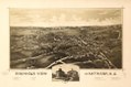
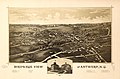 Bird's-eye view of Antwerp, N.Y. LOC 75694745.jpg 7,904 × 5,200; 6.62 MB
-
 Bird's-eye view of Antwerp, N.Y. LOC 75694745.tif 7,904 × 5,200; 117.59 MB
-
 Birds eye view of Plattsburgh, Clinton Co., New York 1877 (2675042381).jpg 2,000 × 1,638; 2.96 MB
-
 Birdseye view of Rochester and Despatch LOC 2009584359.jpg 10,353 × 7,202; 16.77 MB
-

-

-
 BriarcliffOutlookV1-Oct.1906-Mar.1907Image1.jpg 1,003 × 680; 200 KB
-
 BriarcliffOutlookV1-Oct.1906-Mar.1907Image2.jpg 2,416 × 1,668; 3.52 MB
-
 Britannica New York.jpg 2,758 × 1,954; 3.07 MB
-
 British at Frogs Neck (1776).jpg 1,362 × 884; 349 KB
-
 BrunswickDistrict6Map.jpg 1,515 × 1,375; 1.97 MB
-
 Bulletin - New York State Museum (1899) (14598352838).jpg 1,552 × 2,788; 1.1 MB
-
 Cambridge, N.Y. 1886. LOC 75694754.jpg 8,480 × 5,200; 10.98 MB
-
 Canisteo (Village); Canisteo Business Notices. NYPL1603021.tiff 7,230 × 5,428; 112.28 MB
-
 CarrillonAbercrombieRoute1758.png 442 × 549; 184 KB
-

-
-

-

-

-

-

-
 Charlotte County 1777.png 1,071 × 1,223; 2.66 MB
-
 Childwold New York USGS topo map 1920.jpg 2,957 × 3,612; 3.73 MB
-
 Cleveland, N.Y. LOC 2009584347.jpg 11,072 × 7,850; 9.02 MB
-
 Cleveland, N.Y. LOC 2009584347.tif 11,072 × 7,850; 248.67 MB
-
 ClumFarmMap.jpg 7,158 × 5,677; 29.71 MB
-
 ClumFarmMapUnrestored.jpg 7,432 × 6,000; 29.59 MB
-
 CNY Military Tract.png 492 × 599; 606 KB
-
 Cold Spring Harbor NYPL1633852.tiff 5,428 × 6,812; 105.79 MB
-

-
 Conquest (Township) NYPL1583071.tiff 5,414 × 6,542; 101.34 MB
-

-
 Cranberry Lake New York USGS topo map 1919.jpg 2,974 × 3,635; 3.8 MB
-
 Crown Point & part of Lake Champlain. LOC gm71002320.jpg 11,312 × 4,765; 5.62 MB
-
 Crown Point & part of Lake Champlain. LOC gm71002320.tif 11,312 × 4,765; 154.21 MB
-
 Dannemora New York USGS topo map 1911.jpg 2,587 × 3,619; 3.1 MB
-
 Delmarmap1891.jpg 420 × 400; 35 KB
-
 Dirk Jansz van Santen - map finish comparison.jpg 640 × 815; 115 KB
-
-
 Distance map of the state of New York - containing all the towns in the state. LOC 2009584046.tif 8,921 × 6,563; 167.51 MB
-
 East Hempstread and Uniondale; Manor Park NYPL1633870.tiff 5,428 × 6,812; 105.79 MB
-
 East Islip and Connetquot Park; Central Islip NYPL1633908.tiff 7,230 × 4,624; 95.65 MB
-
 East Moriches. (Village) NYPL1603006.tiff 5,428 × 7,230; 112.28 MB
-
 East Northport; Greenlawn; Asharoken Beach NYPL1633977.tiff 7,230 × 4,960; 102.6 MB
-
 East Rockaway NYPL1633794.tiff 7,230 × 4,468; 92.42 MB
-
 East Setauket NYPL1633985.tiff 4,960 × 7,230; 102.6 MB
-
 East to Cold Spring Harbor NYPL1633823.tiff 5,428 × 6,812; 105.79 MB
-
 East Williston NYPL1633781.tiff 5,428 × 6,820; 105.91 MB
-
 EB9 New York.jpg 5,504 × 3,820; 4.02 MB
-
 Elizabethtown New York USGS topo map 1892.jpg 3,043 × 3,597; 4.36 MB
-
 Estatua de la la Libertad, Monumento Nacional - NPS New York LOC 78695230.jpg 4,965 × 5,839; 4.14 MB
-
 Estatua de la la Libertad, Monumento Nacional - NPS New York LOC 78695230.tif 4,965 × 5,839; 82.94 MB
-
 Farmingdale (West) Central Park, Etc. NYPL1633775.tiff 5,428 × 6,812; 105.79 MB
-
-

-

-
 Fort Stanwix, Fort Stanwix National Monument, New York LOC 2005626706.jpg 10,304 × 7,152; 8.85 MB
-
 Fort Stanwix, Fort Stanwix National Monument, New York LOC 2005626706.tif 10,304 × 7,152; 210.84 MB
-
 Fort Stanwix, Fort Stanwix National Monument, New York LOC 2007625817.jpg 10,437 × 7,322; 9.31 MB
-
 Fort Stanwix, Fort Stanwix National Monument, New York LOC 2009584219.jpg 10,366 × 7,243; 9.17 MB


)%27_(11181956496).jpg)
.jpg)
_hung_on_a_horn%27_(11209287926).jpg)


(c).jpg)
.jpg)
(c).jpg)
.jpg)
_-_Geographicus_-_NovaBelgicaetAngliaNova-blaeu-1635.jpg)


_pg021_THOMAS_KITCHIN_(SENIOR%27S)_NEW_YORK_IN_1778,_FROM_THE_LONDON_MAGAZINE.jpg)
_(18238327328).jpg)
_(19178591880).jpg)
_(19360012122).jpg)
_(14592174978).jpg)
_(14592323827).jpg)


%27_(11030451456).jpg)
%27_(11229754364).jpg)

.jpg)
.jpg)
%27_(11117738464).jpg)
.jpg)
.jpg)
.jpg)
.jpg)
.jpg)


.jpg)

.jpg)

.jpg)
.jpg)
.jpg)
,_Connecticut,_Rhode_Island,_Pennsylvania,_New_Jersey,_Delaware,_Maryland_and_Virginia_(4584051716).jpg)

.jpg)


.jpg)
.jpg)


.jpg)
.jpg)

.jpg)
_(14580458869).jpg)


.jpg)
.jpg)
_(14563593820).jpg)
_(17808020573).jpg)
_(18240861298).jpg)
_(18240954790).jpg)
_(18402278616).jpg)
_(14565032210).jpg)
_(14565068358).jpg)
_(18249138408).jpg)
_(19174596818).jpg)
_(14566027347).jpg)
_(19363542255).jpg)
_(19359213612).jpg)
_(18433224995).jpg)
_(18745585063).jpg)


_various_architectural_features_LOC_2019585073.jpg)
.jpg)


_(14776290063).jpg)

.jpg)


.jpg)

_(14598352838).jpg)


.jpg)
.jpg)


_(20079856053).jpg)


_(14785045883).jpg)


,_Mohawk_River,_Niagara_region,_and_Lake_Ontario_in_New_York_Province)._LOC_2006625857.jpg)