Category:Old maps of Vermont
States of the United States: Alabama · Alaska · Arizona · Arkansas · California · Colorado · Connecticut · Delaware · Florida · Georgia · Hawaii · Idaho · Illinois · Indiana · Iowa · Kansas · Kentucky · Louisiana · Maine · Maryland · Massachusetts · Michigan · Minnesota · Mississippi · Missouri · Montana · Nebraska · Nevada · New Hampshire · New Jersey · New Mexico · New York · North Carolina · North Dakota · Ohio · Oklahoma · Oregon · Pennsylvania · Rhode Island · South Carolina · South Dakota · Tennessee · Texas · Utah · Vermont · Virginia · Washington · West Virginia · Wisconsin · Wyoming – District of Columbia: Washington, D.C.
Guam · Northern Mariana Islands · Puerto Rico
Guam · Northern Mariana Islands · Puerto Rico
Subcategories
This category has the following 5 subcategories, out of 5 total.
C
Media in category "Old maps of Vermont"
The following 200 files are in this category, out of 255 total.
(previous page) (next page)-
 10 of 'History of New England. vol. 1-4' (11054440816).jpg 2,672 × 1,545; 1.05 MB
-
 14 of 'Geography, History and Civil Government of Vermont' (11206532505).jpg 2,272 × 1,446; 555 KB
-
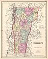
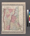
 1855 Colton Map of Vermont - Geographicus - Vermont-colton-1855.jpg 3,300 × 4,000; 3.65 MB
-
 1857 Colton Map of Vermont - Geographicus - Vermont-colton-1857.jpg 2,869 × 3,500; 2.53 MB
-
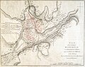
 1861 Johnson Map of Vermont and New Hampshire - Geographicus - VTNH-j-62.jpg 2,127 × 3,000; 2.21 MB
-
 1862 Johnson Map of Vermont and New Hampshire - Geographicus - VTNH-johnson-1862.jpg 3,551 × 5,000; 6.7 MB
-

-
 25 of 'Geography, History and Civil Government of Vermont' (11204747165).jpg 1,473 × 2,216; 644 KB
-

-

-
 29 of 'Geography, History and Civil Government of Vermont' (11206157463).jpg 1,481 × 2,216; 722 KB
-

-
 39 of 'Geography, History and Civil Government of Vermont' (11205958184).jpg 1,444 × 2,216; 644 KB
-
 43 of 'Geography, History and Civil Government of Vermont' (11205971996).jpg 1,473 × 2,213; 687 KB
-
 70 of 'Geography, History and Civil Government of Vermont' (11206735636).jpg 1,443 × 2,251; 735 KB
-

-

-

-

-
-

-

-

-

-
 A Map of the State of Vermont - NARA - 102279630.jpg 9,147 × 7,528; 5.39 MB
-
 A map of the state of Vermont LOC 2017586669.tif 3,649 × 4,637; 48.41 MB
-
 A map of Vermont. LOC 97683593.jpg 2,184 × 2,800; 873 KB
-
 A map of Vermont. LOC 97683593.tif 2,184 × 2,800; 17.5 MB
-

-

-

-

-

-

-
 Arbuckle Bros. Coffee Company (3093841890).jpg 798 × 477; 345 KB
-
 Battle of Bennington, Aug. 16, 1777. LOC gm71005309.jpg 4,994 × 2,914; 2.83 MB
-
 Battle of Bennington, Aug. 16, 1777. LOC gm71005309.tif 4,994 × 2,914; 41.64 MB
-
 BattleOfHubbardtonMap1777.jpg 5,344 × 4,240; 6.85 MB
-
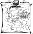 Bennington Heights, VT August 16, 1777.jpg 2,081 × 2,154; 1.74 MB
-
 Bernard. LOC 74692128.jpg 2,434 × 3,832; 1.12 MB
-
 Bernard. LOC 74692128.tif 2,434 × 3,832; 26.69 MB
-
 Birds eye view of Bennington & Bennington Centre, Bennington Co., Vermont LOC 2012588161.jpg 8,876 × 7,104; 11.75 MB
-
 Brattleboro, Vt. (2675061669).jpg 2,000 × 1,562; 3.36 MB
-
 Brattleboro, Vt. (2675062385).jpg 2,000 × 1,343; 1.9 MB
-
 Brattleboro, Vt. 1886. LOC 75696622.jpg 10,144 × 5,344; 9.35 MB
-
 Britannica New Hampshire and Vermont.jpg 1,961 × 2,645; 3.22 MB
-
 BTV partialParcelMap 1798.jpg 3,672 × 3,672; 7.05 MB
-
 BTV partialParcelMap UnivGreen 1798.jpg 3,672 × 3,672; 7.01 MB
-
 Castleton, Vt. 1889. LOC 74693163.jpg 7,808 × 5,136; 8.53 MB
-
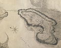 Charles Wintersmith Map of Mount Independence.jpg 2,892 × 2,256; 3.95 MB
-
 Chittenden County, Vermont LOC 81690027.jpg 6,236 × 8,589; 5.94 MB
-
 Chittenden County, Vermont LOC 81690027.tif 6,236 × 8,589; 153.24 MB
-

-

-
 Collier's 1921 New Hampshire and Vermont.jpg 1,926 × 2,382; 1.29 MB
-

-

-

-

-
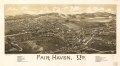
 Fair Haven, Vt. LOC 75696624.jpg 7,608 × 4,208; 7.24 MB
-
 Fair Haven, Vt. LOC 75696624.tif 7,608 × 4,208; 91.59 MB
-

-

-

-
 Folded bird's-eye view of Bennington, VT. - showing all points of interest. LOC 2006628342.tif 9,085 × 4,496; 116.86 MB
-
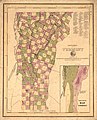
 Franklin County, Vermont LOC 81690026.jpg 8,042 × 6,559; 6.18 MB
-
 Franklin County, Vermont LOC 81690026.tif 8,042 × 6,559; 150.91 MB
-
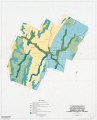
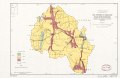
 General soil map, Washington County, Vermont LOC 2005628323.jpg 6,508 × 8,055; 4.77 MB
-
 General soil map, Washington County, Vermont LOC 2005628323.tif 6,508 × 8,055; 149.98 MB
-

-

-

-

-

-

-
 Grand Isle County, Vermont LOC 81690028.jpg 5,916 × 7,129; 4.02 MB
-
 Grand Isle County, Vermont LOC 81690028.tif 5,916 × 7,129; 120.66 MB
-
 Green Mountain National Forest - America's great outdoors, Vermont - 2006 LOC 2007626117.jpg 10,857 × 21,663; 31.37 MB
-
 Green Mountain National Forest, Vermont - 1966 LOC 2011589174.jpg 10,350 × 16,020; 20.48 MB
-
 Green Mountain National Forest, Vermont - 1966 LOC 2011589174.tif 10,350 × 16,020; 474.38 MB
-
 Green Mountain National Forest, Vermont - 1982 LOC 90680379.jpg 9,783 × 15,000; 16.13 MB
-
 Green Mountain National Forest, Vermont - 1982 LOC 90680379.tif 9,783 × 15,000; 419.84 MB
-
 Green Mountain National Forest, Vermont - 1990 LOC 2006628246.jpg 2,551 × 6,653; 2.49 MB
-
 Green Mountain National Forest, Vermont - 1990 LOC 2006628246.tif 2,551 × 6,653; 48.56 MB
-
 Green Mountain National Forest, Vermont LOC 78695354.jpg 11,728 × 14,572; 31.62 MB
-
 Green Mountain National Forest, Vermont. LOC gm70005336.jpg 9,756 × 15,000; 16.78 MB
-
 Hydrologic unit map-1981, Vermont LOC 90683492.jpg 2,636 × 6,668; 1.39 MB
-
 Hydrologic unit map-1981, Vermont LOC 90683492.tif 2,636 × 6,668; 50.29 MB
-

-

-

-
-

-

-
 J. H. Colton's School Atlas, 1860 - DPLA - 9afa4d40de861bb7b2a7e024bba61c0e (page 14).jpg 4,093 × 4,918; 2.26 MB
-
 Lower Missisquoi River watershed, Franklin and Lamoille counties, Vermont LOC 88690963.jpg 5,053 × 3,277; 1.51 MB
-
 Lower Missisquoi River watershed, Franklin and Lamoille counties, Vermont LOC 88690963.tif 5,053 × 3,277; 47.38 MB
-
 Ludlow, Vt. LOC 75696626.jpg 8,224 × 5,184; 8.88 MB
-
 Ludlow, Vt. LOC 75696626.tif 8,224 × 5,184; 121.97 MB
-

-
 Map & profiles of the Vt. Central and Vt. and Canada Railroads LOC 79693228.jpg 19,397 × 8,055; 12.93 MB
-
 Map & profiles of the Vt. Central and Vt. and Canada Railroads LOC 79693228.tif 19,397 × 8,055; 447.01 MB
-
 Map and profiles of the Vt. Central and Vt. and Canada Railroads (13410961605).jpg 2,000 × 925; 1.35 MB
-
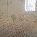
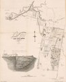
 Map depicting early land division and ownership in Barnard, Vermont (5961395356).jpg 1,432 × 2,000; 2.41 MB
-
 Map of Addison County, Vermont LOC 2012586232.tif 16,328 × 16,369; 764.67 MB
-
 Map of Bennington County, Vermont LOC 2011590005.jpg 16,679 × 12,857; 35.6 MB
-
 Map of Bennington County, Vermont LOC 2011590005.tif 16,679 × 12,857; 613.52 MB
-
 Map of Caledonia County, Vermont (13389122903).jpg 1,967 × 2,000; 3.4 MB
-
 Map of Caledonia County, Vermont LOC 2005625342.jpg 16,438 × 16,388; 37.5 MB
-
 Map of Caledonia County, Vermont LOC 2005625342.tif 16,438 × 16,388; 770.72 MB
-
 Map of Chittenden County, Vermont (13389343854).jpg 2,000 × 1,998; 3.45 MB
-
 Map of Chittenden County, Vermont - from actual surveys LOC 2005625313.jpg 16,596 × 16,373; 40.65 MB
-
-
 Map of Orange County, Vermont LOC 2012586231.jpg 17,018 × 16,818; 39.99 MB
-
 Map of the city of Rutland, Vt. LOC 2011589288.jpg 13,012 × 12,785; 20.36 MB
-
 Map of the city of Rutland, Vt. LOC 2011589288.tif 13,012 × 12,785; 475.96 MB
-
 Map of the counties of Franklin and Grand Isle, Vermont - from actual surveys LOC 2005625354.tif 17,262 × 16,795; 829.45 MB
-
 Map of the counties of Orleans, Lamoille, and Essex, Vermont LOC 2012586229.jpg 16,696 × 16,836; 43.93 MB
-
 Map of the counties of Orleans, Lamoille, and Essex, Vermont LOC 2012586229.tif 16,696 × 16,836; 804.22 MB
-
 Map of the county of Essex, Vermont. LOC 2012586230.jpg 14,649 × 16,993; 32.33 MB
-
 Map of the state of Vermont. LOC 85696909.jpg 4,411 × 7,718; 5.91 MB
-
 Map of the state of Vermont. LOC 85696909.tif 4,411 × 7,718; 97.4 MB
-
 Map of the town of Plymouth, Windsor County, Vermont. LOC 2008624018.jpg 9,396 × 10,148; 14.37 MB
-
 Map of the town of Plymouth, Windsor County, Vermont. LOC 2008624018.tif 9,396 × 10,148; 272.8 MB
-
 Map of the village of Highgate, Franklin County, state of Vermont LOC 2008624023.jpg 10,361 × 7,286; 7.94 MB
-
 Map of the village of Highgate, Franklin County, state of Vermont LOC 2008624023.tif 10,361 × 7,286; 215.98 MB
-
 Map of Vermont & New Hampshire. LOC 2008624079.jpg 7,560 × 8,923; 11.58 MB
-
 Map of Vermont with railroad annotations in 1834.jpg 594 × 799; 129 KB
-
 Map of Windsor County, Vermont LOC 2012586224.tif 13,600 × 16,653; 647.97 MB
-
 Map of Windsor County, Vermont LOC 2012586225.jpg 13,547 × 16,471; 36.33 MB
-

-
 McClellan's map of Windham County, Vermont LOC 2012586226.jpg 13,408 × 16,136; 33.9 MB
-
 Middlebury, Vt. LOC 75696627.jpg 8,480 × 5,424; 8.52 MB
-
 Middlebury, Vt. LOC 75696627.tif 8,480 × 5,424; 131.59 MB
-

-

-
 Missisquoi National Wildlife Refuge LOC 2003620543.jpg 7,353 × 5,251; 5.4 MB
-
 Missisquoi National Wildlife Refuge LOC 2003620543.tif 7,353 × 5,251; 110.47 MB
-
 Montpelier, county seat of Washington County & capital of Vermont - 1884 LOC 2008624296.jpg 11,707 × 8,891; 18.22 MB
-
 NIE 1905 New Hampshire - and Vermont.jpg 1,699 × 2,043; 1.76 MB
-
 New Hampshire and Vermont (NYPL b13663520-1510798).tiff 5,246 × 6,298; 95.19 MB
-
 A map of Vermont (NYPL b14115138-1567519).jpg 5,428 × 6,598; 4.21 MB
-
 Orange County, Vermont LOC 81690025.jpg 8,341 × 7,468; 6.25 MB
-
 Orange County, Vermont LOC 81690025.tif 8,341 × 7,468; 178.22 MB
-
-

-
 Plan of Rutland, Rutland County, Vermont (13383963913).jpg 1,718 × 2,000; 2.87 MB
-
 Plan of Sandgate. LOC 74692127.jpg 2,360 × 3,840; 1.11 MB
-
 Plan of Sandgate. LOC 74692127.tif 2,360 × 3,840; 25.93 MB
-
 Plan of the city of Burlington shewing (i.e. showing) water & sewer service. LOC 2011589282.jpg 18,756 × 12,877; 25.31 MB
-

-
-

-

-

-

-

-

-

-

-

-

-
 Poultney, Vt. LOC 75696629.jpg 6,736 × 4,912; 7.3 MB
-
 Poultney, Vt. LOC 75696629.tif 6,736 × 4,912; 94.66 MB
-
 Railroad Commissioners' map of the State of Vermont (13383964193).jpg 1,273 × 2,000; 2.68 MB
-
 Reconnaissance erosion survey of the States of New-Hampshire and Vermont - btv1b531894871.jpg 7,056 × 10,008; 6.69 MB
-

-

-
 Scott's map of Rutland County, Vermont LOC 2012586227.jpg 14,347 × 17,744; 46 MB
-
 Scott's map of Rutland County, Vermont LOC 2012586227.tif 14,347 × 17,744; 728.34 MB
-

-

-

-
-
-

-

-

-

-

-
-
-

-

-

-
 Soil erodibility index map, Malletts Bay Watershed, Chittenden County, Vermont LOC 82693208.tif 3,262 × 5,117; 47.76 MB
-
-

-

-

-

-

-

-

-

-

-

-

-

-

.jpg)
.jpg)


_Annual_Report_on_the_Geology_of_the_State_of_Vermont%27_(11024518294).jpg)
.jpg)
.jpg)
.jpg)
.jpg)
%27_(11200184323).jpg)
.jpg)
.jpg)
.jpg)
%27_(11059319524).jpg)
.jpg)


_(14735402636).jpg)

.jpg)


.jpg)
.jpg)


_Annual_Report_on_the_Geology_of_the_State_of_Vermont%27_(11024343295).jpg)
.jpg)


.jpg)


.jpg)
.jpg)

.jpg)

.jpg)

.jpg)


_and_Boston_from_Concord_%26_Manchester,_N.H_(8346292853).jpg)


.jpg)


.jpg)

_water_%26_sewer_service._LOC_2011589282.jpg)

_(14767161072).jpg)


.jpg)


n_the_provinces_of_Quebec_and_New_York_LOC_73691803.jpg)