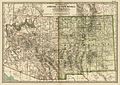
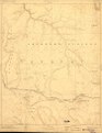
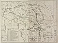
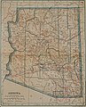
Category:Old maps of Arizona
States of the United States: Alabama · Alaska · Arizona · Arkansas · California · Colorado · Connecticut · Delaware · Florida · Georgia · Hawaii · Idaho · Illinois · Indiana · Iowa · Kansas · Kentucky · Louisiana · Maine · Maryland · Massachusetts · Michigan · Minnesota · Mississippi · Missouri · Montana · Nebraska · Nevada · New Hampshire · New Jersey · New Mexico · New York · North Carolina · North Dakota · Ohio · Oklahoma · Oregon · Pennsylvania · Rhode Island · South Carolina · South Dakota · Tennessee · Texas · Utah · Vermont · Virginia · Washington · West Virginia · Wisconsin · Wyoming – District of Columbia: Washington, D.C.
Guam · Northern Mariana Islands · Puerto Rico
Guam · Northern Mariana Islands · Puerto Rico
Subcategories
This category has the following 9 subcategories, out of 9 total.
Media in category "Old maps of Arizona"
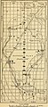
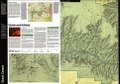
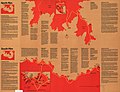
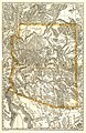
The following 140 files are in this category, out of 140 total.
-

-

-
 1875-sahuarito.JPG 605 × 467; 104 KB
-
 1877 Mitchell Map of Arizona and New Mexico - Geographicus - AZNM-mitchell-1877.jpg 4,000 × 3,237; 3.33 MB
-
 1903 Congress quadrangle Walnut Grove and Prescott Forest Reserve.jpg 850 × 1,680; 716 KB
-
 1911 Britannica - Arizona.png 860 × 1,171; 2.53 MB
-
 Map of the Grand Canyon National Park 1926.jpg 4,696 × 2,668; 2.43 MB
-

-
 A portion of south eastr'n Arizona (NBY 15529).jpg 3,600 × 2,420; 1.28 MB
-

-

-

-

-
 Annual Reports of the Department of the Interior 1905 (1905) (14598033359).jpg 3,408 × 4,354; 2.36 MB
-
 Arbuckle Bros. Coffee Company (3093819838).jpg 799 × 476; 319 KB
-

-
 Arizona 1860 2.jpg 890 × 1,002; 106 KB
-
 Arizona 1860 3.jpg 890 × 1,002; 106 KB
-
 Arizona 1860 4.jpg 890 × 1,002; 106 KB
-
 Arizona and New Mexico Territories Map, 1867.jpg 2,946 × 2,422; 2.77 MB
-
 Arizona and New Mexico Territories Map, 1899.jpg 3,112 × 2,212; 3.68 MB
-
 Arizona and New Mexico. LOC 98687198.jpg 4,402 × 3,564; 3.51 MB
-
 Arizona and New Mexico. LOC 98687198.tif 4,402 × 3,564; 44.89 MB
-
 Arizona and Sonora Missions.png 723 × 1,183; 1.57 MB
-
 Arizona Map 1883.jpg 2,839 × 4,001; 4.12 MB
-
 Arizona Territory Map, 1881.jpg 2,074 × 2,551; 2.34 MB
-
 Arizona Territory Map, 1883.jpg 2,832 × 3,994; 5.18 MB
-
 Arizona-New Mexico. LOC 73693046.jpg 9,560 × 5,650; 7.91 MB
-
 Arizona-New Mexico. LOC 73693046.tif 9,560 × 5,650; 154.54 MB
-
 Arizona. LOC 99446127-1.jpg 4,777 × 5,916; 4.11 MB
-
 Arizona. LOC 99446127-1.tif 4,777 × 5,916; 80.85 MB
-
 Arizona. LOC 99446127-2.jpg 4,428 × 5,734; 3.3 MB
-
 Arizona. LOC 99446127-2.tif 4,428 × 5,734; 72.64 MB
-
 Arizona. LOC 99446127-3.jpg 4,664 × 5,890; 3.64 MB
-
 Arizona. LOC 99446127-3.tif 4,664 × 5,890; 78.6 MB
-
 Arizona. LOC 99446127-4.jpg 4,698 × 5,861; 4.39 MB
-
 Arizona. LOC 99446127-4.tif 4,698 × 5,861; 78.78 MB
-
 AZ NW 1866 Public Surveys Map 290375.JPG 1,600 × 1,510; 1.73 MB
-
 AZ-NM1867.jpg 621 × 484; 97 KB
-
 Bulletin. 1901-13 (20235907148).jpg 2,182 × 3,576; 1.32 MB
-
 CLAREMONT DIGITAL Title Map of Pimeria Alta, 1687-1711 P15831coll14 129 full.jpg 4,001 × 2,927; 3.35 MB
-
 Cochise County 1881.jpg 759 × 705; 318 KB
-
 Cochise County, Arizona 1882 (Charleston-Millville).jpg 537 × 665; 340 KB
-
 Collier's 1921 Arizona.jpg 1,771 × 2,186; 970 KB
-
-
 EB9 Utah - Utah and Arizona.jpg 3,720 × 5,409; 2.84 MB
-

-
 First Powell Expedition 1869 USGS Pioh120.jpg 4,356 × 5,456; 3.7 MB
-
 From the Pimas villages to Fort Fillmore - from explorations and surveys LOC 98688427.jpg 11,820 × 7,495; 9.31 MB
-
 From the Pimas villages to Fort Fillmore - from explorations and surveys LOC 98688427.tif 11,820 × 7,495; 253.46 MB
-
 G. M. Wheeler, Topographical atlas 1869-1878 Wellcome L0027632.jpg 1,529 × 1,321; 1.1 MB
-
 Geology and water resources of Sulphur Spring Valley, Arizona (1913) (14578465509).jpg 2,128 × 3,560; 971 KB
-
 Geology and water resources of Sulphur Spring Valley, Arizona (1913) (14761936401).jpg 1,692 × 3,748; 983 KB
-
 Geology and water resources of Sulphur Spring Valley, Arizona (1913) (14765103725).jpg 2,144 × 3,588; 1.02 MB
-
 Geology and water resources of Sulphur Spring Valley, Arizona (1913) (14765104875).jpg 2,116 × 3,512; 952 KB
-
 Geology and water resources of Sulphur Spring Valley, Arizona (1913) (14784983473).jpg 1,948 × 3,368; 1,019 KB
-
 Grand Canyon LOC 84695480.jpg 7,103 × 5,049; 7.27 MB
-
 Grand Canyon LOC 84695480.tif 7,103 × 5,049; 102.61 MB
-
 Grand Canyon National Monument within Grand Canyon National Forest Arizona. LOC 98687191.jpg 4,976 × 7,535; 5.63 MB
-
 Grand Canyon National Monument within Grand Canyon National Forest Arizona. LOC 98687191.tif 4,976 × 7,535; 107.27 MB
-
 Grand Canyon National Park and vicinity, Arizona - 1962 LOC 96682204.jpg 17,903 × 11,295; 48.35 MB
-
 Grand Canyon National Park and vicinity, Arizona LOC 97682276.jpg 17,887 × 11,264; 37.57 MB
-
 Grand Canyon National Park, Arizona LOC 91682960.jpg 6,935 × 4,951; 9.24 MB
-
 Grand Canyon National Park, Arizona LOC 91682960.tif 6,935 × 4,951; 98.23 MB
-
 Grand Canyon National Park, Arizona LOC 96682413.jpg 7,043 × 4,970; 8.81 MB
-
 Grand Canyon National Park, Arizona LOC 96682413.tif 7,043 × 4,970; 100.15 MB
-
 Grand Canyon of the Colorado. LOC 98687190.jpg 4,458 × 3,808; 2.96 MB
-
 Grand Canyon of the Colorado. LOC 98687190.tif 4,458 × 3,808; 48.57 MB
-
 Grand Canyon. LOC 78691582.jpg 7,163 × 5,508; 6.18 MB
-
 Grand Canyon. LOC 78691582.tif 7,163 × 5,508; 112.88 MB
-
 Harshaw Area USGS Topographical Map.JPG 1,200 × 800; 1.62 MB
-
 Hartley's map of Arizona. LOC 98687199.tif 11,180 × 9,362; 299.46 MB
-
-
 Indexed map of Arizona showing the stage lines, counties, lakes & rivers. LOC 98688443.tif 3,912 × 6,024; 67.42 MB
-

-
 Map of Colonel Sanford's Expedition to Sombrero Butte - NARA - 103396422.jpg 6,376 × 4,746; 1.91 MB
-

-
 Map of Gila Valley, Arizona USGS 1903 Gila and Salt River Meridian.png 1,675 × 1,788; 3.24 MB
-
 Map of Grand Canyon National Park. LOC 98687204.jpg 4,696 × 2,668; 2.77 MB
-
 Map of Grand Canyon National Park. LOC 98687204.tif 4,696 × 2,668; 35.85 MB
-
 Map of Hermit Rim Road and Hermit Trail. LOC 98687194.jpg 2,520 × 1,752; 867 KB
-
 Map of Hermit Rim Road and Hermit Trail. LOC 98687194.tif 2,520 × 1,752; 12.63 MB
-
 Map of Indian Areas in Arizona and New Mexico - NARA - 84785487.jpg 8,896 × 11,409; 8.76 MB
-
 Map of Navajo Areas - NARA - 84785481.jpg 11,360 × 12,430; 10.31 MB
-
 Map of Peralta land grant.jpg 1,994 × 990; 384 KB
-
 Map of the Tombstone mining district - Cochise Co., Arizona Ter. LOC 2012586611.jpg 18,396 × 13,482; 31.42 MB
-
 Map of the Tombstone mining district - Cochise Co., Arizona Ter. LOC 2012586611.tif 18,396 × 13,482; 709.58 MB
-
 Maricopa and Pimas Villages, Military District of New Mexico 1858.jpg 745 × 1,002; 181 KB
-
 Mineral resources of the United States (1913) (14775414434).jpg 1,552 × 3,632; 503 KB
-
 National Wetlands Inventory, (Arizona). LOC 99446173.jpg 6,917 × 4,944; 9.2 MB
-
 National Wetlands Inventory, (Arizona). LOC 99446173.tif 6,917 × 4,944; 97.84 MB
-
 NIE 1905 Arizona (and New Mexico).jpg 2,081 × 1,682; 1.13 MB
-
 North Rim, Grand Canyon National Park, Arizona. LOC 78691591.jpg 3,896 × 5,056; 4.17 MB
-
 North Rim, Grand Canyon National Park, Arizona. LOC 78691591.tif 3,896 × 5,056; 56.36 MB
-
 Parts of Northern and North Western Arizona and Southern Utah. LOC 99446142.jpg 6,994 × 5,591; 6.9 MB
-
 Parts of Northern and North Western Arizona and Southern Utah. LOC 99446142.tif 6,994 × 5,591; 111.88 MB
-
 Pclmaps-topo-az-maricopa-1913.jpg 2,700 × 3,228; 1.71 MB
-
 Pg-23.jpg 1,247 × 1,043; 629 KB
-
 Pima County, Arizona circa 1883 (Harshaw).jpg 1,263 × 598; 873 KB
-
 Preliminary map no.2 of the country surveyed in 1872 and 1873. LOC 98687121.jpg 6,832 × 8,456; 10.82 MB
-
 Preliminary map no.2 of the country surveyed in 1872 and 1873. LOC 98687121.tif 6,832 × 8,456; 165.29 MB
-
 Probable Route of Cardenas BHoU-p5.png 3,935 × 3,141; 147 KB
-
 R.P. Kelley's map of the territory of Arizona LOC 2008621510.jpg 12,609 × 7,174; 11.44 MB
-
 R.P. Kelley's map of the territory of Arizona LOC 2008621510.tif 12,609 × 7,174; 258.8 MB
-
-

-
 Rio Colorado of the West 1858.jpg 10,701 × 4,739; 6.96 MB
-
 Sacate Arizona 1913 bless the Perry-Castañeda library.jpg 391 × 391; 76 KB
-
 Sacate Sacaton Mountain Sacaton Gila River Pima Butte.jpg 570 × 570; 130 KB
-
 Sheet 23. Ocatilla to Norton (north line) and Estrella, Ariz. (south line).jpg 1,050 × 1,096; 154 KB
-
 South Rim, Grand Canyon National Park, Arizona. LOC 78691592.jpg 3,904 × 5,072; 4.09 MB
-
 South Rim, Grand Canyon National Park, Arizona. LOC 78691592.tif 3,904 × 5,072; 56.65 MB
-
 Southeast Cochise County 1880.png 1,647 × 982; 3.99 MB
-
 Southwestern Defense System before the Civil War.jpg 450 × 286; 22 KB
-
 Territory of Arizona. LOC 98687197.jpg 9,641 × 11,506; 23.85 MB
-
 Territory of Arizona. LOC 98687197.tif 9,641 × 11,506; 317.37 MB
-
 Territory of Arizona. LOC 99446141.jpg 9,123 × 7,643; 10.74 MB
-
 Territory of Arizona. LOC 99446141.tif 9,123 × 7,643; 199.49 MB
-
 Territory of New Mexico - DPLA - b23869ff2be039061d8f5bd436ac1381.jpg 8,999 × 7,260; 7.57 MB
-
 The American journal of science (1913) (18153915521).jpg 2,928 × 2,000; 1.02 MB
-
 The American Museum journal (c1900-(1918)) (17537857744).jpg 946 × 1,026; 369 KB
-

-

-

-
 Tombstone area map 1887.jpg 1,385 × 931; 379 KB
-
 Tombstone Mining Map 1907.jpg 2,616 × 3,880; 4.58 MB
-
 Topographic map of the Grand Canyon National Park Arizona . LOC 98687188.jpg 12,009 × 13,640; 10.49 MB
-
 Topographic map of the Grand Canyon National Park Arizona . LOC 98687188.tif 12,009 × 13,640; 468.64 MB
-
 Topographic map of the Grand Canyon National Park Arizona . LOC 98687189.jpg 12,198 × 13,675; 29.21 MB
-
 Topographic map of the Grand Canyon National Park Arizona . LOC 98687189.tif 12,198 × 13,675; 477.24 MB
-
 Township 14N 3W 1871 ARIZONA Plat 196539 1.jpg 3,568 × 3,304; 9.34 MB
-
 Tucson Arizona area 1883.jpg 500 × 400; 71 KB
-
 USGS Map of Santa Rita and Patagonia Mts 1910.jpg 928 × 588; 280 KB
-
 Utah and Nevada 1795 BHoU-p27a.png 3,911 × 3,091; 216 KB
-
 Visitors' guide to Grand Canyon National Park, North Rim. LOC 99446143.jpg 4,318 × 3,174; 2.02 MB
-
 Visitors' guide to Grand Canyon National Park, North Rim. LOC 99446143.tif 4,318 × 3,174; 39.21 MB
-
 Visitors' guide to Grand Canyon National Park, South Rim. LOC 99446144.jpg 4,284 × 3,174; 1.81 MB
-
 Visitors' guide to Grand Canyon National Park, South Rim. LOC 99446144.tif 4,284 × 3,174; 38.9 MB
-
 Walnut Grove in Arizona Territory circa 1877.jpg 736 × 736; 146 KB
-
 Yuma County, Arizona circa 1883 (Castle Dome Landing).jpg 793 × 1,233; 958 KB
.jpg)
.jpg)


.jpg)
.jpg)
_(19174181100).jpg)
_(19361836725).jpg)
_(19365855031).jpg)
_(19336876556).jpg)
_(14598033359).jpg)
.jpg)


.jpg)


.jpg)

_(14804072533).jpg)


_(14578465509).jpg)
_(14761936401).jpg)
_(14765103725).jpg)
_(14765104875).jpg)
_(14784983473).jpg)


.jpg)


_(14775414434).jpg)
._LOC_99446173.jpg)
.jpg)


.jpg)


_(14574452109).jpg)
_(14577624139).jpg)


_and_Estrella,_Ariz._(south_line).jpg)


_(18153915521).jpg)
)_(17537857744).jpg)
_of_the_Colorado_of_the_West_and_the_cliffs_of_southern_Utah._LOC_98687193.jpg)
.jpg)


.jpg)