Category:Old maps of Idaho
States of the United States: Alabama · Alaska · Arizona · Arkansas · California · Colorado · Connecticut · Delaware · Florida · Georgia · Hawaii · Idaho · Illinois · Indiana · Iowa · Kansas · Kentucky · Louisiana · Maine · Maryland · Massachusetts · Michigan · Minnesota · Mississippi · Missouri · Montana · Nebraska · Nevada · New Hampshire · New Jersey · New Mexico · New York · North Carolina · North Dakota · Ohio · Oklahoma · Oregon · Pennsylvania · Rhode Island · South Carolina · South Dakota · Tennessee · Texas · Utah · Vermont · Virginia · Washington · West Virginia · Wisconsin · Wyoming – District of Columbia: Washington, D.C.
Guam · Northern Mariana Islands · Puerto Rico
Guam · Northern Mariana Islands · Puerto Rico
Subcategories
This category has the following 5 subcategories, out of 5 total.
O
- Old geological maps of Idaho (11 F)
Media in category "Old maps of Idaho"
The following 23 files are in this category, out of 23 total.
-

-
 Arbuckle Bros. Coffee Company (3093822812).jpg 799 × 486; 344 KB
-
 Boise City and southwestern Idaho (NBY 16468).jpg 3,600 × 2,514; 2.31 MB
-
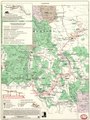
 Clearwater National Forest map EO 842 illustration.png 2,550 × 3,312; 60 KB
-
 EB1911 Idaho.jpg 2,597 × 1,873; 3.39 MB
-

-

-

-
 Indians of Oregon, Idaho, and Washington (map).png 2,202 × 1,358; 2.92 MB
-
 Lewis and Clark in the Rocky Mountains LOC 91682738.tif 5,384 × 7,159; 110.28 MB
-
 Map Eastern Oregon and Western Idaho - NARA - 93193210.jpg 8,888 × 4,539; 2.12 MB
-
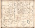
 Map of Idaho, 1876 (NBY 17745).jpg 2,396 × 3,600; 2.53 MB
-

-
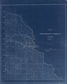 Map of Shoshone County, Idaho LOC 2011593043.jpg 11,089 × 13,779; 12.72 MB
-

-
-
 NIE 1905 Wyoming - Idaho, Montana and Wyoming.jpg 1,971 × 1,563; 1.51 MB
-
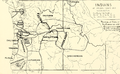
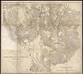
 Parts of Idaho, Montana and Wyoming territories (8347615560).jpg 800 × 707; 125 KB
-
 Parts of Idaho, Montana and Wyoming territories (9138377678).jpg 800 × 710; 131 KB
-
-

-

-
_(19361937565).jpg)
.jpg)
.jpg)


_-_Worth_County-_--_Idaho_-Ada_County_-_Bingham_County_(part)-_-_NARA_-_17500347_(page_1779).jpg)
.png)

.jpg)
.jpg)


.jpg)
.jpg)

_(14780541351).jpg)
_(14804416083).jpg)
_(14578784438).jpg)