Category:Old maps of Pennsylvania
States of the United States: Alabama · Alaska · Arizona · Arkansas · California · Colorado · Connecticut · Delaware · Florida · Georgia · Hawaii · Idaho · Illinois · Indiana · Iowa · Kansas · Kentucky · Louisiana · Maine · Maryland · Massachusetts · Michigan · Minnesota · Mississippi · Missouri · Montana · Nebraska · Nevada · New Hampshire · New Jersey · New Mexico · New York · North Carolina · North Dakota · Ohio · Oklahoma · Oregon · Pennsylvania · Rhode Island · South Carolina · South Dakota · Tennessee · Texas · Utah · Vermont · Virginia · Washington · West Virginia · Wisconsin · Wyoming – District of Columbia: Washington, D.C.
Guam · Northern Mariana Islands · Puerto Rico
Guam · Northern Mariana Islands · Puerto Rico
Subcategories
This category has the following 69 subcategories, out of 69 total.
-
A
B
C
D
E
F
G
H
I
J
L
M
N
O
P
S
T
U
V
W
Media in category "Old maps of Pennsylvania"
The following 200 files are in this category, out of 1,322 total.
(previous page) (next page)-

-
 1837 Erie, Pennsylvania map - DPLA - e8c4837a3afedf84be4d88fe9fd7f44f.jpg 6,743 × 8,674; 3.86 MB
-
 279 of 'The Story of the Palatines. An episode in colonial history' (11243671506).jpg 2,016 × 1,183; 211 KB
-
 307 of 'Martial Deeds of Pennsylvania' (11114494334).jpg 2,613 × 1,664; 774 KB
-

-

-

-

-

-

-

-

-

-

-

-

-

-

-

-

-

-
 A plan of the city and environs of Philadelphia. LOC 74692172.jpg 7,972 × 10,255; 9.73 MB
-
 A plan of the city and environs of Philadelphia. LOC 74692172.tif 7,972 × 10,255; 233.9 MB
-

-

-

-

-

-
 Aero view of Bangor, Pennsylvania 1918 LOC gm71005366.jpg 9,712 × 7,088; 12.21 MB
-
 Aero view of Bangor, Pennsylvania 1918 LOC gm71005366.tif 9,712 × 7,088; 196.95 MB
-
 Aero view of Pen Argyl, Pennsylvania 1916 LOC gm71005358.jpg 10,712 × 5,760; 10.15 MB
-
 Aero view of Pen Argyl, Pennsylvania 1916 LOC gm71005358.tif 10,712 × 5,760; 176.53 MB
-
 Aero view of Pen Argyl, Pennsylvania 1916. LOC 75696516.jpg 11,160 × 6,336; 11.45 MB
-
 Aero view of Pen Argyl, Pennsylvania 1916. LOC 75696516.tif 11,160 × 6,336; 202.3 MB
-
 Alburtis and Lockridge, Lehigh County, Pennsylvania 1893. LOC 75694943.jpg 5,664 × 3,704; 4.4 MB
-
 Alburtis and Lockridge, Lehigh County, Pennsylvania 1893. LOC 75694943.tif 5,664 × 3,704; 60.02 MB
-
 Alvin R. Bush Dam LOC 2005626839.jpg 9,588 × 5,448; 5.63 MB
-
 Alvin R. Bush Dam LOC 2005626839.tif 9,588 × 5,448; 149.45 MB
-
 AmCyc Anthracite - Pennsylvania regional map.jpg 4,289 × 3,341; 1.68 MB
-
 America's Industrial Heritage Project, southwestern Pennsylvania LOC 92680007.jpg 7,723 × 11,600; 11.65 MB
-
 America's Industrial Heritage Project, southwestern Pennsylvania LOC 92680007.tif 7,723 × 11,600; 256.31 MB
-
 American railway transportation (1908) (14572819860).jpg 2,848 × 1,816; 1,015 KB
-

-

-

-

-

-

-
 Base map of Pennsylvania. LOC 2005625114.jpg 17,425 × 10,372; 23.95 MB
-
 Base map of Pennsylvania. LOC 2005625114.tif 17,425 × 10,372; 517.08 MB
-
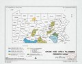
 Basin and area planning, Pennsylvania LOC 92683610.jpg 3,273 × 2,527; 1,013 KB
-
 Basin and area planning, Pennsylvania LOC 92683610.tif 3,273 × 2,527; 23.66 MB
-
 Belle Vernon, Pennsylvania, 1902. LOC 75694947.jpg 7,776 × 4,208; 6.52 MB
-
 Belle Vernon, Pennsylvania, 1902. LOC 75694947.tif 7,776 × 4,208; 93.62 MB
-
 Berks County, Pennsylvania LOC 82690676.jpg 8,039 × 6,968; 6.6 MB
-
 Berks County, Pennsylvania LOC 82690676.tif 8,039 × 6,968; 160.26 MB
-
 Bernville, Pennsylvania. LOC 74693216.jpg 7,160 × 3,720; 7.71 MB
-
 Bernville, Pennsylvania. LOC 74693216.tif 7,160 × 3,720; 76.2 MB
-
 Bird's eye view of Sinking Spring, Pennsylvania. LOC 76695289.jpg 4,432 × 3,416; 2.4 MB
-
 Bird's eye view of Sinking Spring, Pennsylvania. LOC 76695289.tif 4,432 × 3,416; 43.32 MB
-
 Bird's eye view of the city of Allentown, Pa. LOC 78694441.jpg 8,080 × 6,424; 10.65 MB
-
-

-
 Bird's-eye-view Brownsville, Bridgeport, W. Brownsville, Pa. 1883. LOC 74693155.jpg 8,080 × 4,296; 6.89 MB
-
 Bird's-eye-view Brownsville, Bridgeport, W. Brownsville, Pa. 1883. LOC 74693155.tif 8,080 × 4,296; 99.31 MB
-
 Bird's-eye-view of Allentown, Pennsylvania. LOC gm71005331.jpg 22,304 × 8,896; 35.95 MB
-
 Bird's-eye-view of Allentown, Pennsylvania. LOC gm71005331.tif 22,304 × 8,896; 567.67 MB
-
 Bird's-eye-view of Allentown, Pennsylvania. LOC gm71005350.jpg 10,752 × 4,640; 8.52 MB
-
 Bird's-eye-view of Allentown, Pennsylvania. LOC gm71005350.tif 10,752 × 4,640; 142.73 MB
-
 Birds eye view of Burnham and Yeagertown, Mifflin Co., Pa. 1906. LOC 75694952.jpg 6,472 × 5,376; 10.31 MB
-
 Birds eye view of Burnham and Yeagertown, Mifflin Co., Pa. 1906. LOC 75694952.tif 6,472 × 5,376; 99.55 MB
-
 Birds eye view of Orbisonia and Rock Hill, Pennsylvania 1906. LOC 75696513.jpg 6,560 × 4,960; 8.43 MB
-
 Birds eye view of Orbisonia and Rock Hill, Pennsylvania 1906. LOC 75696513.tif 6,560 × 4,960; 93.09 MB
-
 Birds eye view of Oxford, Chester Co., Pennsylvania. LOC 75696514.jpg 7,448 × 6,008; 12.74 MB
-
 Birds eye view of Oxford, Chester Co., Pennsylvania. LOC 75696514.tif 7,448 × 6,008; 128.02 MB
-
 Birds eye view of the city of Titusville, Crawford County, Pennsylvania 1871. LOC 73694524.jpg 8,624 × 6,912; 16.34 MB
-
 Birds eye view of Williamsburg, Blair Co., Pa. 1906. LOC 75694987.jpg 8,080 × 6,912; 15.28 MB
-
 Birds eye view of Williamsburg, Blair Co., Pa. 1906. LOC 75694987.tif 8,080 × 6,912; 159.79 MB
-
 Birds-eye view of the battlefield of Gettysburg. LOC 2007630413.jpg 3,713 × 2,109; 691 KB
-
 Birds-eye view of the battlefield of Gettysburg. LOC 2007630413.tif 3,713 × 2,109; 22.4 MB
-
 Birds-eye view of the Bethlehems, Pa. LOC 2015585060.jpg 8,321 × 6,436; 9.21 MB
-
 Birdsboro, Berks County, Pa. 1890. LOC 75694948.jpg 7,592 × 5,448; 8.84 MB
-
 Birdsboro, Berks County, Pa. 1890. LOC 75694948.tif 7,592 × 5,448; 118.34 MB
-
 Blue Marsh Lake hiking trails LOC 93685460.jpg 4,218 × 5,142; 2.2 MB
-
 Blue Marsh Lake hiking trails LOC 93685460.tif 4,218 × 5,142; 62.05 MB
-
 Blue Marsh Lake LOC 93685445.jpg 7,188 × 5,421; 5.27 MB
-
 Blue Marsh Lake LOC 93685445.tif 7,188 × 5,421; 111.48 MB
-

-

-
 Brookville, Jefferson County, Pennsylvania 1895. LOC 75694950.jpg 9,008 × 6,208; 12.26 MB
-
 Brookville, Jefferson County, Pennsylvania 1895. LOC 75694950.tif 9,008 × 6,208; 159.99 MB
-
 Bucks County, Pennsylvania LOC 82690600.jpg 7,459 × 7,158; 6.99 MB
-
 Bucks County, Pennsylvania LOC 82690600.tif 7,459 × 7,158; 152.75 MB
-
 Butler, Butler County, Pennsylvania, 1896. LOC 75694953.jpg 9,440 × 6,272; 14.05 MB
-
 Butler, Butler County, Pennsylvania, 1896. LOC 75694953.tif 9,440 × 6,272; 169.39 MB
-
 California, Washington County, Pennsylvania 1902 LOC 73693131.jpg 6,296 × 3,880; 5.57 MB
-
 California, Washington County, Pennsylvania 1902 LOC 73693131.tif 6,296 × 3,880; 69.89 MB
-
 Canonsburg, Washington County, Pennsylvania 1897 LOC 73693122.jpg 7,864 × 5,512; 9.91 MB
-
 Canonsburg, Washington County, Pennsylvania 1897 LOC 73693122.tif 7,864 × 5,512; 124.02 MB
-

-

-
 Captain Snow's sketch. LOC gm71000593.jpg 4,451 × 3,935; 1.91 MB
-
 Captain Snow's sketch. LOC gm71000593.tif 4,451 × 3,935; 50.11 MB
-
 Carbondale, Pennsylvania, 1890. LOC 75694954.jpg 10,800 × 6,704; 20.32 MB
-
 Carbondale, Pennsylvania, 1890. LOC 75694954.tif 10,800 × 6,704; 207.15 MB
-
 Catasauqua, Pa. LOC 2015585070.jpg 6,082 × 4,501; 4.24 MB
-
 Catasauqua, Pa. LOC 2015585070.tif 6,082 × 4,501; 78.32 MB
-
 Cavalry battle, Gettysburg, Pa. July 3rd 3-30 p.m. LOC gvhs01.vhs00150.jpg 1,582 × 2,015; 481 KB
-
 Cavalry battle, Gettysburg, Pa. July 3rd 3-30 p.m. LOC gvhs01.vhs00150.tif 1,582 × 2,015; 9.12 MB
-
 Cawanesque. LOC 86694761.jpg 12,382 × 6,228; 10.91 MB
-
 Cawanesque. LOC 86694761.tif 12,382 × 6,228; 220.63 MB
-
 Census 2000-Pennsylvania profile - population density by census tract LOC 2004625630.jpg 3,223 × 2,493; 1.06 MB
-
 Census 2000-Pennsylvania profile - population density by census tract LOC 2004625630.tif 3,223 × 2,493; 22.99 MB
-
 Chambersburg, Pennsylvania, burned by rebel cavalry July 30th 1864. LOC 76695230.jpg 10,368 × 6,192; 14.29 MB
-
 Chambersburg, Pennsylvania, burned by rebel cavalry July 30th 1864. LOC 76695230.tif 10,368 × 6,192; 183.67 MB
-
 Charleston. LOC 86694754.jpg 7,236 × 7,995; 9.51 MB
-
 Charleston. LOC 86694754.tif 7,236 × 7,995; 165.52 MB
-
 City of McKeesport & vicinity. LOC 75694998.jpg 9,648 × 4,976; 9.53 MB
-
 City of McKeesport & vicinity. LOC 75694998.tif 9,648 × 4,976; 137.35 MB
-
 City of Reading, Berks Co. Penna. LOC 2011593670.jpg 5,313 × 6,654; 3.79 MB
-
 City of Reading, Berks Co. Penna. LOC 2011593670.tif 5,313 × 6,654; 101.15 MB
-
 City of Reading, Berks Co. Penna. LOC 2011593671.jpg 5,202 × 6,474; 3.75 MB
-
 City of Reading, Berks Co. Penna. LOC 2011593671.tif 5,202 × 6,474; 96.35 MB
-
 Clarion County, Pennsylvania LOC 81693316.jpg 5,020 × 6,810; 4.42 MB
-
 Clarion County, Pennsylvania LOC 81693316.tif 5,020 × 6,810; 97.81 MB
-
 Clarion, Clarion County, Pennsylvania 1896. LOC 75694956.jpg 7,456 × 5,096; 10.71 MB
-
 Clarion, Clarion County, Pennsylvania 1896. LOC 75694956.tif 7,456 × 5,096; 108.71 MB
-
 Clearfield, Clearfield County, Pennsylvania. 1895. LOC 76693069.jpg 8,608 × 5,344; 9.46 MB
-
 Clearfield, Clearfield County, Pennsylvania. 1895. LOC 76693069.tif 8,608 × 5,344; 131.61 MB
-

-
 Collegeville, Montgomery County, Pennsylvania 1894 LOC gm71005341.jpg 8,016 × 5,552; 9.53 MB
-
 Collegeville, Montgomery County, Pennsylvania 1894 LOC gm71005341.tif 8,016 × 5,552; 127.33 MB
-
 Collier's 1921 Pennsylvania.jpg 2,584 × 1,871; 1.39 MB
-
 Columbia, Pennsylvania 1894 LOC gm71005347.jpg 8,288 × 6,112; 8.81 MB
-
 Columbia, Pennsylvania 1894 LOC gm71005347.tif 8,288 × 6,112; 144.93 MB
-
 Columbia, Pennsylvania. LOC 76695288.jpg 10,292 × 6,800; 13.49 MB
-
 Columbia, Pennsylvania. LOC 76695288.tif 10,292 × 6,800; 200.23 MB
-

-
 Commission mission statement - (Altoona region of southwestern Pennsylvania). LOC 92686679.tif 4,040 × 3,424; 39.58 MB
-
 Conemaugh River Lake LOC 98689605.jpg 7,283 × 5,476; 4.83 MB
-
 Conemaugh River Lake LOC 98689605.tif 7,283 × 5,476; 114.1 MB
-
 Conemaugh River Lake LOC 98689625.jpg 6,636 × 4,278; 2.86 MB
-
 Conemaugh River Lake LOC 98689625.tif 6,636 × 4,278; 81.22 MB
-
 Confluence, Pennsylvania 1905 LOC gm71005345.jpg 6,848 × 5,264; 7.54 MB
-
 Confluence, Pennsylvania 1905 LOC gm71005345.tif 6,848 × 5,264; 103.13 MB
-
 Connellsville, Fayette County, Pennsylvania 1897 LOC 73693125.jpg 9,728 × 6,416; 13.04 MB
-
 Connellsville, Fayette County, Pennsylvania 1897 LOC 73693125.tif 9,728 × 6,416; 178.57 MB
-
 Copy of a sketch of the Monongahela, with the field of battle, LOC gm71002314.jpg 3,122 × 3,040; 1.12 MB
-
 Copy of a sketch of the Monongahela, with the field of battle, LOC gm71002314.tif 3,122 × 3,040; 27.15 MB
-

-
 Cornwall ore bank, map and sections. LOC 76692517.jpg 10,405 × 8,208; 12.64 MB
-
 Cornwall ore bank, map and sections. LOC 76692517.tif 10,405 × 8,208; 244.34 MB
-
 Corry, Pennsylvania 1895 LOC 73693126.jpg 9,584 × 6,128; 14.5 MB
-
 Corry, Pennsylvania 1895 LOC 73693126.tif 9,584 × 6,128; 168.03 MB
-
 Cowanesque Lake LOC 00557303.jpg 9,840 × 5,482; 6.19 MB
-
 Cowanesque Lake LOC 00557303.tif 9,840 × 5,482; 154.33 MB
-
 Cowanesque Lake LOC 2002620845.jpg 9,686 × 5,489; 6.23 MB
-
 Cowanesque Lake LOC 2002620845.tif 9,686 × 5,489; 152.11 MB
-
 Crooked Creek Lake LOC 98689635.jpg 7,828 × 4,287; 3.79 MB
-
 Crooked Creek Lake LOC 98689635.tif 7,828 × 4,287; 96.01 MB
-
 Crooked Creek Lake LOC 98689790.jpg 9,750 × 5,504; 5.15 MB
-
 Crooked Creek Lake LOC 98689790.tif 9,750 × 5,504; 153.53 MB
-
 Crooked Creek Reservoir, Pennsylvania LOC 99447695.jpg 12,154 × 4,279; 8.56 MB
-
 Crooked Creek Reservoir, Pennsylvania LOC 99447695.tif 12,154 × 4,279; 148.79 MB
-
 Cummings' map of Columbia and Montour counties, Penn'a - from actual surveys LOC 2012590210.jpg 18,675 × 18,340; 46.59 MB
-
 Curwensville, Clearfield County, Pennsylvania 1895. LOC 75694957.jpg 8,208 × 5,088; 9.49 MB
-
 Curwensville, Clearfield County, Pennsylvania 1895. LOC 75694957.tif 8,208 × 5,088; 119.48 MB
-
 Darlington map of Pennsylvania 1680.png 1,084 × 674; 1.82 MB
-
 Dawson, Pennsylvania 1902 LOC gm71005337.jpg 6,464 × 5,152; 6.72 MB
-
 Dawson, Pennsylvania 1902 LOC gm71005337.tif 6,464 × 5,152; 95.28 MB
-

-

-

-

-

-

-
 Derry Station, Pennsylvania 1900. LOC 74693151.jpg 7,104 × 4,480; 6.91 MB
-
 Derry Station, Pennsylvania 1900. LOC 74693151.tif 7,104 × 4,480; 91.05 MB
-
 Directory map of Huntingdon Co., Pennsylvania - from recent surveys LOC 2012593315.jpg 14,499 × 19,706; 36.69 MB
-
 Directory map of Huntingdon Co., Pennsylvania - from recent surveys LOC 2012593315.tif 14,499 × 19,706; 817.44 MB
-
 DL&W RR Depot, Plymouth PA Nov1896.jpg 5,184 × 3,494; 5.78 MB
-
 Donora, Washington County, Pennsylvania, 1901 LOC 2002620680.jpg 6,238 × 3,949; 4.04 MB
-
 Donora, Washington County, Pennsylvania, 1901 LOC 2002620680.tif 6,238 × 3,949; 70.48 MB
-
 Downingtown, Chester County, Pennsylvania 1893. LOC 75694959.jpg 8,352 × 5,824; 11.47 MB
-
 Downingtown, Chester County, Pennsylvania 1893. LOC 75694959.tif 8,352 × 5,824; 139.17 MB
-
 Draft of Potter County, Pennsylvania LOC 2012592197.jpg 6,935 × 8,928; 6.45 MB
-
 Draft of Potter County, Pennsylvania LOC 2012592197.tif 6,935 × 8,928; 177.14 MB
-

-

-
 Du Bois, Clearfield County, Pennsylvania, 1895. LOC 75694960.jpg 10,624 × 6,000; 13.69 MB
-
 Du Bois, Clearfield County, Pennsylvania, 1895. LOC 75694960.tif 10,624 × 6,000; 182.37 MB
-
 Dunbar, Fayette County, Pennsylvania 1900. LOC 75694961.jpg 7,192 × 4,304; 7.27 MB
-
 Dunbar, Fayette County, Pennsylvania 1900. LOC 75694961.tif 7,192 × 4,304; 88.56 MB
-
 Dwellings with basements, Mifflin County, Pennsylvania - soil limitation LOC 87694340.jpg 5,295 × 3,445; 2.17 MB
-
 Dwellings with basements, Mifflin County, Pennsylvania - soil limitation LOC 87694340.tif 5,295 × 3,445; 52.19 MB
-

-

-
 E. Sugar Creek, Bradford Co. LOC 86694775.jpg 12,356 × 4,858; 7.33 MB
-
 East Branch Clarion River Lake LOC 93686532.jpg 9,692 × 5,500; 4.9 MB
-
 East Branch Clarion River Lake LOC 93686532.tif 9,692 × 5,500; 152.51 MB
%27_(11006547073).jpg)

.jpg)
.jpg)
%27_(11111370294).jpg)
.jpg)
%27_(11107928174).jpg)
.jpg)
.jpg)
.jpg)
.jpg)
%27_(11214528333).jpg)
%27_(11149551686).jpg)
%27_(11154380496).jpg)
%27_(11231499393)_(2).jpg)
%27_(11303792965).jpg)
.jpg)
.jpg)


_(19174581050).jpg)


_with_the_attack_made_by_Major_General_Grey_against_the_rebels_near_White_Horse_Tavern._LOC_gm71000677.jpg)


._LOC_92686679.jpg)


_(14572819860).jpg)