Category:SVG labeled maps of administrative divisions of Oceania (location map scheme) (colored scheme)


.svg)


_(Paris_zoom).svg)
.svg)
,_administrative_divisions_-_de_-_colored_(multizoom).svg)
_-_colored.svg)
.svg)
,_administrative_divisions_-_Nmbrs_(multizoom).svg)
,_administrative_divisions_-_de_-_colored.svg)
_-_de_-_colored.svg)

.svg)

.svg)
Subcategories
This category has only the following subcategory.
Media in category "SVG labeled maps of administrative divisions of Oceania (location map scheme) (colored scheme)"
The following 7 files are in this category, out of 7 total.
-
 Oceania, administrative divisions - de - colored (-markers).svg 1,181 × 1,013; 2.7 MB
-
 Oceania, administrative divisions - de - colored (-sea borders).svg 1,181 × 1,013; 2.7 MB
-
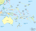 Oceania, administrative divisions - de - colored.svg 1,181 × 1,013; 2.7 MB
-
 Oceania, administrative divisions - hu - colored.svg 1,181 × 1,013; 2.7 MB
-
 Oceania, administrative divisions - Nmbrs - colored (-markers).svg 1,181 × 1,013; 2.7 MB
-
 Oceania, administrative divisions - Nmbrs - colored (-sea borders).svg 1,181 × 1,013; 2.7 MB
-
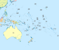
 Oceania, administrative divisions - Nmbrs - colored.svg 1,181 × 1,013; 2.7 MB
.svg)
.svg)

.svg)
.svg)
