Category:SVG labeled maps of administrative divisions of Scotland (location map scheme)
Constituent countries of the United Kingdom: England · Northern Ireland · Scotland · Wales – British Crown dependencies: Bailiwick of Guernsey · Isle of Man · Jersey


.svg)


_(Paris_zoom).svg)
.svg)
,_administrative_divisions_-_de_-_colored_(multizoom).svg)
_-_colored.svg)
.svg)
,_administrative_divisions_-_Nmbrs_(multizoom).svg)
,_administrative_divisions_-_de_-_colored.svg)
_-_de_-_colored.svg)

.svg)

.svg)
Media in category "SVG labeled maps of administrative divisions of Scotland (location map scheme)"
The following 10 files are in this category, out of 10 total.
-
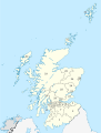
 NUTS 3 regions of central and southern Scotland map.svg 418 × 401; 666 KB
-
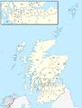
 NUTS 3 regions of Scotland map.svg 1,023 × 1,345; 2.92 MB
-
 Scotland, administrative divisions - de - colored (zoom).svg 1,128 × 1,483; 1.41 MB
-
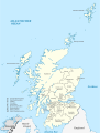
 Scotland, administrative divisions - de - colored.svg 1,128 × 1,483; 1.15 MB
-
 Scotland, administrative divisions - de - monochrome (zoom).svg 1,128 × 1,483; 1.4 MB
-
 Scotland, administrative divisions - de - monochrome.svg 1,128 × 1,483; 1.14 MB
-
 Scotland, administrative divisions - Nmbrs - colored (zoom).svg 1,128 × 1,483; 1.39 MB
-
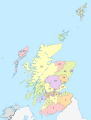 Scotland, administrative divisions - Nmbrs - colored.svg 1,128 × 1,483; 1.14 MB
-
 Scotland, administrative divisions - Nmbrs - monochrome (zoom).svg 1,128 × 1,483; 1.4 MB
-
 Scotland, administrative divisions - Nmbrs - monochrome.svg 1,128 × 1,483; 1.14 MB


.svg)

.svg)

.svg)

.svg)
