Category:SVG labeled maps of administrative divisions of the Republic of China (location map scheme)


.svg)


_(Paris_zoom).svg)
.svg)
,_administrative_divisions_-_de_-_colored_(multizoom).svg)
_-_colored.svg)
.svg)
,_administrative_divisions_-_Nmbrs_(multizoom).svg)
,_administrative_divisions_-_de_-_colored.svg)
_-_de_-_colored.svg)

.svg)

.svg)
| NO WIKIDATA ID FOUND! Create new Wikidata item | |
| Upload media |
Media in category "SVG labeled maps of administrative divisions of the Republic of China (location map scheme)"
The following 30 files are in this category, out of 30 total.
-
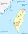 Republic of China, administrative divisions (1st-tier) - de - colored.svg 1,016 × 1,221; 289 KB
-
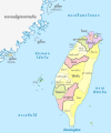
 Republic of China, administrative divisions (1st-tier) - Nmbrs - colored.svg 1,016 × 1,221; 289 KB
-
 Republic of China, administrative divisions (1st-tier) - th - colored.svg 1,016 × 1,221; 436 KB
-
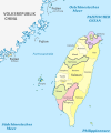 Republic of China, administrative divisions (1st-tier+counties) - de - colored.svg 1,016 × 1,221; 440 KB
-
 Republic of China, administrative divisions (1st-tier+counties) - Nmbrs - colored.svg 1,016 × 1,221; 441 KB
-
 Republic of China, administrative divisions (1st-tier+counties) - th - colored.svg 1,016 × 1,221; 592 KB
-
 Republic of China, administrative divisions (county level) - de - colored, Noto font.svg 1,016 × 1,221; 587 KB
-
 Republic of China, administrative divisions (county level) - de - colored.svg 1,016 × 1,221; 428 KB
-

-
 Republic of China, administrative divisions (county level) - de - monochrome.svg 1,016 × 1,221; 429 KB
-

-
 Republic of China, administrative divisions (county level) - en - colored.svg 1,016 × 1,221; 572 KB
-
 Republic of China, administrative divisions (county level) - en - monochrome.svg 1,016 × 1,221; 571 KB
-
 Republic of China, administrative divisions (county level) - es - colored.svg 1,016 × 1,221; 604 KB
-
 Republic of China, administrative divisions (county level) - es - monochrome.svg 1,016 × 1,221; 604 KB
-
 Republic of China, administrative divisions (county level) - fr - colored.svg 1,016 × 1,221; 603 KB
-
 Republic of China, administrative divisions (county level) - ja - colored.svg 1,016 × 1,221; 484 KB
-
 Republic of China, administrative divisions (county level) - Nmbrs - colored.svg 1,016 × 1,221; 428 KB
-
 Republic of China, administrative divisions (county level) - Nmbrs - monochrome.svg 1,016 × 1,221; 429 KB
-
 Republic of China, administrative divisions (county level) - zh-hans - colored.svg 1,016 × 1,221; 481 KB
-
 Republic of China, administrative divisions (county level) - zh-hant - colored.svg 1,016 × 1,221; 503 KB
-
 Republic of China, administrative divisions (county level) - zh-hant - monochrome.svg 1,016 × 1,221; 503 KB
-
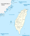
 Republic of China, administrative divisions from 2010 (1st-tier) - de - monochrome.svg 1,016 × 1,221; 290 KB
-

-

-
-
 Taiwan map labeled - no town.svg 1,440 × 2,055; 440 KB
-
 Taiwan map labeled.svg 1,440 × 2,055; 1.63 MB
-
 Taiwan ROC political divisions labeled de.svg 850 × 1,200; 254 KB
-
 Taiwan ROC political divisions labeled.svg 850 × 1,200; 343 KB
_-_de_-_colored.svg)
_-_Nmbrs_-_colored.svg)
_-_th_-_colored.svg)
_-_de_-_colored.svg)
_-_Nmbrs_-_colored.svg)
_-_th_-_colored.svg)
_-_de_-_colored,_Noto_font.svg)
_-_de_-_colored.svg)
_-_de_-_monochrome_(counties_vs._towns).svg)
_-_de_-_monochrome.svg)
_-_en_-_colored,_Hanyu_Pinyin.svg)
_-_en_-_colored.svg)
_-_en_-_monochrome.svg)
_-_es_-_colored.svg)
_-_es_-_monochrome.svg)
_-_fr_-_colored.svg)
_-_ja_-_colored.svg)
_-_Nmbrs_-_colored.svg)
_-_Nmbrs_-_monochrome.svg)
_-_zh-hans_-_colored.svg)
_-_zh-hant_-_colored.svg)
_-_zh-hant_-_monochrome.svg)
_-_de_-_monochrome.svg)
_-_Nmbrs_-_monochrome.svg)
_-_de_-_monochrome.svg)
_-_Nmbrs_-_monochrome.svg)


