Category:Topographic maps of Mexico
Countries of North America: Antigua and Barbuda · The Bahamas · Barbados · Belize · Canada · Costa Rica · Cuba · Dominica · Dominican Republic · El Salvador · Grenada · Guatemala · Haiti · Honduras · Jamaica · Mexico · Nicaragua · Panama · Saint Kitts and Nevis · Saint Lucia · Saint Vincent and the Grenadines · Trinidad and Tobago‡ · United States of America‡
Other territories: Anguilla · Bermuda · British Virgin Islands · Greenland · Guadeloupe · Martinique · Montserrat · Puerto Rico · Saint Barthélemy · Saint-Martin · Saint Pierre and Miquelon · United States Virgin Islands
‡: partly located in North America
Other territories: Anguilla · Bermuda · British Virgin Islands · Greenland · Guadeloupe · Martinique · Montserrat · Puerto Rico · Saint Barthélemy · Saint-Martin · Saint Pierre and Miquelon · United States Virgin Islands
‡: partly located in North America
Subcategories
This category has the following 2 subcategories, out of 2 total.
S
Media in category "Topographic maps of Mexico"
The following 36 files are in this category, out of 36 total.
-
-

-
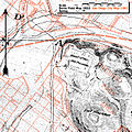
 2003 Colima earthquake.jpg 524 × 556; 67 KB
-
 2018-Migrationstreck-Mexico.jpg 2,255 × 1,473; 2.31 MB
-
 A glimpse of Guatemala - Map of Utatlan, the ancient capital of the Quichés.png 2,263 × 1,810; 985 KB
-
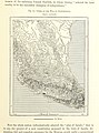
 Anales del Instituto Geológico de México (1917) (18169254971).jpg 3,763 × 2,945; 1.32 MB
-
 Campfires on desert and lava (1908) (14770015211).jpg 2,832 × 1,762; 1.27 MB
-
 Central american mountains.jpg 2,492 × 2,292; 2.03 MB
-
 CIA map Central America & Caribbean.png 1,390 × 1,044; 1.6 MB
-
 Classic Maya Dialects.png 467 × 532; 342 KB
-
 El Rio Corte.png 305 × 543; 354 KB
-
 FLII Mexico.png 1,306 × 850; 544 KB
-
 Geographic Map of Mexico.jpg 1,024 × 722; 455 KB
-
 HemirrhagusDistribution.png 914 × 578; 822 KB
-
 HemirrhagusDistributionMap.png 931 × 624; 893 KB
-
 Intensidad del terremoto de Puebla, USGS.png 1,000 × 1,500; 1.06 MB
-
 Kosa'aay's Spring.jpg 1,209 × 1,211; 1.51 MB
-
 Locator map of El Vichi in Mexico.png 255 × 166; 77 KB
-
 Locator map of Sierra Las Pilas in Mexico.png 253 × 165; 76 KB
-
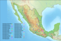
 Map of Mexico topo.jpg 2,000 × 1,379; 226 KB
-
 Mex cent amer map.jpg 638 × 628; 211 KB
-
 Mexican volcanoes Topo Rainbow Zebra 2550.png 7,163 × 3,743; 25.03 MB
-
 Mexico GHI Solar-resource-map GlobalSolarAtlas World-Bank-Esmap-Solargis.png 1,842 × 1,693; 1.48 MB
-
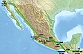
 Mexico relief location map.jpg 2,255 × 1,473; 1.36 MB
-
 Mexico satellite.png 800 × 566; 546 KB
-
 Mexico Terrain and Transportation - DPLA - 56dcb1d3a1e19c79ebb55c5d41109b36.jpg 8,412 × 6,243; 4.32 MB
-
 Mexico terrain.png 3,000 × 3,000; 12.11 MB
-
 Mexico topo.jpg 1,400 × 922; 837 KB
-
 Mexiko topo.jpg 1,400 × 922; 444 KB
-
 México El Bajío.jpg 1,400 × 922; 882 KB
-
 Northeast Mexico 24to29N 100to104W Topo Rainbow Zebra 1734.jpg 4,800 × 6,000; 22.86 MB
-
 Otonyctomys hatti distribution.png 1,259 × 944; 1.21 MB
-
 Sierra mazateca.png 797 × 872; 1.1 MB
-
 USA Region West relief Sierra San Pedro Martir location map.jpg 1,867 × 2,091; 1.05 MB
-
 Vampyrum spectrum distribution (colored).png 1,259 × 944; 2.09 MB
-
 Vampyrum spectrum distribution (gray).png 1,259 × 944; 1.03 MB
.jpg)
.jpg)


_(18169254971).jpg)
_(14770015211).jpg)


.png)
.png)