Category:Topographic maps of Trinidad and Tobago
Countries of the Americas: Antigua and Barbuda · Argentina · The Bahamas · Barbados · Belize · Bolivia · Brazil · Canada · Chile · Colombia · Costa Rica · Cuba · Dominica · Dominican Republic · Ecuador · El Salvador · Grenada · Guatemala · Guyana · Haiti · Honduras · Jamaica · Mexico · Nicaragua · Panama · Paraguay · Peru · Saint Kitts and Nevis · Saint Lucia · Saint Vincent and the Grenadines · Suriname · Trinidad and Tobago · United States of America · Uruguay · Venezuela
Other areas: Anguilla · Aruba · Bermuda · British Virgin Islands · Curaçao · French Guiana · Greenland · Guadeloupe · Martinique · Montserrat · Puerto Rico · Saint Barthélemy · Saint-Martin · Saint Pierre and Miquelon · Sint Maarten · South Georgia and the South Sandwich Islands · United States Virgin Islands
Other areas: Anguilla · Aruba · Bermuda · British Virgin Islands · Curaçao · French Guiana · Greenland · Guadeloupe · Martinique · Montserrat · Puerto Rico · Saint Barthélemy · Saint-Martin · Saint Pierre and Miquelon · Sint Maarten · South Georgia and the South Sandwich Islands · United States Virgin Islands
Subcategories
This category has only the following subcategory.
Media in category "Topographic maps of Trinidad and Tobago"
The following 10 files are in this category, out of 10 total.
-
 FSO Nabarima location.png 995 × 692; 978 KB
-
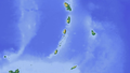
 Karibik 19.png 1,353 × 767; 650 KB
-
 Karibik 20.png 1,355 × 765; 321 KB
-
 Karibik 24.png 1,344 × 810; 440 KB
-
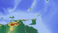
 Karte Golf von Paria.png 995 × 692; 702 KB
-
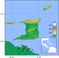
 Trinidad and Tobago location map Topographic.png 1,216 × 1,178; 731 KB
-
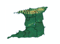 Trinidad map.png 1,100 × 817; 490 KB
-
 Trinidad Topography.png 1,750 × 1,704; 1.06 MB
-
 TRINIDAD-01.tif 2,550 × 2,775; 23.78 MB
-
 Рельеф Тринидада и Тобаго.png 1,571 × 1,227; 744 KB


