Category:United Kingdom photographs taken on 2008-03-11
Countries of Europe: Austria · Belarus · Finland · France‡ · Germany · Republic of Ireland · Italy · Lithuania · Netherlands‡ · Poland · Portugal‡ · Romania · Russia‡ · Spain‡ · Sweden · Switzerland · Ukraine · United Kingdom
‡: partly located in Europe
‡: partly located in Europe
| ← | 11 March 2008 | → | ||
| ← | March 2008 | → | ||

United Kingdom photographs taken on 11 March 2008.
Image files should be categorized here automatically using {{taken on}} template. Direct categorisation is also possible, if automatic is impossible.
Subcategories
This category has only the following subcategory.
Media in category "United Kingdom photographs taken on 2008-03-11"
The following 200 files are in this category, out of 724 total.
(previous page) (next page)-
 "The Quay" radio station - geograph.org.uk - 723089.jpg 640 × 480; 50 KB
-
 (Another) waterfall on Rookhope Burn - geograph.org.uk - 728905.jpg 640 × 480; 139 KB
-
 (Private) road to Woo Dale - geograph.org.uk - 721832.jpg 640 × 480; 182 KB
-
 1 to 5 Ship Street, Brighouse - geograph.org.uk - 723104.jpg 640 × 540; 84 KB
-
 11 and 15 Bradford Road, Brighouse - geograph.org.uk - 723173.jpg 640 × 480; 76 KB
-

-
 17 and 19 Bradford Road, Brighouse - geograph.org.uk - 723176.jpg 640 × 480; 80 KB
-
 21 to 27 Bradford Road, Brighouse - geograph.org.uk - 723184.jpg 640 × 510; 73 KB
-
 23 to 27 Bethel Street, Brighouse - geograph.org.uk - 723039.jpg 640 × 490; 61 KB
-
 24 to 26 Bethel Street, Brighouse - geograph.org.uk - 723043.jpg 640 × 545; 74 KB
-
 29 to 33 Bradford Road, Brighouse - geograph.org.uk - 723190.jpg 640 × 604; 87 KB
-
 44 to 50 Park Street, Brighouse - geograph.org.uk - 723051.jpg 640 × 430; 61 KB
-
 82 -84, Commercial Street, Brighouse - geograph.org.uk - 722390.jpg 640 × 584; 82 KB
-
 A lodge on Watling Street - geograph.org.uk - 723386.jpg 640 × 480; 92 KB
-
 A Pond in Drewton Dale - geograph.org.uk - 722766.jpg 640 × 486; 109 KB
-
 A walk round Martin's Pond (1) - geograph.org.uk - 728315.jpg 640 × 427; 105 KB
-
 A walk round Martin's Pond (10) - geograph.org.uk - 728476.jpg 640 × 427; 145 KB
-
 A walk round Martin's Pond (11) - geograph.org.uk - 728490.jpg 640 × 427; 119 KB
-
 A walk round Martin's Pond (12) - geograph.org.uk - 728499.jpg 640 × 427; 151 KB
-
 A walk round Martin's Pond (13) - geograph.org.uk - 728501.jpg 640 × 427; 138 KB
-
 A walk round Martin's Pond (14) - geograph.org.uk - 728505.jpg 640 × 427; 141 KB
-
 A walk round Martin's Pond (2) - geograph.org.uk - 728347.jpg 640 × 427; 147 KB
-
 A walk round Martin's Pond (3) - geograph.org.uk - 728375.jpg 640 × 427; 112 KB
-
 A walk round Martin's Pond (4) - geograph.org.uk - 728394.jpg 640 × 427; 133 KB
-
 A walk round Martin's Pond (5) - geograph.org.uk - 728406.jpg 640 × 427; 112 KB
-
 A walk round Martin's Pond (6) - geograph.org.uk - 728418.jpg 640 × 427; 143 KB
-
 A walk round Martin's Pond (7) - geograph.org.uk - 728431.jpg 640 × 427; 156 KB
-
 A walk round Martin's Pond (8) - geograph.org.uk - 728443.jpg 640 × 607; 158 KB
-
 A walk round Martin's Pond (9) - geograph.org.uk - 728465.jpg 640 × 427; 107 KB
-
 A walk through Harrison's Plantation (2) - geograph.org.uk - 722427.jpg 640 × 427; 144 KB
-
 A walk through Harrison's Plantation (3) - geograph.org.uk - 727286.jpg 640 × 427; 128 KB
-
 A walk through Harrison's Plantation (8) - geograph.org.uk - 727333.jpg 640 × 427; 132 KB
-
 A616 Road Scene - geograph.org.uk - 722142.jpg 640 × 480; 45 KB
-
 A616 Road Scene.jpg 484 × 351; 32 KB
-
 A63 South Cave intersection - geograph.org.uk - 721899.jpg 640 × 480; 163 KB
-
 Across Ellerker Drain - geograph.org.uk - 721696.jpg 480 × 640; 182 KB
-
 Across the fields to Upper Dryton - geograph.org.uk - 723393.jpg 640 × 480; 72 KB
-

-

-

-

-
 Addiewell post office - geograph.org.uk - 721874.jpg 640 × 480; 61 KB
-
 After the storm - geograph.org.uk - 721885.jpg 640 × 365; 390 KB
-
 Aghyaran Methodist Church - geograph.org.uk - 722595.jpg 640 × 479; 62 KB
-
 Aghyaran Post Office - geograph.org.uk - 722598.jpg 640 × 479; 58 KB
-
 Aghyaran RC Church - geograph.org.uk - 723601.jpg 640 × 479; 37 KB
-
 Aghyaran Townland - geograph.org.uk - 722592.jpg 640 × 479; 48 KB
-
 Aghyaran Townland - geograph.org.uk - 722600.jpg 640 × 479; 73 KB
-
 Aghyaran Townland - geograph.org.uk - 722607.jpg 640 × 479; 55 KB
-

-

-
 Alloa Station Junction - geograph.org.uk - 997081.jpg 640 × 480; 82 KB
-
 Allotments in Horsea Lane - geograph.org.uk - 721998.jpg 640 × 480; 57 KB
-
 Angerstein Road, Stamshaw - geograph.org.uk - 723116.jpg 640 × 480; 58 KB
-

-
 Approaching Longworth Bridge - geograph.org.uk - 722627.jpg 640 × 457; 161 KB
-
 Argyle Street - geograph.org.uk - 722750.jpg 640 × 480; 44 KB
-
 At the side of Jackdaw Plantation - geograph.org.uk - 722777.jpg 640 × 480; 110 KB
-
 B and B Cottage - geograph.org.uk - 1538881.jpg 640 × 443; 83 KB
-
 Ballet for excavators, Reins Wood, Elland - geograph.org.uk - 724101.jpg 640 × 640; 156 KB
-
 Barns and sheepfold near Peasmeadows - geograph.org.uk - 730241.jpg 640 × 480; 96 KB
-
 Baxtergate - geograph.org.uk - 722531.jpg 640 × 480; 147 KB
-
 Belmont Avenue, Belfast - geograph.org.uk - 721928.jpg 640 × 448; 96 KB
-
 Belmont Park, Belfast (1) - geograph.org.uk - 721894.jpg 640 × 399; 84 KB
-
 Belmont Park, Belfast (2) - geograph.org.uk - 721897.jpg 640 × 404; 92 KB
-
 Blackburn - geograph.org.uk - 721854.jpg 640 × 480; 62 KB
-
 Blaze Hill - geograph.org.uk - 1530579.jpg 640 × 428; 74 KB
-
 Bloomhouse Lane - geograph.org.uk - 722084.jpg 640 × 480; 121 KB
-
 Bloomhouse Lane barns - geograph.org.uk - 722090.jpg 640 × 467; 68 KB
-
 Blooms of Bressingham Garden Centre - geograph.org.uk - 741737.jpg 640 × 480; 70 KB
-
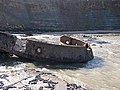 Bow section of the MV Creteblock - geograph.org.uk - 722556.jpg 640 × 480; 168 KB
-
 Boxes on Baxtergate - geograph.org.uk - 722517.jpg 480 × 640; 162 KB
-
 Braunstone Park, Leicester - geograph.org.uk - 727080.jpg 640 × 615; 94 KB
-
 Braunstone Park, Leicester - geograph.org.uk - 727086.jpg 515 × 640; 90 KB
-
 Bridge and weir across the River Teme. - geograph.org.uk - 735471.jpg 640 × 480; 136 KB
-
 Bridge at Cromwell Lock, Southowram - geograph.org.uk - 724165.jpg 640 × 441; 73 KB
-

-

-
 Bridleway towards Mackershaw Trough - geograph.org.uk - 732949.jpg 640 × 480; 126 KB
-

-
 Brook running down to join the Wye - geograph.org.uk - 722509.jpg 507 × 640; 260 KB
-
 Brook through a tangle of branches - geograph.org.uk - 722496.jpg 480 × 640; 218 KB
-
 Burstwick Drain - geograph.org.uk - 721996.jpg 640 × 480; 91 KB
-
 Burstwick Drain - geograph.org.uk - 722013.jpg 640 × 480; 92 KB
-
 Burstwick Drain looking westwards - geograph.org.uk - 721984.jpg 640 × 480; 114 KB
-
 Burstwick Golf Course - geograph.org.uk - 722028.jpg 640 × 386; 46 KB
-
 By Sands Lane, Ellerker - geograph.org.uk - 721810.jpg 640 × 480; 166 KB
-
 Bynner Street - geograph.org.uk - 723412.jpg 640 × 480; 72 KB
-
 Can't sleep ^ - geograph.org.uk - 1530526.jpg 640 × 428; 63 KB
-
 Canada Geese on Martin's Pond - geograph.org.uk - 722377.jpg 640 × 480; 151 KB
-
 Canal Street, Brighouse - geograph.org.uk - 723112.jpg 640 × 474; 73 KB
-

-
 Caravan graveyard - geograph.org.uk - 721898.jpg 640 × 480; 201 KB
-
 Carraclghan Townland - geograph.org.uk - 723580.jpg 640 × 479; 73 KB
-
 Carracoghan Townland - geograph.org.uk - 723606.jpg 640 × 479; 50 KB
-
 Carracoghan Townland - geograph.org.uk - 723608.jpg 640 × 479; 49 KB
-
 Carracoghan Townland - geograph.org.uk - 723610.jpg 640 × 479; 54 KB
-
 Chippy, Blackburn - geograph.org.uk - 721850.jpg 640 × 480; 75 KB
-
-
 Church of St.Mary the Virgin - geograph.org.uk - 724886.jpg 640 × 427; 62 KB
-
 City Evangelical Church - geograph.org.uk - 722113.jpg 640 × 469; 84 KB
-
-
 Clarence Mill - geograph.org.uk - 1530589.jpg 640 × 428; 89 KB
-
 Cluster of houses - geograph.org.uk - 722371.jpg 640 × 360; 52 KB
-
 Coastal footpath at Hilsea - geograph.org.uk - 722119.jpg 640 × 480; 38 KB
-
 Comber Dale looking northwards - geograph.org.uk - 722731.jpg 640 × 480; 81 KB
-
 Comber Dale looking westwards - geograph.org.uk - 722740.jpg 640 × 480; 108 KB
-
 Community Hall - geograph.org.uk - 722596.jpg 640 × 479; 49 KB
-
 Corgary Road - geograph.org.uk - 723576.jpg 640 × 479; 57 KB
-
 Corgary Road - geograph.org.uk - 723603.jpg 640 × 460; 55 KB
-
 Corpus Christi Presbytery - geograph.org.uk - 723136.jpg 640 × 480; 54 KB
-

-
 Cottage at Carracoghan - geograph.org.uk - 723579.jpg 640 × 479; 51 KB
-
 Country Baskets - geograph.org.uk - 722099.jpg 640 × 303; 68 KB
-
 Country cottage, Larport - geograph.org.uk - 722624.jpg 640 × 494; 149 KB
-
-
 Croagh Townland - geograph.org.uk - 723424.jpg 640 × 479; 62 KB
-
 Croagh Townland - geograph.org.uk - 723427.jpg 640 × 479; 74 KB
-
 St John's church, Crossens, Southport - geograph.org.uk - 725233.jpg 640 × 480; 73 KB
-
 Crown and Anchor, Cotts Lane, Lugwardine - geograph.org.uk - 723467.jpg 640 × 480; 118 KB
-
 Cycling into Woolhope - geograph.org.uk - 722593.jpg 449 × 640; 145 KB
-
 Cyclist on the coastal path at Hilsea - geograph.org.uk - 722136.jpg 640 × 480; 37 KB
-
 Date stone on Longworth Bridge, 1892 - geograph.org.uk - 722632.jpg 640 × 417; 160 KB
-
 Deer above Allt a' Chinn Mhonaich - geograph.org.uk - 859346.jpg 640 × 480; 92 KB
-
 Deer Fence on Moorland - geograph.org.uk - 723743.jpg 640 × 480; 62 KB
-

-
 Derby Road Post Office - geograph.org.uk - 723128.jpg 640 × 480; 46 KB
-
 Derby Road taxi rank - geograph.org.uk - 723129.jpg 640 × 480; 45 KB
-
 Derelict cottage by the roadside - geograph.org.uk - 722284.jpg 640 × 360; 62 KB
-
 Derelict industrial site, Blackburn - geograph.org.uk - 721858.jpg 640 × 480; 80 KB
-
-

-

-
 Doorway of No2 Church Brow, Clitheroe - geograph.org.uk - 743694.jpg 470 × 628; 213 KB
-
 Drain near Ellerker Sands Farm - geograph.org.uk - 721687.jpg 468 × 640; 184 KB
-
 Dreich day at Cobbinshaw - geograph.org.uk - 724113.jpg 640 × 480; 75 KB
-
 East Allen Dale at Tedham Green - geograph.org.uk - 730286.jpg 640 × 480; 88 KB
-
 Edge of Alexandra Park, Hilsea - geograph.org.uk - 722163.jpg 640 × 480; 40 KB
-
 End of New Road - geograph.org.uk - 792969.jpg 640 × 480; 69 KB
-
 End of Saltwick Nab - geograph.org.uk - 722588.jpg 640 × 480; 144 KB
-
 Entrance to Attingham Park.jpg 640 × 480; 83 KB
-

-
 Entrance to Rock Farm, Lugwardine - geograph.org.uk - 723460.jpg 640 × 480; 145 KB
-
 Euston Road - geograph.org.uk - 723977.jpg 640 × 480; 111 KB
-
 Evans Above - geograph.org.uk - 1125202.jpg 640 × 480; 119 KB
-
 Ewe Cote - geograph.org.uk - 722514.jpg 640 × 480; 145 KB
-
 Fallen Telegraph Pole - geograph.org.uk - 722795.jpg 640 × 480; 164 KB
-
 Farm Road in Drewton Dale - geograph.org.uk - 722762.jpg 640 × 480; 84 KB
-

-
 Felix Kearney, Drumquin - geograph.org.uk - 723618.jpg 640 × 479; 72 KB
-
 Filling water bottles - geograph.org.uk - 727540.jpg 640 × 480; 81 KB
-
 Fire drill at London City Airport - geograph.org.uk - 722859.jpg 640 × 480; 60 KB
-

-
 Fleetwood Offshore Survival Centre - geograph.org.uk - 722094.jpg 640 × 425; 53 KB
-
 Fleetwood pier - geograph.org.uk - 722653.jpg 640 × 425; 59 KB
-
 Flooding at Roath Basin - geograph.org.uk - 722217.jpg 640 × 480; 48 KB
-
 Foerst Road, Killeter Forest - geograph.org.uk - 722709.jpg 640 × 479; 73 KB
-
 Footbridge on Hagg Gill - geograph.org.uk - 722021.jpg 640 × 480; 98 KB
-
 Footpath at Bartestree - geograph.org.uk - 722676.jpg 480 × 640; 188 KB
-

-
-

-

-
 Former Kincardine power station site - geograph.org.uk - 997056.jpg 640 × 480; 63 KB
-
 Free-range pig farm - geograph.org.uk - 721992.jpg 640 × 480; 79 KB
-
 Freeman's Bridge, Southowram - geograph.org.uk - 724135.jpg 640 × 480; 100 KB
-
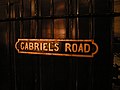 Gabriels Road - panoramio.jpg 4,000 × 3,000; 3.69 MB
-
 Gala Day 2008 - panoramio.jpg 745 × 1,280; 286 KB
-
 Garvagh Blane Townland - geograph.org.uk - 723522.jpg 640 × 479; 86 KB
-
 Garvagh Townland - geograph.org.uk - 723523.jpg 640 × 479; 70 KB
-
 Garvagh Townland - geograph.org.uk - 723524.jpg 640 × 479; 62 KB
-
 Gasometer through the trees - geograph.org.uk - 727044.jpg 640 × 480; 102 KB
-
-
 Glendergan River - geograph.org.uk - 722625.jpg 640 × 479; 84 KB
-
 Golfers' Bridge - geograph.org.uk - 721991.jpg 640 × 480; 98 KB
-
 Grange Road, North End - geograph.org.uk - 723120.jpg 640 × 480; 56 KB
-

-
 Grey Corrie Hostel Roybridge - geograph.org.uk - 729238.jpg 640 × 480; 88 KB
-
 Grounded - geograph.org.uk - 1025762.jpg 640 × 561; 162 KB
-
 Guest House - geograph.org.uk - 1538888.jpg 640 × 428; 80 KB
-
 Hillary Road - geograph.org.uk - 721986.jpg 640 × 458; 53 KB
-
 Hillary Road - geograph.org.uk - 721994.jpg 640 × 454; 52 KB
-
 Hillary Road - geograph.org.uk - 722001.jpg 640 × 452; 53 KB
-
 Hillary Road - semis - geograph.org.uk - 722002.jpg 640 × 454; 47 KB
-
 Hillside NE of Lugwardine Chapel - geograph.org.uk - 722714.jpg 640 × 480; 135 KB
-
 Horsea Lane, Hilsea - geograph.org.uk - 722003.jpg 640 × 480; 58 KB
-
 Houndmills Roundabout - geograph.org.uk - 721972.jpg 640 × 450; 61 KB
-
 Houses in Northern Parade, Hilsea - geograph.org.uk - 722191.jpg 640 × 480; 50 KB
-
 HSBC Bank, Bethel Street, Brighouse - geograph.org.uk - 723132.jpg 640 × 502; 80 KB
-
 Hugh llewelyn 168 108 (6349909633).jpg 2,592 × 1,944; 1.23 MB
-
 Hugh llewelyn 168 113 (6349911943).jpg 2,592 × 1,944; 1.24 MB
-
 Hut by the weir, Elland - geograph.org.uk - 724071.jpg 640 × 494; 92 KB
-
 Inside the Mill Centre - geograph.org.uk - 721856.jpg 640 × 480; 59 KB
-
 Ipswich to Norwich line - geograph.org.uk - 741719.jpg 640 × 480; 71 KB
-
 Isle of Mull - panoramio.jpg 1,600 × 1,200; 264 KB
-

-

-
 Killeter Forest - geograph.org.uk - 722727.jpg 640 × 479; 102 KB
-
 Killeter Forest near Slievedoo - geograph.org.uk - 722699.jpg 640 × 479; 69 KB
-
 Kingsclere Road - geograph.org.uk - 721975.jpg 640 × 453; 55 KB

_waterfall_on_Rookhope_Burn_-_geograph.org.uk_-_728905.jpg)
_road_to_Woo_Dale_-_geograph.org.uk_-_721832.jpg)


_-_geograph.org.uk_-_728315.jpg)
_-_geograph.org.uk_-_728476.jpg)
_-_geograph.org.uk_-_728490.jpg)
_-_geograph.org.uk_-_728499.jpg)
_-_geograph.org.uk_-_728501.jpg)
_-_geograph.org.uk_-_728505.jpg)
_-_geograph.org.uk_-_728347.jpg)
_-_geograph.org.uk_-_728375.jpg)
_-_geograph.org.uk_-_728394.jpg)
_-_geograph.org.uk_-_728406.jpg)
_-_geograph.org.uk_-_728418.jpg)
_-_geograph.org.uk_-_728431.jpg)
_-_geograph.org.uk_-_728443.jpg)
_-_geograph.org.uk_-_728465.jpg)
_-_geograph.org.uk_-_722427.jpg)
_-_geograph.org.uk_-_727286.jpg)
_-_geograph.org.uk_-_727333.jpg)


_-_geograph.org.uk_-_721894.jpg)
_-_geograph.org.uk_-_721897.jpg)


.jpg)
.jpg)


