Category:United Kingdom photographs taken on 2008-03-18
Countries of Europe: Albania · Austria · Belarus · Belgium · Czech Republic · Denmark · Finland · France‡ · Germany · Republic of Ireland · Italy · Latvia · Lithuania · Netherlands‡ · Norway · Poland · Russia‡ · Spain‡ · Sweden · Switzerland · Ukraine · United Kingdom
‡: partly located in Europe
‡: partly located in Europe
| ← | 18 March 2008 | → | ||
| ← | March 2008 | → | ||

United Kingdom photographs taken on 18 March 2008.
Image files should be categorized here automatically using {{taken on}} template. Direct categorisation is also possible, if automatic is impossible.
Subcategories
This category has the following 2 subcategories, out of 2 total.
L
Media in category "United Kingdom photographs taken on 2008-03-18"
The following 200 files are in this category, out of 1,095 total.
(previous page) (next page)-

-
 'Semis' in Hillary Road - geograph.org.uk - 745701.jpg 640 × 456; 61 KB
-
 60083 at Flasby Moor Side.jpg 1,607 × 2,400; 1.93 MB
-
 A boggy bridleway - geograph.org.uk - 740367.jpg 640 × 480; 98 KB
-
 A1077 Junction - geograph.org.uk - 729093.jpg 640 × 425; 90 KB
-
 A37, Broad Road - geograph.org.uk - 730717.jpg 640 × 479; 59 KB
-
 A469 road.jpg 2,028 × 1,592; 1.12 MB
-
 Abbot's Hospital - geograph.org.uk - 729698.jpg 640 × 480; 95 KB
-
 Abergynolwyn - 2008-03-18-edit1.jpg 2,592 × 1,944; 3.04 MB
-
 Abergynolwyn - 2008-03-18.jpg 2,592 × 1,944; 2.03 MB
-
 Aberystwyth 'Park and Ride' - geograph.org.uk - 729544.jpg 640 × 480; 198 KB
-
 Access denied from Lindisfarne - geograph.org.uk - 730092.jpg 640 × 480; 72 KB
-
 Across the Allen valley - geograph.org.uk - 730072.jpg 640 × 480; 72 KB
-

-
 Adit, Tregoodwell - geograph.org.uk - 734770.jpg 480 × 640; 147 KB
-
-
-
 Allt na Doire-daraich - geograph.org.uk - 934470.jpg 480 × 640; 94 KB
-
 Alltwyllt incline - 2008-03-18.jpg 2,592 × 1,944; 2.19 MB
-

-
 APL Plastics - Io Centre - geograph.org.uk - 745752.jpg 640 × 469; 55 KB
-
 Approaching Pont Felinwnda bridge - geograph.org.uk - 729653.jpg 640 × 480; 125 KB
-
 Approaching Rannoch Station - geograph.org.uk - 731320.jpg 640 × 428; 90 KB
-
 Ashley Walk, Cosham - geograph.org.uk - 730047.jpg 640 × 480; 68 KB
-
 Auchen Castle from the SE - geograph.org.uk - 729112.jpg 640 × 480; 97 KB
-
 Auchen Castle.jpg 640 × 480; 109 KB
-

-
 Auchenhay Hill - geograph.org.uk - 728996.jpg 640 × 480; 113 KB
-
 Auchenhay Hill from near Houstard - geograph.org.uk - 730312.jpg 640 × 480; 93 KB
-
 Auchenskeoch - Bargrug lane - geograph.org.uk - 729558.jpg 640 × 480; 101 KB
-
 Aylestone Park Post Office - geograph.org.uk - 732778.jpg 640 × 428; 65 KB
-
 Baldernock Cemetery - geograph.org.uk - 729042.jpg 640 × 480; 49 KB
-
 Ballyavelin Road - geograph.org.uk - 730801.jpg 640 × 479; 62 KB
-
-
 Bank on Waterpit Down - geograph.org.uk - 730643.jpg 640 × 480; 94 KB
-
 Barcafley Plantations - geograph.org.uk - 729016.jpg 640 × 480; 71 KB
-
 Barnfield Bridge - Daw End Canal - geograph.org.uk - 906366.jpg 640 × 480; 93 KB
-
 Bat droppings in Mill - geograph.org.uk - 729521.jpg 640 × 480; 56 KB
-
 Batts Pond, Batts Pond Lane - geograph.org.uk - 739555.jpg 640 × 480; 125 KB
-
 Beacon House - geograph.org.uk - 730595.jpg 640 × 480; 54 KB
-
 Beaconsfield Avenue, Cosham - geograph.org.uk - 730059.jpg 640 × 480; 49 KB
-
 Beech hedge on Heathfield Moor - geograph.org.uk - 729520.jpg 640 × 480; 120 KB
-
 Beginning of a short cycle path - geograph.org.uk - 912555.jpg 640 × 480; 83 KB
-
 Bellever Bridge - geograph.org.uk - 740196.jpg 640 × 480; 65 KB
-
 Bellever Tor from the East - geograph.org.uk - 740325.jpg 640 × 480; 90 KB
-
 Bellever Tor, across the gap - geograph.org.uk - 740334.jpg 640 × 480; 71 KB
-
 Bellever Youth Hostel - geograph.org.uk - 740199.jpg 640 × 517; 60 KB
-
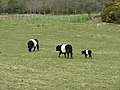 Belted Galloway cows and calf - geograph.org.uk - 730084.jpg 640 × 480; 106 KB
-
 Bickershaw Ponds - geograph.org.uk - 922517.jpg 640 × 426; 151 KB
-
 Bickershaw Ponds - geograph.org.uk - 922518.jpg 640 × 426; 153 KB
-
 Bickershaw Ponds - geograph.org.uk - 922519.jpg 640 × 426; 167 KB
-
 Bickershaw Ponds - geograph.org.uk - 922520.jpg 426 × 640; 161 KB
-
 Boat, River Bann, Castleroe - geograph.org.uk - 729283.jpg 633 × 415; 90 KB
-
 Boflat wagon on Talyllyn Railway - 2008-03-18.jpg 2,592 × 1,944; 2.23 MB
-
 Bogfoot, Caulkerbush - geograph.org.uk - 729537.jpg 640 × 480; 97 KB
-
 Boreland Lane, Caulkerbush - geograph.org.uk - 729524.jpg 640 × 480; 94 KB
-
 Boreland of Southwick - geograph.org.uk - 729531.jpg 640 × 480; 104 KB
-
 Bowling Green at Cosham Park - geograph.org.uk - 729182.jpg 640 × 480; 51 KB
-
 Bracken on Roundfell - geograph.org.uk - 729508.jpg 640 × 480; 91 KB
-
 Breaking the Ice, Loch Skeen - geograph.org.uk - 744806.jpg 640 × 480; 103 KB
-
 Brethren's Meeting Hall, Cosham - geograph.org.uk - 730056.jpg 640 × 480; 83 KB
-

-
 Bridge over Tregoodwell Brook - geograph.org.uk - 734726.jpg 640 × 480; 124 KB
-
 Bridge to Hilsea from Tudor Crescent - geograph.org.uk - 729222.jpg 640 × 480; 63 KB
-
 Broad Road, Limavady - geograph.org.uk - 730723.jpg 640 × 479; 63 KB
-
 Broad Road, Limavady - geograph.org.uk - 730728.jpg 640 × 479; 50 KB
-
 Bronglais Hospital - geograph.org.uk - 729538.jpg 640 × 480; 185 KB
-
 Bryn Eglwys building - 2008-03-18.jpg 2,592 × 1,944; 2.25 MB
-
 Bryn Eglwys quarry - 2008-03-18.jpg 2,592 × 1,944; 2.22 MB
-
 Bryn Eglwys wagon turntable - 2008-03-18.jpg 2,592 × 1,944; 2.28 MB
-
 Bryn Eglwys winding house - 2008-03-18.jpg 2,592 × 1,944; 2.26 MB
-
 Signs on road by Burgh Marsh - geograph.org.uk - 733436.jpg 640 × 480; 288 KB
-

-
-

-
 Cahery Townland - geograph.org.uk - 730715.jpg 640 × 479; 55 KB
-

-
 Cantrybedd incline - 2008-03-18.jpg 1,944 × 2,592; 2.01 MB
-
-
-
 Carrick Mills car park - geograph.org.uk - 730681.jpg 640 × 479; 121 KB
-
-
 Castle Of Dudley.jpg 1,280 × 960; 539 KB
-
 Cattle at Hendra - geograph.org.uk - 734386.jpg 640 × 480; 126 KB
-
 Cattle grid on road to Boustead Hill - geograph.org.uk - 733425.jpg 640 × 483; 285 KB
-
 Cattle near Hendraburnick - geograph.org.uk - 740933.jpg 640 × 480; 77 KB
-
 Chancel Arch - geograph.org.uk - 763484.jpg 640 × 427; 80 KB
-
 Chapman Barrows - geograph.org.uk - 732178.jpg 640 × 426; 84 KB
-
 Charcoal Making, Millington Woods - geograph.org.uk - 728810.jpg 640 × 401; 228 KB
-
 Charles Street in Leicester - geograph.org.uk - 733025.jpg 640 × 433; 75 KB
-
 Cherry blossom time in Battersea Park - geograph.org.uk - 730004.jpg 640 × 480; 151 KB
-
 Christie Park, Coleraine (2) - geograph.org.uk - 728990.jpg 640 × 429; 100 KB
-
 Church Path - geograph.org.uk - 755762.jpg 640 × 427; 101 KB
-
 Church Street, Dumbarton - geograph.org.uk - 731754.jpg 640 × 428; 102 KB
-
 City Hall And The Belfast Wheel.jpg 3,072 × 1,728; 2.22 MB
-
 Clady Road, Markethill - geograph.org.uk - 729582.jpg 640 × 480; 78 KB
-
 Cladymore Presbyterian Church - geograph.org.uk - 1515599.jpg 640 × 480; 56 KB
-
 Cladymore Presbyterian Church Manse - geograph.org.uk - 729635.jpg 640 × 480; 63 KB
-
 Cladymore Presbyterian Church School - geograph.org.uk - 729638.jpg 640 × 480; 56 KB
-
 Clarendon Park Road, Leicester - geograph.org.uk - 732875.jpg 640 × 491; 76 KB
-
 Clawbelly Hill - geograph.org.uk - 729498.jpg 640 × 480; 111 KB
-
 Clawbelly Hill - geograph.org.uk - 729503.jpg 640 × 480; 102 KB
-
 Clayton cutting - geograph.org.uk - 729285.jpg 640 × 428; 80 KB
-
 Cleared forest by Windsor Ride - geograph.org.uk - 729560.jpg 480 × 640; 204 KB
-
 Cleddau River, Haverfordwest - geograph.org.uk - 831774.jpg 640 × 446; 78 KB
-
 Concrete pipe factory - geograph.org.uk - 730579.jpg 640 × 480; 63 KB
-
 Control weir at Orchardleigh Lake - geograph.org.uk - 733206.jpg 640 × 456; 123 KB
-
 Cormorant surveying the scene below - geograph.org.uk - 831779.jpg 337 × 480; 38 KB
-
 Cornhill, Dorchester - geograph.org.uk - 733776.jpg 510 × 640; 139 KB
-
 Cosham Park - geograph.org.uk - 729191.jpg 640 × 480; 113 KB
-
 Cosham Park Bowling Club - geograph.org.uk - 729194.jpg 640 × 480; 61 KB
-
 Cottage and barn at Carcade - geograph.org.uk - 730232.jpg 640 × 453; 110 KB
-
 Cottages at Hallworthy - geograph.org.uk - 731925.jpg 640 × 480; 68 KB
-
 Country Road near Winteringham - geograph.org.uk - 728997.jpg 640 × 480; 71 KB
-
 Cromwell Museum, Huntingdon - geograph.org.uk - 729359.jpg 480 × 640; 64 KB
-
 Cross Hands Hotel - geograph.org.uk - 729985.jpg 640 × 418; 54 KB
-
 Crowdy Marsh - geograph.org.uk - 729031.jpg 640 × 480; 107 KB
-
 Crowthorne Reservoir, Swinley Forest - geograph.org.uk - 729702.jpg 640 × 479; 225 KB
-
 Cuckoo Bridge - geograph.org.uk - 730496.jpg 640 × 427; 77 KB
-
 Curragh Road - geograph.org.uk - 731185.jpg 640 × 479; 61 KB
-
 Curragh Road - geograph.org.uk - 731213.jpg 640 × 479; 56 KB
-
 Curraghlane Mountainside - geograph.org.uk - 731216.jpg 640 × 479; 59 KB
-
 Curraghlane Townland - geograph.org.uk - 731182.jpg 640 × 479; 63 KB
-
 Curraghlane Townland - geograph.org.uk - 731188.jpg 640 × 479; 76 KB
-
 Curraghlane Townland - geograph.org.uk - 731211.jpg 640 × 479; 57 KB
-

-
 Cusher River, Loughgilly - geograph.org.uk - 729664.jpg 640 × 480; 96 KB
-
 Cycle path - Hamilton Close - geograph.org.uk - 745729.jpg 640 × 468; 89 KB
-
 Davidstow Creamery - geograph.org.uk - 730296.jpg 640 × 393; 65 KB
-
 Davidstow Creamery - geograph.org.uk - 735475.jpg 640 × 355; 37 KB
-
 Departing Rannoch Station - geograph.org.uk - 730596.jpg 640 × 428; 111 KB
-
 Departing Rannoch Station - geograph.org.uk - 730642.jpg 640 × 428; 96 KB
-
 Department of Engineering - geograph.org.uk - 732926.jpg 498 × 640; 91 KB
-
 Devil's Bridge - geograph.org.uk - 729860.jpg 640 × 480; 329 KB
-
 Devil's Bridge Station - geograph.org.uk - 730128.jpg 640 × 480; 258 KB
-
 Dinas Station from the road bridge - geograph.org.uk - 729578.jpg 640 × 388; 70 KB
-
 Dip in Windsor Ride, Swinley Forest - geograph.org.uk - 729357.jpg 640 × 640; 290 KB
-

-

-
 Dolgoch Viaduct - 2008-03-18.jpg 2,592 × 1,944; 2.24 MB
-
 Donaldson Road, Cosham - geograph.org.uk - 729216.jpg 640 × 480; 53 KB
-
 Doonside from Fairgirth - geograph.org.uk - 729752.jpg 640 × 480; 95 KB
-
 Doseley and its sleeping policemen - geograph.org.uk - 730576.jpg 640 × 480; 67 KB
-
 Down the lane to Sunniside - geograph.org.uk - 729943.jpg 640 × 480; 113 KB
-
 Downland and track, Bincombe - geograph.org.uk - 735376.jpg 640 × 480; 117 KB
-
 Downland, Bincombe - geograph.org.uk - 734183.jpg 640 × 480; 136 KB
-
 Downland, Bincombe - geograph.org.uk - 734192.jpg 640 × 480; 93 KB
-
 Downland, Bincombe - geograph.org.uk - 735382.jpg 640 × 480; 115 KB
-
 Downland, Bincombe - geograph.org.uk - 735390.jpg 640 × 480; 112 KB
-
 Driveway to Orchardleigh House - geograph.org.uk - 730776.jpg 640 × 498; 157 KB
-
 Drumchapel Water Tower - geograph.org.uk - 729015.jpg 640 × 480; 39 KB
-
 Drumstinchall House - geograph.org.uk - 741777.jpg 640 × 480; 115 KB
-
 Drumsurn RC Church - geograph.org.uk - 730978.jpg 640 × 495; 70 KB
-
 Dudley Castle, Grounds and Local Area.jpg 982 × 644; 202 KB
-
 Dudley Priory By The Zoo and Castle.jpg 1,144 × 960; 468 KB
-
 Dumbarton (2).jpg 640 × 434; 121 KB
-

-
 Dungiven Parish Church of Ireland - geograph.org.uk - 731231.jpg 640 × 480; 48 KB
-
 East Barcloy farm, Colvend - geograph.org.uk - 730101.jpg 640 × 480; 84 KB
-
 East Barcloy, Colvend - geograph.org.uk - 729235.jpg 640 × 480; 118 KB
-
 East Dart Hotel - geograph.org.uk - 740347.jpg 640 × 480; 60 KB
-
 East Usk Lighthouse, Uskmouth - geograph.org.uk - 729159.jpg 640 × 480; 72 KB
-
 Edward Thomas in Fathew Valley - 2008-03-18-edit1.jpg 2,592 × 1,944; 2.95 MB
-
 Edward Thomas in Fathew Valley - 2008-03-18.jpg 2,592 × 1,944; 2.16 MB
-
 Edward Thomas on Dolgoch Viaduct - 2008-03-18.jpg 1,944 × 2,592; 2.09 MB
-
 Elgin Road, Cosham - geograph.org.uk - 730005.jpg 640 × 480; 65 KB
-
 End of the road, Carcade - geograph.org.uk - 734912.jpg 640 × 480; 88 KB
-
 Enjoying the view from the visitor centre - geograph.org.uk - 729146.jpg 640 × 640; 123 KB
-
 Entrance to Devil's Bridge Station - geograph.org.uk - 731851.jpg 640 × 480; 208 KB
-

-
-
 Ewe and lambs at Derwen - geograph.org.uk - 729792.jpg 640 × 480; 280 KB
-
 Ewe and lambs at Derwen - geograph.org.uk - 729796.jpg 640 × 480; 290 KB
-
 Fairgirth Doon - geograph.org.uk - 729180.jpg 640 × 480; 98 KB
-
 Fairgirth Farm - geograph.org.uk - 729128.jpg 640 × 480; 89 KB
-
 Fairgirth Lochan - geograph.org.uk - 729157.jpg 640 × 480; 73 KB
-
 Falgunzeon Airfield track - geograph.org.uk - 729554.jpg 640 × 480; 110 KB
-
 Fallen conifers - geograph.org.uk - 740314.jpg 640 × 615; 134 KB
-
-
 Farmland Drumchapel - geograph.org.uk - 729013.jpg 640 × 556; 27 KB
-
 Farmland, Bincombe - geograph.org.uk - 734056.jpg 640 × 480; 136 KB
-
 Farmland, Bincombe - geograph.org.uk - 735407.jpg 640 × 480; 131 KB
-
 Farmland, Bincombe - geograph.org.uk - 735410.jpg 640 × 480; 116 KB
-
 Felinwnda to Dinas-y-prif road - geograph.org.uk - 729661.jpg 640 × 480; 106 KB
-
 Field above the Inny - geograph.org.uk - 731008.jpg 640 × 461; 126 KB
-
 Field and cottage at Heathhall - geograph.org.uk - 729527.jpg 640 × 480; 115 KB
-
 Field and trees at Meikle Firthhead - geograph.org.uk - 729584.jpg 640 × 480; 113 KB
-

-
 Field boundary near Hendraburnick - geograph.org.uk - 733261.jpg 640 × 480; 108 KB
-
 Field by the River Allen - geograph.org.uk - 734448.jpg 640 × 480; 96 KB
-
 Field near Trefrew - geograph.org.uk - 734572.jpg 640 × 480; 91 KB
-
 Field near Trewalder - geograph.org.uk - 729493.jpg 640 × 480; 86 KB
-
 Field near Trewen - geograph.org.uk - 733734.jpg 640 × 432; 80 KB
-
 Field on Banks Hill - geograph.org.uk - 730318.jpg 640 × 480; 74 KB
-
 Field with horses at Barend - geograph.org.uk - 729758.jpg 640 × 480; 89 KB
-
 Field, Greenhill - geograph.org.uk - 729422.jpg 640 × 450; 58 KB
-
 Fields near Carcade - geograph.org.uk - 734810.jpg 640 × 390; 76 KB
-
 Fields near Parkburn - geograph.org.uk - 729601.jpg 640 × 480; 66 KB
-
 Finishing touches at the Visitor Centre - geograph.org.uk - 729141.jpg 640 × 479; 140 KB
-
 Flat Wagon on Talyllyn Railway - 2008-03-18.jpg 2,592 × 1,944; 2.28 MB


_-_geograph.org.uk_-_728990.jpg)


.jpg)


