Category:United Kingdom photographs taken on 2008-03-14
| ← | Friday 14 March 2008 | → | ||
| ← | March 2008 | → | ||

United Kingdom photographs taken on 14 March 2008.
Image files should be categorized here automatically using {{taken on}} template. Direct categorisation is also possible, if automatic is impossible.
Subcategories
This category has the following 2 subcategories, out of 2 total.
Media in category "United Kingdom photographs taken on 2008-03-14"
The following 200 files are in this category, out of 675 total.
(previous page) (next page)-
-
 142006 C Cardiff Central.JPG 2,048 × 1,536; 893 KB
-
 142069 C Cardiff Queen Street.JPG 2,048 × 1,536; 1.37 MB
-
 142069 C Cardiff Bay.JPG 2,048 × 1,536; 890 KB
-
 142069 C Interior.JPG 2,008 × 1,535; 872 KB
-
 142076 C Cardiff Queen Street.JPG 2,048 × 1,536; 793 KB
-
 143605 C Cardiff Central.JPG 2,048 × 1,536; 1.2 MB
-
 143614 C Cardiff Central.JPG 1,940 × 1,257; 934 KB
-
 150120 Interior.JPG 2,025 × 1,535; 1.01 MB
-
 150208 C Cardiff Central.JPG 1,893 × 1,530; 1 MB
-
 150251 C Cardiff Central.JPG 2,048 × 1,536; 951 KB
-
 158760 Cardiff Central.JPG 2,048 × 1,536; 862 KB
-
 158766 Bristol Temple Meads.JPG 2,048 × 1,536; 1.12 MB
-
 158768 Cardiff Central.JPG 2,048 × 1,536; 864 KB
-
 357m. point above Broughton - geograph.org.uk - 724383.jpg 640 × 360; 56 KB
-
 A 4168 approaching Shifnal - geograph.org.uk - 725020.jpg 640 × 480; 68 KB
-
 A fallen tree blocks the path - geograph.org.uk - 725260.jpg 480 × 640; 143 KB
-
 A fence leading up to Firthhope Rig - geograph.org.uk - 726021.jpg 640 × 480; 138 KB
-
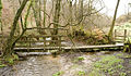
 A footbridge over the Ettrick Water - geograph.org.uk - 727076.jpg 480 × 640; 134 KB
-

-
 A rock outcrop shepherds the beck - geograph.org.uk - 725248.jpg 480 × 640; 116 KB
-
 A sheepfold at the foot of Mid Cleuch - geograph.org.uk - 728294.jpg 427 × 640; 147 KB
-
 A small pond near North Dalton - geograph.org.uk - 725054.jpg 640 × 480; 226 KB
-
 A waterfall - geograph.org.uk - 725250.jpg 480 × 640; 124 KB
-
 Aberffrwd viewed from Cnwch yr Arian - geograph.org.uk - 724461.jpg 640 × 480; 187 KB
-
 Abersoch LifeBoat Station - geograph.org.uk - 724879.jpg 640 × 426; 114 KB
-

-

-
-

-
 All Saints Church Pocklington.jpg 1,744 × 1,308; 1.29 MB
-
 All Saints Church, Chelsworth - geograph.org.uk - 724586.jpg 640 × 489; 95 KB
-
 All Saints Church, Chelsworth - geograph.org.uk - 724590.jpg 640 × 475; 87 KB
-
 All Saints Church, Chelsworth - geograph.org.uk - 724591.jpg 640 × 417; 78 KB
-
 American Steakhouse - geograph.org.uk - 814625.jpg 640 × 482; 65 KB
-
 Approaching the Sportsmans Arms - geograph.org.uk - 724943.jpg 640 × 476; 88 KB
-
 Building beside Axbridge church - geograph.org.uk - 728005.jpg 480 × 640; 95 KB
-

-
 Church porch and steps at Axbridge - geograph.org.uk - 727431.jpg 640 × 479; 98 KB
-

-
 Axbridge church wells - geograph.org.uk - 727179.jpg 480 × 640; 116 KB
-
 A much used old fence post - geograph.org.uk - 724676.jpg 480 × 640; 175 KB
-
 B1115 road junction - geograph.org.uk - 724634.jpg 640 × 434; 70 KB
-
 Back Alleyway - geograph.org.uk - 724740.jpg 640 × 475; 75 KB
-

-
 Beehives near North Dalton - geograph.org.uk - 725053.jpg 640 × 390; 207 KB
-
 Beich Burn in upper Glen Beich - geograph.org.uk - 724806.jpg 640 × 480; 147 KB
-
 Belhaven Bay - geograph.org.uk - 727947.jpg 640 × 426; 46 KB
-
 Belle View, Upper Solva - geograph.org.uk - 771350.jpg 640 × 480; 63 KB
-
 Belles Knott - geograph.org.uk - 724972.jpg 480 × 640; 104 KB
-

-
 Birches in lower Glen Beich - geograph.org.uk - 724863.jpg 640 × 480; 85 KB
-
 Black Swan, Harrogate (2434068419).jpg 1,622 × 1,523; 2.74 MB
-
 Blacksmiths Lane, Maisemore - geograph.org.uk - 725069.jpg 640 × 480; 161 KB
-
 Blanch Farm, near Huggate, East Yorks. - geograph.org.uk - 725544.jpg 640 × 427; 172 KB
-
 Boddam - geograph.org.uk - 727874.jpg 640 × 426; 90 KB
-
 Bosley Cloud - geograph.org.uk - 1527948.jpg 640 × 428; 63 KB
-
 Bowland Road, Clovenfords - geograph.org.uk - 913928.jpg 640 × 480; 72 KB
-

-
 Brent Eleigh village hall - geograph.org.uk - 724604.jpg 640 × 493; 91 KB
-
 Brick and flint - geograph.org.uk - 724666.jpg 640 × 480; 175 KB
-
 Bridge Farm housing development - geograph.org.uk - 724555.jpg 640 × 480; 128 KB
-

-
 Bridge to Culkiest - geograph.org.uk - 724732.jpg 640 × 480; 125 KB
-

-
 Brook and footpath running parallel - geograph.org.uk - 724511.jpg 480 × 640; 178 KB
-
 Broughton - Skirling Path - geograph.org.uk - 724404.jpg 640 × 360; 57 KB
-
 Broughton - Skirling Path - geograph.org.uk - 724408.jpg 640 × 480; 122 KB
-
 Arch Way leading to Boduan Church - geograph.org.uk - 724865.jpg 640 × 489; 169 KB
-
 St.Mary's angel - geograph.org.uk - 731912.jpg 640 × 427; 74 KB
-
 Buckden Post Box - geograph.org.uk - 731855.jpg 427 × 640; 97 KB
-
 Buckden War Memorial - geograph.org.uk - 731919.jpg 640 × 427; 80 KB
-
 Built to last - geograph.org.uk - 725061.jpg 640 × 480; 125 KB
-
 Burnetland Farm - geograph.org.uk - 724373.jpg 640 × 360; 56 KB
-
 Bus shelter - geograph.org.uk - 724546.jpg 640 × 402; 90 KB
-
 Cambusnethan Priory 1819 - Interior View - geograph.org.uk - 767917.jpg 640 × 426; 203 KB
-
 Cambusnethan Priory 1819 - Rear View - geograph.org.uk - 767901.jpg 640 × 426; 167 KB
-
 Car Park View near Alfreton Park - geograph.org.uk - 725102.jpg 640 × 480; 108 KB
-
 Carlingnose Point - geograph.org.uk - 738930.jpg 640 × 480; 90 KB
-
 Cattle Grid - geograph.org.uk - 724682.jpg 640 × 480; 71 KB
-
 Chainsaw otter - geograph.org.uk - 724409.jpg 480 × 640; 89 KB
-

-
 Church Road, Maisemore - geograph.org.uk - 724503.jpg 640 × 472; 141 KB
-
 Churchyard, St. John the Baptist, Lea - geograph.org.uk - 724497.jpg 480 × 640; 176 KB
-
 Clarilaw Hill - geograph.org.uk - 914610.jpg 640 × 480; 71 KB
-
 Clump of trees, Minto Hills - geograph.org.uk - 914544.jpg 640 × 480; 47 KB
-
 Codale Tarn - geograph.org.uk - 724982.jpg 640 × 480; 71 KB
-
 Codale Tarn - geograph.org.uk - 725228.jpg 640 × 480; 101 KB
-
-
 Commemorative plaque on Maisemore Bridge - geograph.org.uk - 725055.jpg 640 × 341; 103 KB
-
 Cottage at Chelsworth - geograph.org.uk - 724594.jpg 640 × 594; 107 KB
-
 Cottages in Maisemore - geograph.org.uk - 725067.jpg 640 × 480; 118 KB
-
 Country Friends - geograph.org.uk - 726126.jpg 640 × 477; 76 KB
-
 Country lane with passing place - geograph.org.uk - 725082.jpg 483 × 640; 185 KB
-
 County Boundary, Portsmouth - geograph.org.uk - 725202.jpg 640 × 467; 131 KB
-

-
 Cramond foreshore - geograph.org.uk - 727750.jpg 640 × 480; 121 KB
-
 Crops and Westfield Farm - geograph.org.uk - 725602.jpg 640 × 320; 138 KB
-
 Cross Lane at Folly Hall - geograph.org.uk - 724609.jpg 640 × 427; 78 KB
-
 Cross Lee Road, Todmorden - geograph.org.uk - 726063.jpg 640 × 424; 75 KB
-
 Crossing the Severn on Maisemore Bridge - geograph.org.uk - 724548.jpg 640 × 435; 106 KB
-
 Culkiest Sign - geograph.org.uk - 724704.jpg 640 × 416; 55 KB
-
 Cycleway at Maisemore - geograph.org.uk - 724559.jpg 442 × 640; 187 KB
-
 Cycleway Plaque - geograph.org.uk - 724673.jpg 640 × 438; 73 KB
-

-

-
 Dale Head - geograph.org.uk - 725336.jpg 640 × 480; 164 KB
-
 Dale Hill (A615) View - geograph.org.uk - 726643.jpg 640 × 480; 70 KB
-
 Damage to the parapet, Maisemore Bridge. - geograph.org.uk - 725056.jpg 640 × 422; 118 KB
-
 Danby Rigg - geograph.org.uk - 725369.jpg 640 × 480; 139 KB
-
 Darlington Road housing - geograph.org.uk - 724737.jpg 640 × 473; 64 KB
-
 Denholm - geograph.org.uk - 914540.jpg 640 × 480; 73 KB
-

-

-
 Dire Warnings - geograph.org.uk - 725051.jpg 640 × 474; 200 KB
-
 Disused workings - geograph.org.uk - 725428.jpg 640 × 480; 126 KB
-
 Drifting snow by a drystane dyke - geograph.org.uk - 725988.jpg 480 × 640; 139 KB
-
 Drome Workshops - geograph.org.uk - 724750.jpg 640 × 369; 41 KB
-
 Ducking and diving - geograph.org.uk - 724541.jpg 640 × 450; 172 KB
-
 Dunlee Hill - geograph.org.uk - 913918.jpg 640 × 480; 72 KB
-
 Easedale Tarn - geograph.org.uk - 724959.jpg 640 × 480; 100 KB
-
 Easedale Tarn - geograph.org.uk - 724967.jpg 640 × 480; 87 KB
-
 Easedale Tarn - geograph.org.uk - 725212.jpg 640 × 480; 95 KB
-
 Easedale Tarn - geograph.org.uk - 725217.jpg 640 × 480; 76 KB
-
 Emerging Bluebell - geograph.org.uk - 724630.jpg 640 × 564; 234 KB
-
 Erosion in upper Glen Beich - geograph.org.uk - 724809.jpg 640 × 480; 178 KB
-

-
 Extension to Omagh Leisure Centre - geograph.org.uk - 724487.jpg 640 × 480; 66 KB
-
 Fallen beech, Minto Golf Club - geograph.org.uk - 914521.jpg 640 × 480; 102 KB
-

-
 Farmland near Hassendeanburn - geograph.org.uk - 914599.jpg 640 × 480; 59 KB
-
 Felbrigg Hall 3.jpg 640 × 480; 186 KB
-
 Felbrigg Pond - geograph.org.uk - 724692.jpg 640 × 480; 138 KB
-
 Ferngill Crag - geograph.org.uk - 725237.jpg 480 × 640; 126 KB
-
 Field access road, Nelson Plantation - geograph.org.uk - 914558.jpg 640 × 480; 123 KB
-
 Field and Woodland at Cross Lane - geograph.org.uk - 724616.jpg 640 × 427; 92 KB
-
 Field beside the Caddon Water - geograph.org.uk - 913930.jpg 640 × 480; 100 KB
-
 Field near Malham - geograph.org.uk - 1103627.jpg 640 × 480; 72 KB
-
 Fields near Tibthorpe, East Yorks. - geograph.org.uk - 725340.jpg 640 × 281; 126 KB
-
 First Bluebell - geograph.org.uk - 724625.jpg 640 × 545; 366 KB
-
 Fishergate, Ripon - geograph.org.uk - 724814.jpg 640 × 632; 91 KB
-
 Flats, Coley Park, Reading - geograph.org.uk - 729366.jpg 640 × 480; 145 KB
-
 Fleck - geograph.org.uk - 727894.jpg 640 × 426; 58 KB
-
 Flowers by the Minster - geograph.org.uk - 724905.jpg 472 × 640; 111 KB
-
 Following a fence up to White Coomb - geograph.org.uk - 726012.jpg 640 × 480; 151 KB
-
 Footpath at Cross Stone, Todmorden - geograph.org.uk - 724917.jpg 478 × 640; 162 KB
-
 Footpath by a brook - geograph.org.uk - 724509.jpg 640 × 442; 178 KB
-
 Footpath off Mowson Lane, near Worrall - geograph.org.uk - 725457.jpg 640 × 427; 122 KB
-
 Footpath past Felbrigg Pond - geograph.org.uk - 724697.jpg 640 × 480; 137 KB
-

-

-
 Former school at Lea - geograph.org.uk - 724489.jpg 640 × 480; 144 KB
-
 Free range - geograph.org.uk - 724502.jpg 640 × 480; 209 KB
-
 Friendly type - geograph.org.uk - 725072.jpg 480 × 640; 216 KB
-

-
 Gateposts near Crag Farm - geograph.org.uk - 729793.jpg 640 × 428; 154 KB
-
 Gateway in wall, Wells Hall - geograph.org.uk - 724624.jpg 480 × 640; 127 KB
-

-
 Gathering pens - geograph.org.uk - 913922.jpg 605 × 475; 95 KB
-
 Geese on Felbrigg Pond - geograph.org.uk - 724695.jpg 640 × 480; 152 KB
-
 Gelli-gaer Common - geograph.org.uk - 724457.jpg 640 × 480; 59 KB
-

-
 Goose Hall Farm - geograph.org.uk - 1220141.jpg 640 × 481; 48 KB
-
 Grassland and the Minto Hills - geograph.org.uk - 914549.jpg 640 × 480; 56 KB
-
 Grassland, Hassendean - geograph.org.uk - 914579.jpg 640 × 480; 89 KB
-
 Graveside cat - geograph.org.uk - 724491.jpg 640 × 437; 169 KB
-
 Grazed woodland, Hassendeanburn - geograph.org.uk - 914595.jpg 640 × 480; 121 KB
-
 Green End Road, Sawtry - geograph.org.uk - 725909.jpg 640 × 480; 62 KB
-
 Greenways Shop Parade Sawtry - geograph.org.uk - 725838.jpg 640 × 480; 107 KB
-
 Grey Alder in flower - geograph.org.uk - 724411.jpg 640 × 480; 118 KB
-
 Grouse butt near Wolf Pit - geograph.org.uk - 725403.jpg 640 × 480; 143 KB
-
 Growth on tree trunk - geograph.org.uk - 724687.jpg 480 × 640; 199 KB
-
 Gulf Plantation - geograph.org.uk - 1500754.jpg 640 × 480; 59 KB
-
 Guston Mill, Kent - geograph.org.uk - 724723.jpg 640 × 426; 80 KB
-
 Harbour Wall - geograph.org.uk - 725613.jpg 480 × 640; 51 KB
-
 Hassendean - geograph.org.uk - 914583.jpg 636 × 386; 40 KB
-
 Haywold Farm, near North Dalton - geograph.org.uk - 725358.jpg 640 × 480; 237 KB
-
 Hedgerow on Cross Lane - geograph.org.uk - 724642.jpg 640 × 427; 59 KB
-
 Hewish Barton, Bittadon - geograph.org.uk - 731544.jpg 640 × 363; 50 KB
-
 High Street, Merthyr Tydfil - geograph.org.uk - 724580.jpg 640 × 480; 77 KB
-
 Higher Aylescott Farm - geograph.org.uk - 731695.jpg 640 × 428; 101 KB
-
 Higher Green End Farm - geograph.org.uk - 725159.jpg 640 × 480; 85 KB
-
 Higher Upcott Wood - geograph.org.uk - 732077.jpg 640 × 372; 133 KB
-
 Highley Farm - geograph.org.uk - 731631.jpg 640 × 426; 93 KB
-
 Highway to Health, Omagh - geograph.org.uk - 724485.jpg 640 × 386; 59 KB
-
 Hill countryside at Muchra - geograph.org.uk - 726048.jpg 640 × 480; 110 KB
-
 Hillsborough Leisure Centre - geograph.org.uk - 725381.jpg 640 × 427; 85 KB
-
 Hillside above Merthyr - geograph.org.uk - 724584.jpg 640 × 480; 69 KB
-
 Hillside clutter - geograph.org.uk - 724406.jpg 640 × 360; 77 KB
-
 Horbury Bypass - geograph.org.uk - 805504.jpg 492 × 640; 84 KB
-
 Horse pasture, Fairy Cross Plain - geograph.org.uk - 726479.jpg 640 × 480; 160 KB
-
 Hospital Road, Omagh - geograph.org.uk - 724481.jpg 640 × 480; 119 KB
-
 House at Monks Eleigh Tye - geograph.org.uk - 724727.jpg 640 × 429; 105 KB
-
 House at Shortacombe - geograph.org.uk - 731525.jpg 640 × 416; 100 KB
-
 Housing - geograph.org.uk - 724397.jpg 640 × 480; 58 KB
-
 Imam Hussien Mosque - geograph.org.uk - 724992.jpg 640 × 480; 63 KB
-
 Improvised weir - geograph.org.uk - 724712.jpg 480 × 640; 162 KB
-
 Japanese Butterbur (Petasites japonicus) - geograph.org.uk - 726083.jpg 640 × 480; 159 KB
-

-
 Junction Main Street and St Helen's Square Barmby Moor - geograph.org.uk - 724711.jpg 1,744 × 1,308; 1.16 MB


.jpg)


_View_-_geograph.org.uk_-_726643.jpg)


,_Flockton_-_geograph.org.uk_-_726085.jpg)


_-_geograph.org.uk_-_726083.jpg)
_by_the_Yarrow_Water_-_geograph.org.uk_-_726089.jpg)
