File:A new map of part of the United States of North America - containing those of New York, Vermont, New Hampshire, Massachusets (sic), Connecticut, Rhode Island, Pennsylvania (IA newmapofpartoftheunitedstates1811lond).pdf

Size of this JPG preview of this PDF file: 675 × 600 pixels. Other resolutions: 270 × 240 pixels | 540 × 480 pixels | 925 × 822 pixels.
Original file (925 × 822 pixels, file size: 3.6 MB, MIME type: application/pdf)
Captions
Captions
Add a one-line explanation of what this file represents
Summary
edit| Author |
Cary, John, approximately 1754-1835 |
| Title |
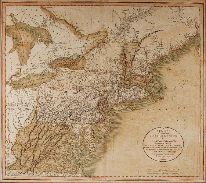
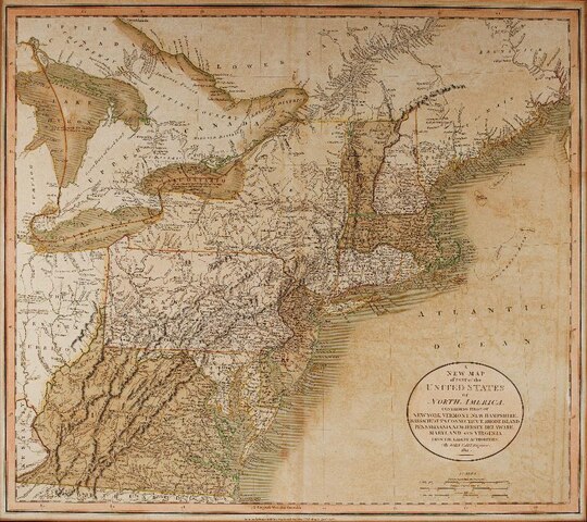
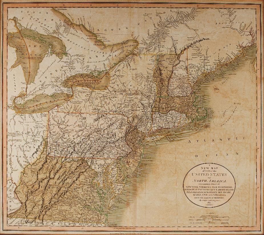
A new map of part of the United States of North America : containing those of New York, Vermont, New Hampshire, Massachusets [sic], Connecticut, Rhode Island, Pennsylvania, New Jersey, Delaware, Maryland and Virginia. From the latest authorities : 1811 |
| Publisher |
London : J. Cary |
| Description |
1 map : hand col. 44 x 50 cm.
Subjects: Northeastern States, Maps; Southern States, Maps; Western Reserve (Ohio), Maps; Connecticut Western Reserve (Ohio), Maps. |
| Language | English |
| Publication date | 1811 |
| Current location |
IA Collections: uconn_libraries |
| Accession number |
newmapofpartoftheunitedstates1811lond |
| Notes | Relief shown pictorially. Library’s copy mounted in frame. |
| Source |
|
Licensing
edit|
This work is in the public domain in its country of origin and other countries and areas where the copyright term is the author's life plus 100 years or fewer. This work is in the public domain in the United States because it was published (or registered with the U.S. Copyright Office) before January 1, 1929. | |
| This file has been identified as being free of known restrictions under copyright law, including all related and neighboring rights. | |
File history
Click on a date/time to view the file as it appeared at that time.
| Date/Time | Thumbnail | Dimensions | User | Comment | |
|---|---|---|---|---|---|
| current | 21:20, 1 January 2021 |  | 925 × 822 (3.6 MB) | Fæ (talk | contribs) | IA Query "subject:maps date:[1000 TO 1869] " newmapofpartoftheunitedstates1811lond Category:Old maps (COM:IA books#query) (1811 #632) |
You cannot overwrite this file.
File usage on Commons
The following page uses this file: