Category:SVG labeled maps of administrative divisions of countries of Africa (location map scheme) (english)


.svg)


_(Paris_zoom).svg)
.svg)
,_administrative_divisions_-_de_-_colored_(multizoom).svg)
_-_colored.svg)
.svg)
,_administrative_divisions_-_Nmbrs_(multizoom).svg)
,_administrative_divisions_-_de_-_colored.svg)
_-_de_-_colored.svg)

.svg)

.svg)
Media in category "SVG labeled maps of administrative divisions of countries of Africa (location map scheme) (english)"
The following 8 files are in this category, out of 8 total.
-
 Algeria, administrative divisions (+northern) - en - monochrome.svg 508 × 755; 161 KB
-
 Senegal, administrative divisions - en - monochrome.svg 1,265 × 930; 10.7 MB
-
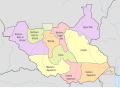 South Sudan, administrative divisions - en - colored (2011).svg 1,561 × 1,133; 279 KB
-
 South Sudan, administrative divisions - en - colored (2015).svg 1,561 × 1,133; 364 KB
-
 South Sudan, administrative divisions - en - colored (2017).svg 1,561 × 1,133; 363 KB
-
 South Sudan, administrative divisions - en - colored.svg 1,561 × 1,133; 310 KB
-
 Zambia, administrative divisions - en - colored.svg 1,363 × 1,130; 1.44 MB
-
 Zambia, administrative divisions - en - monochrome.svg 1,363 × 1,130; 1.16 MB
_-_en_-_monochrome.svg)

.svg)
.svg)
.svg)


