Category:17th-century maps of Asia
Temperate regions: North America · South America · Africa · Europe · Asia · Oceania – Polar regions: Antarctica · Arctic – Other regions:
Subcategories
This category has the following 55 subcategories, out of 55 total.
Media in category "17th-century maps of Asia"
The following 30 files are in this category, out of 30 total.
-

-

-
-

-

-

-

-
 1627 Carte de l'Asie Bertius.jpg 1,928 × 1,480; 3.13 MB
-
 Asia recens, summa cura delineata - Auct Jud. Hondio - btv1b8468659w (1 of 2).jpg 8,663 × 6,872; 9.72 MB
-
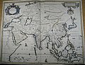
 A new map of Asia divided into Kingdoms and provinces - btv1b530888567.jpg 8,107 × 6,460; 10.43 MB
-

-
 Asia (1600).jpg 800 × 600; 199 KB
-
 Asia (1604).jpg 800 × 600; 170 KB
-
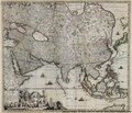
 Asia novita delineata - Auctore Guilielmo Blaeuw - btv1b8468662c (1 of 2).jpg 9,492 × 7,843; 12.24 MB
-
 Asia noviter delineata (8343806654).jpg 800 × 653; 157 KB
-

-
 Asia, 1658 (plaine, and map described by N.I. Visscher).jpg 8,759 × 7,023; 52.09 MB
-
 Asiae nova (8430919406).jpg 800 × 684; 162 KB
-
 Atlas Van der Hagen-KW1049B13 002-ASIAE NOVA DELINEATIO.jpeg 5,500 × 4,452; 3.94 MB
-
 Atlas Van der Hagen-KW1049B13 003-TVRCICVM IMPERIVM.jpeg 5,500 × 4,396; 3.83 MB
-
 B26056026E - A new mapp of Asia divide.pdf 3,393 × 2,910; 13.23 MB
-

-
 Exacta Totius Asiae Tabula by Nicolaes Visscher II.jpg 18,682 × 14,367; 192.43 MB
-
 Exacta totius Asiæ tabula - Kungliga Biblioteket - 10397528-thumb.png 10,270 × 7,824; 300.09 MB
-
 Exacta totius Asiæ tabula - Kungliga Biblioteket - 10397528.tif 10,270 × 7,824, 2 pages; 459.82 MB
-
 Imperii Sinarum nova descriptio - btv1b5963029q.jpg 7,232 × 5,592; 6.17 MB
-
 Matteo Ricci Far East 1602 Larger.jpg 1,925 × 2,463; 1.62 MB
-

-
 Thomas Porcacchi. Tavola Settima Dell'Asia Tabula Asiae VII. Padua 1620.jpg 5,371 × 4,553; 4.17 MB
-
 Vincenzo Coronelli - Map of Asia (1700 ca.).jpg 7,872 × 10,652; 8.81 MB


.jpg)


.jpg)

.jpg)
.jpg)
.jpg)
.jpg)
.jpg)
.jpg)
.jpg)
.jpg)


.jpg)